In the wake of devastating rainfall events, accurately predicting landslide risks has become an imperative challenge for geoscientists and urban planners alike. A team of Brazilian researchers, affiliated with the Institute of Mathematical and Computer Sciences at the University of São Paulo (ICMC-USP) and the National Institute for Space Research (INPE), has recently unveiled a novel and statistically grounded approach that enhances the precision of landslide susceptibility assessments. This advanced methodology, hinged on the Gaussian Analytical Hierarchy Process (AHP), shows promising improvements over the conventional AHP technique, offering a potentially transformative tool for disaster preparedness and environmental management.
The impetus for this research stems from an extreme weather incident that struck February 2023 in São Sebastião, a municipality along the northern coast of São Paulo state. Within a span of less than 15 hours, an unprecedented 683 millimeters of rain—a stark contrast to the typical monthly average of approximately 300 millimeters—triggered catastrophic landslides leading to 65 fatalities and leaving hundreds of inhabitants displaced. Such events underline the critical necessity of deploying robust predictive models that help foresee zones susceptible to landslides, thereby facilitating timely warnings and mitigation strategies.
At the heart of this breakthrough is the adoption of a Gaussian or normal distribution framework within the Analytical Hierarchy Process, a statistical method used for decision-making that traditionally relies on expert judgments involving pairwise comparisons of contributing variables. The classical AHP approach necessitates experts to subjectively evaluate the relative weights of factors such as elevation, terrain slope, ruggedness, proximity to hydrological features, and land use. In contrast, the Gaussian AHP technique mathematically derives the importance of these variables from their probabilistic distributions, fundamentally eliminating subjective biases and enhancing objectivity.
By applying this statistical refinement, the researchers incorporated sixteen key geospatial variables directly implicated in landslide genesis. These parameters not only include geomorphological features like slope steepness and surface relief but also anthropogenic factors reflective of human influence, such as proximity to roads that may destabilize slopes due to construction modifications. This blend of natural and human-induced factors enables a comprehensive understanding of the complex interactions governing slope stability under extreme precipitation conditions.
To validate their novel model, the research team meticulously analyzed a dataset for São Sebastião, noted as highly susceptible to landslides based on an Index of Vulnerability to Natural Disasters related to mass wasting processes. Employing high-resolution aerial imagery with a spatial granularity of 10 centimeters, supplemented by satellite platforms such as Google Earth and PlanetScope, the team cataloged nearly a thousand landslide crown points—origins of slope failures—and over a thousand scar polygons delineating impacted zones. Such detailed spatial inventories underpin a rigorous ground-truthing framework critical for model efficacy assessments.
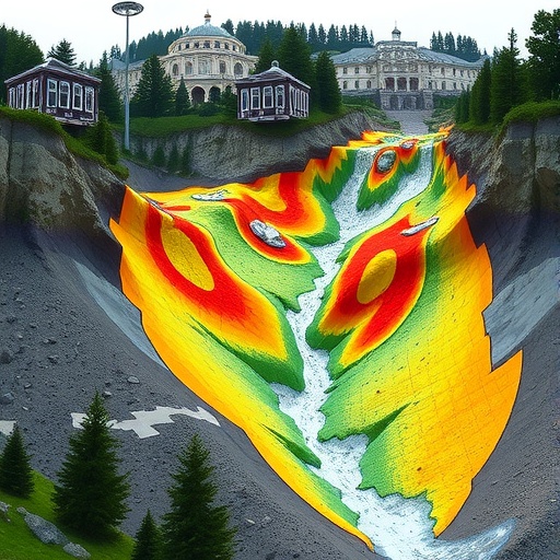
Comparative results between the traditional and Gaussian AHP methodologies revealed that the latter classified a slightly higher proportion of the area—26.31%—as highly susceptible to landslide occurrence, as opposed to 23.52% classified by the classic method. This differential, albeit modest, signifies an enhanced predictive power aligned better with the recorded landslide distributions. Notably, the Gaussian AHP’s reliance on the statistical dispersion of data—modeled through mean and standard deviation parameters—enables refined weighting of influential factors, avoiding typical expert-induced inconsistencies inherent in the traditional pairwise comparison framework.
The refined model identified geomorphology and proximity to rivers and roads as critical determinants in landslide susceptibility—an insightful departure from traditional AHP findings, which prioritized slope inclination and positioning. The influence of roads is particularly significant, as road construction in rugged terrains often entails earthworks including cuts and embankments that undermine slope integrity, thus exacerbating landslide risk during intense rainfall periods. This highlights the indispensable need for integrating anthropogenic influences within risk assessment paradigms.
Beyond landslide prediction, the Gaussian AHP framework harbors broad applicability prospects. Its adaptability to monitor and forecast an array of environmental challenges—such as wildfires, deforestation, soil subsidence, and desertification—is especially valuable in the context of accelerating climate change. Rising global temperatures and shifting weather patterns are projected to increase the frequency and severity of these phenomena, underscoring the urgency of deploying efficient, scalable, and data-driven monitoring solutions to safeguard vulnerable landscapes and populations.
Moreover, the accessibility and simplicity of this method are noteworthy. As emphasized by the lead author Rômulo Marques-Carvalho, the approach requires only fundamental geospatial datasets and standard computational resources equipped with free geographic information system (GIS) software like QGIS. This democratization of advanced analytical capabilities is a game-changer, particularly for local governments and developing regions where resource constraints hamper sophisticated hazard modeling efforts.
The implications of this study extend into policy and urban planning domains. Implementing Gaussian AHP-based risk maps could guide infrastructure development standards, emergency response preparedness, and land-use zoning, thereby mitigating potential disaster impacts. The objective quantification of hazard susceptibility also fosters transparent decision-making processes supported by empirical evidence rather than subjective expert assessments.
In essence, the integration of probabilistic statistical methods within established multi-criteria decision frameworks marks a significant evolution in geohazard assessment methodologies. By effectively harnessing the Gaussian distribution characteristics, the new AHP model illuminates complexities in landslide susceptibility with improved clarity and reliability. As climate-driven extreme weather events continue to pose escalating threats worldwide, such innovations represent vital strides toward resilient and adaptive environmental management strategies.
The Brazilian research team’s contributions underscore the value of interdisciplinary collaboration between computational sciences and geospatial analytics. Their findings, recently published in the distinguished journal Scientific Reports, advance landslide susceptibility science and open avenues for further research into refining hazard prediction accuracy using statistical learning approaches. As these models become increasingly sophisticated, the overarching goal remains clear: to protect lives and infrastructure through informed anticipation and intervention.
Subject of Research: Landslide susceptibility assessment using enhanced statistical methods
Article Title: Comparative analysis of traditional and Gaussian Analytical Hierarchy Process (AHP) methods for landslide susceptibility assessment
News Publication Date: 31-Oct-2025
Web References:
- Article DOI: 10.1038/s41598-025-22136-6
Keywords: Landslides, Disaster management, Extreme weather events
