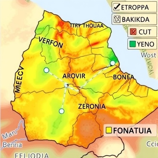
In the heart of Ethiopia’s Borkena River Basin lies a pressing challenge, one that intertwines environmental sustainability and human development: the critical need to map groundwater potential zones. Groundwater serves as a lifeline for countless communities, especially in regions heavily reliant on agriculture and drinking water supply. Researchers have recently adopted cutting-edge methodologies in their quest to generate efficient maps identifying these vital groundwater reserves, employing multi-criteria decision making (MCDM) and geospatial analysis techniques.
Groundwater scarcity is not a new issue; it has been an enduring challenge faced by many communities in arid and semi-arid regions globally. In Ethiopia, the rising population has increased the demand for water, compounded by climate variability and unsustainable land use practices. These changes exacerbate the already challenging circumstances, making effective groundwater management not just beneficial, but essential for sustainable development. It is here that the research conducted by Amognehegn, Nigussie, and Molla offers significant insights.
This innovative research utilized a robust geospatial framework to evaluate multiple factors influencing groundwater availability. By integrating geographical information systems (GIS) with MCDM approaches, the researchers were able to assess and prioritize various criteria essential for groundwater potential mapping. The study delves into hydrological parameters, geological formations, land use, soil characteristics, and socio-economic aspects, converging a multidisciplinary perspective vital for a comprehensive understanding of groundwater resources.
Key to the success of the methodology deployed in this research is the fine-tuned analysis of several layers of data. Each layer corresponds to different variables that play a pivotal role in groundwater sustainability. Factors such as rainfall patterns, surface water bodies, and existing groundwater extraction practices are among the multitude of considerations. These elements were processed to create a synthesis that encompasses both the opportunities and risks associated with groundwater resources in the region.
Furthermore, the implementation of MCDM in this context means prioritizing the variables based on their significance. For instance, while the presence of geological formations contributes to aquifer recharge, factors like land use change and human activity can either enhance or diminish groundwater infiltrability. By assigning weights to these variables, researchers were able to create a hierarchical structure that effectively directs attention to regions with the highest potential for sustainable groundwater management.
The findings from this comprehensive analysis are not only academically significant but also hold pragmatic implications for water resource management. Mapping zones of high groundwater potential can guide policymakers, stakeholders, and local communities in making informed decisions regarding water extraction and conservation strategies. It brings a laser-focus to areas that require immediate attention, optimizing resource allocation in a time of escalating water scarcity.
Moreover, the detailed mapping of groundwater potential has broader implications, extending beyond immediate water management. These findings can contribute to climate adaptation strategies, helping safeguard agricultural productivity and overall community resilience. By focusing on sustainable practices fostered through informed decision-making, the research offers a roadmap not only for local stakeholders but also for national water resource planning.
However, the study does not shy away from acknowledging the uncertainties inherent to groundwater resource assessment. Factors such as over-extraction and changes in land use continue to threaten the sustainability of aquifers. The research highlights the necessity for continuous monitoring and adaptive management strategies to ensure that groundwater remains a viable resource for future generations.
In conclusion, the work conducted in the Borkena River Basin exemplifies a forward-thinking approach to groundwater management in Ethiopia. By combining state-of-the-art geospatial analysis with participatory decision-making processes, the research enhances the scope of groundwater sustainability efforts, urging stakeholders to embrace a more holistic view of natural resource management. This study serves as a beacon for similar initiatives across the globe, reinforcing the message that sustainable development is an achievable goal through data-driven, cooperative strategies.
With water scarcity threatening livelihoods and sustainability worldwide, the necessity for such research cannot be overstated. As communities grapple with the implications of climate change exacerbating water shortages, the methodologies developed in this study may offer a vital toolkit for future groundwater assessments and management.
The incredible intersection of technology and environmental studies as illustrated in the Borkena River Basin research sets a precedent for the intricacies of modern resource management. Through the lens of MCDM and geospatial analysis, researchers are carving a path towards not only understanding but thriving in the face of environmental challenges.
In a world that is progressively leaning towards data-centric solutions, the detailed assessment and mapping of groundwater resources stand as a testament to innovative research. It invites stakeholders across various sectors to engage in a collective responsibility towards ensuring the protection and judicious use of precious water resources. The journey towards sustainable development is paved with informed decisions, and initiatives like these highlight the importance of blending scientific insights with proactive environmental stewardship.
Envisioning a sustainable future relies on such research and the dedication of scientists striving for practical solutions to real-world problems. The integration of science, policy, and community action will ultimately determine the path forward, securing sufficient and sustainable groundwater supplies essential for life and future development.
Subject of Research: Groundwater potential mapping in Ethiopia’s Borkena River Basin using geospatial analysis.
Article Title: Mapping groundwater potential zones for sustainable development using multi-criteria decision making and geospatial analysis in the Borkena River Basin, Ethiopia.
Article References:
Amognehegn, A.E., Nigussie, A.B. & Molla, W.A. Mapping groundwater potential zones for sustainable development using multi-criteria decision making and geospatial analysis in the Borkena River Basin Ethiopia.
Discov Sustain 6, 1014 (2025). https://doi.org/10.1007/s43621-025-01510-4
Image Credits: AI Generated
DOI:
Keywords: Groundwater management, sustainable development, geospatial analysis, multi-criteria decision making, Borkena River Basin, Ethiopia.


