Groundwater is one of the most vital natural resources sustaining life, agriculture, and industry around the world. Yet, accurately monitoring and predicting groundwater levels remains an ongoing scientific challenge due to the complex interplay between hydrological, geological, and climatic factors. Recent research conducted by Zhang, Rui, Zhao, and colleagues brings a significant advancement to this field through their innovative use of a Spatio-temporal CoKriging approach for groundwater level interpolation in the Datong Basin, Shanxi Province. This study not only refines groundwater level estimations but provides a groundbreaking model that integrates spatial and temporal dynamics, which can be extended globally to improve water resource management.
The Datong Basin represents a crucial hydrogeological zone in Shanxi Province, China, where groundwater significantly supports agricultural irrigation and domestic consumption. However, this region has faced challenges due to fluctuating water tables and data scarcity, complicating traditional interpolation methods that often fail to capture the spatial heterogeneity and temporal variability inherent in such groundwater systems. The study’s adoption of a Spatio-temporal CoKriging technique overcomes many limitations encountered by conventional geostatistical methods, delivering enhanced accuracy and resolution in groundwater level prediction.
CoKriging is a geostatistical interpolation method that leverages multiple correlated variables to improve spatial estimation. Unlike ordinary kriging, which uses known values of a single variable, CoKriging incorporates secondary variables to supplement the primary data, thereby reducing estimation errors. When extended into the spatio-temporal domain, the method accounts for variations across both space and time, crucial for dynamic systems like groundwater aquifers which change seasonally or due to human activities.
The novelty in the authors’ approach lies in coupling groundwater level data with auxiliary hydrological and meteorological information, including precipitation, temperature, and local topography. This multivariate integration within a spatio-temporal framework enables a robust model that captures not only the groundwater distribution patterns but also their evolution over time. Such comprehensive modeling provides deeper insights essential for understanding aquifer recharge, depletion rates, and potential responses to climatic variability.
The study meticulously addresses the underlying mathematical formulations necessary for implementing Spatio-temporal CoKriging. This involves constructing covariance functions that define relationships in both spatial and temporal dimensions, coupled with cross-covariance matrices to incorporate secondary variables. Zhang and colleagues carefully calibrate these models using historical data, optimizing parameters to reduce bias and variance in groundwater level estimates. Their method recognizes the anisotropy typical of groundwater flow and variations caused by geological heterogeneity.
One of the paper’s significant contributions is the demonstration of this methodology on the Datong Basin, a vitally important agricultural region in Northern China. Using extensive datasets collected from monitoring wells, weather stations, and satellite observations, the researchers validate their model by comparing predictions with observed groundwater levels. Results exhibit substantial improvements in accuracy over traditional kriging and inverse distance weighting methods, with enhanced ability to reproduce both spatial gradients and temporal fluctuations.
This improved groundwater level interpolation is not just an academic exercise; it bears direct implications for sustainable water resource management. Accurate mapping and forecasting enable better planning and regulation of groundwater extraction, helping to prevent overexploitation and subsequent land subsidence or ecological degradation. The authors emphasize that policymakers and stakeholders can utilize such models to enforce water quotas, design recharge projects, and evaluate the impacts of climate change scenarios.
Furthermore, the integration of remote sensing data and in situ measurements within the spatio-temporal CoKriging framework demonstrates the increasing relevance of interdisciplinary datasets in hydrological research. Satellite data provides wide-ranging spatial coverage while local sensors offer precise temporal updates, combining to form a comprehensive observational network. Zhang et al.’s work underscores the importance of harmonizing diverse data types to tackle the multifaceted challenges in groundwater science effectively.
The robustness of the model also allows it to be adapted for other regions with similar data constraints and hydrogeological complexities. By providing a rigorous statistical framework, the study sets a precedent for groundwater monitoring in arid and semi-arid environments prone to data scarcity. The model’s reliance on spatial covariance structures and temporal trends means it can integrate novel datasets as they become available, including those from emerging sensor technologies or crowdsourced water level observations.
Groundwater sustainability is an urgent global challenge amid growing populations and the intensification of agricultural demand. The approach taken by Zhang, Rui, Zhao, and collaborators exemplifies the innovative solutions required to balance human needs with environmental conservation. By improving the precision and reliability of groundwater level estimations, their research supports science-based decision-making that can lead to more resilient water resource policies, particularly in vulnerable basins experiencing rapid anthropogenic pressures and climatic shifts.
The correction issued by the authors highlights their commitment to scientific accuracy and transparency. Technical corrections ensure the validity of the results and solidify confidence in the methodology among the research community and practitioners alike. This dedication to continual refinement is crucial as new data and computational capabilities evolve, promising even greater advancements in hydrological modeling.
Future avenues stemming from this research include expanding the spatio-temporal CoKriging approach to incorporate predictive elements, transforming it into a forecasting tool capable of simulating groundwater responses under various scenarios. Integrating machine learning techniques with geostatistical models could further enhance predictive performance, while coupling with surface water dynamics may offer a unified framework for comprehensive watershed management.
In conclusion, the innovative spatio-temporal CoKriging technique developed by Zhang and colleagues addresses a critical gap in groundwater level interpolation by effectively integrating multifaceted spatial and temporal data. Their application to the Datong Basin represents a compelling case study with implications extending far beyond the region. This advancement marks a significant step forward in hydrogeological modeling, offering a powerful tool for sustainable management of groundwater resources under increasing environmental stresses.
As water scarcity escalates as a global concern, methodologies that provide accurate, timely, and dynamic groundwater assessments will be indispensable. The work presented invites a shift towards more holistic and data-integrated approaches in hydrological research. It also signals the emerging role of advanced statistical techniques in bridging observational gaps, fostering collaboration between hydrologists, statisticians, and policymakers dedicated to securing water for future generations.
Subject of Research: Groundwater level interpolation estimation using spatio-temporal CoKriging methods in the Datong Basin, Shanxi Province.
Article Title: Correction: Spatio-temporal CoKriging approach for groundwater level interpolation estimation — a case study of the Datong Basin, Shanxi Province.
Article References: Zhang, H., Rui, X., Zhao, X. et al. Correction: Spatio-temporal CoKriging approach for groundwater level interpolation estimation — a case study of the Datong Basin, Shanxi Province. Environ Earth Sci 84, 495 (2025). https://doi.org/10.1007/s12665-025-12475-y
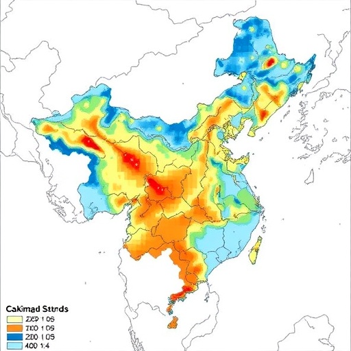
Image Credits: AI Generated
