In the rapidly evolving field of geotechnical hazard assessment, a groundbreaking approach combining satellite-based radar technology and machine learning algorithms is redefining how engineers and scientists evaluate slope stability along critical infrastructure corridors. A recent study spearheaded by Liang, Liu, Meng, and colleagues presents an innovative methodology that leverages Interferometric Synthetic Aperture Radar (InSAR) coupled with advanced machine learning techniques to assess slope hazards in the distinctive red beds formations that characterize Southern China’s mountainous terrain. This fusion of remote sensing and artificial intelligence offers unprecedented precision and predictive capabilities, critical for mitigating landslide risks and ensuring the longevity of highway networks in vulnerable regions.
The study, detailed in the 2025 volume of Environmental Earth Sciences, addresses a longstanding challenge in geohazard monitoring: accurate and continuous assessment of slopes composed primarily of red beds—a sedimentary geological formation known for its unique mechanical properties and susceptibility to weathering and erosion. Traditional ground-based surveys and visual inspections, while invaluable, often fall short in providing comprehensive, real-time data over large and difficult-to-access areas. Here, the researchers showcase how InSAR’s capacity for detecting millimeter-level surface movements over wide spatial extents creates a powerful foundation for systematic hazard evaluation.
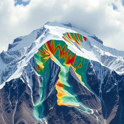
InSAR technology operates by comparing radar images of the Earth’s surface taken at different times from satellite platforms. The resulting interferograms reveal subtle ground deformations, which are crucial to identifying potential slope instabilities well before catastrophic failure. Liang and colleagues utilized a time series of these radar interferograms to monitor displacement within Southern China’s highway slopes over several months. The data captured not only highlighted areas of persistent ground movement but also allowed for temporal trend analysis, which is vital for understanding the progression of deformation mechanisms affecting slope stability.
Yet, the truly transformative element of this research lies in the integration of machine learning models into the hazard assessment framework. By training algorithms on remote sensing data combined with geological and hydrological parameters, the team developed predictive models that classify hazard levels with remarkable accuracy. These models assimilate complex nonlinear relationships often obscured in traditional analytical methods, effectively identifying subtle precursors to slope failure that human observers might overlook. This synergy between big data analytics and remote sensing elevates hazard assessment from reactive measures to proactive risk management.
The research further delves into the distinct geomechanical behaviors of red beds, which present unique challenges due to their heterogeneity and sensitivity to environmental factors. Red beds typically consist of iron oxide-rich sandstones and siltstones, features influencing their cohesion and frictional properties. Seasonal rainfall infiltration and temperature variations can significantly affect pore water pressures within these formations, triggering deformation or failure. By incorporating these parameters into the machine learning model inputs, the study establishes a nuanced understanding of how environmental conditions interact with intrinsic geological properties to govern slope behavior.
Moreover, the spatial distribution of stability indicators derived from the InSAR data depicts a comprehensive vulnerability map along the Southern China highway corridor. This spatial visualization empowers engineers and decision-makers to prioritize interventions, allocate resources efficiently, and design targeted mitigation strategies that consider local terrain specificity. Conventional hazard maps often generalize risk over extensive zones; by contrast, this InSAR-driven approach offers a fine-grained, data-rich perspective, marking a significant leap forward in geohazard spatial analysis.
One compelling aspect highlighted by this research is the method’s scalability and adaptability. While focused on red beds in Southern China, the combination of InSAR and machine learning models is largely transferable to other lithologies and geographic contexts. This adaptability opens avenues for global applications in infrastructure projects that contend with landslide risks, particularly in regions where resource constraints limit ground-based monitoring capacity. Consequently, this approach speaks to both high-tech and practical imperatives, bridging the gap between remote sensing innovation and on-the-ground safety needs.
Critically, the study also addresses the temporal dynamics of slope deformation. By analyzing successive radar acquisitions, the authors trace acceleration phases preceding failures, resulting in early warning capabilities. They demonstrate that by integrating time-series deformation data, the machine learning algorithms can not only detect ongoing movement but also forecast potential failure windows, crucial for emergency preparedness. This marks a pivotal evolution from static hazard maps toward dynamic, real-time risk surveillance systems.
The multidisciplinary nature of the work is noteworthy. Combining expertise in geotechnical engineering, remote sensing physics, and computational data science, the authors exemplify the collaborative spirit necessary to tackle complex environmental hazards. Their methodology reflects a trend toward data-driven science where empirical observations are enhanced by algorithmic interpretations, pushing the boundaries of conventional geohazard assessment paradigms.
Furthermore, the implications for policy and infrastructure management are profound. Highways are lifelines for trade, emergency response, and regional development, and their disruption by slope failures poses severe economic and humanitarian risks. The ability to preemptively identify hazardous slopes translates directly into improved safety protocols, optimized maintenance schedules, and informed engineering designs that embrace risk reduction as a core principle. This research, therefore, aligns with global sustainability goals by promoting resilient infrastructure in the face of geophysical hazards.
In terms of technological innovation, the study pushes the envelope in utilizing publicly available satellite data sources combined with proprietary machine learning frameworks. This democratization of hazard assessment tools enables local agencies and researchers to adopt similar methodologies without prohibitive costs, catalyzing broader adoption of cutting-edge geotechnologies. As satellite constellations expand and computational resources become increasingly accessible, the potential for scaling such integrated systems only grows stronger.
While the paper is rich with promising results, the authors acknowledge challenges that remain, such as the need for continual model refinement with more extensive training datasets and enhanced ground-truth validation efforts. They also recognize the intrinsic complexities of natural systems that cannot be fully encapsulated by models, underscoring the importance of complementing technological approaches with expert judgment and field verification. This balanced perspective is essential for fostering trust in emerging hazard assessment frameworks.
In sum, the collaborative work by Liang, Liu, Meng, and colleagues represents a milestone in geohazard research, melding remote sensing precision with the predictive power of machine learning to transform how slope hazards are understood and managed in complex sedimentary formations. This integrated approach offers a forward-looking blueprint for addressing stability challenges along vital infrastructure networks worldwide, harnessing the twin engines of technology and data science to safeguard communities and economies against the ever-present threats of natural terrain deformation.
As geotechnical hazards continue to threaten infrastructure resilience amid changing climatic and environmental conditions, the refinement and dissemination of such innovative methodologies will be paramount. The integration of satellite earth observation and artificial intelligence not only heralds a new era of hazard diagnostics but also sets the stage for enhanced global collaboration in disaster risk reduction and sustainable infrastructure development.
Subject of Research: Slope hazard assessment using remote sensing and machine learning in red bed geological formations.
Article Title: InSAR and machine learning-based red beds highway slope hazard assessment in Southern China.
Article References:
Liang, J., Liu, Z., Meng, F. et al. InSAR and machine learning-based red beds highway slope hazard assessment in Southern China. Environmental Earth Sciences 84, 472 (2025). https://doi.org/10.1007/s12665-025-12470-3
Image Credits: AI Generated
