In the rapidly evolving field of atmospheric science, the ability to accurately quantify and understand the dispersion effect of aerosols across the globe remains an essential challenge. A recent landmark study by Wang, H., Peng, Y., Di Noia, A., and colleagues, published in Nature Communications in 2025, offers an unprecedented global quantification of the dispersion effect derived from POLDER satellite data. This breakthrough not only refines our comprehension of aerosol behavior in Earth’s atmosphere but also holds significant implications for climate modeling, weather forecasting, and environmental policy-making.
Aerosols—tiny particles suspended in the atmosphere—play a pivotal role in climate systems by interacting with solar radiation and influencing cloud formation. However, the dispersion of these particles, which governs how aerosols spread and dilute after being emitted into the atmosphere, is notoriously difficult to measure on a global scale. Traditional ground-based measurements provide limited spatial coverage, and many satellite sensors, while adept at detecting aerosols, have struggled to disentangle the intricate dispersion dynamics. The POLDER (Polarization and Directionality of the Earth’s Reflectances) instrument, aboard the PARASOL satellite, has empowered researchers with its unique ability to capture polarized light measurements, which are especially sensitive to aerosol properties.
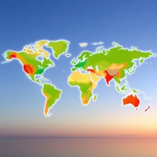
Using POLDER data, Wang and colleagues have developed an innovative approach for dissecting the dispersion effect with extraordinary precision. Their methodology leverages polarization measurements combined with sophisticated retrieval algorithms to isolate aerosol optical thickness from multiple scattering effects. This advancement allows for the first time a detailed mapping of aerosol dispersion patterns around the globe, highlighting differences driven by geographical regions, seasons, and aerosol types. The result is a comprehensive global dataset that delineates how aerosols are transported and dispersed through the atmosphere after emission events.
One of the major revelations of this study is the identification of distinct regional signatures in aerosol dispersion. For example, the researchers observed that industrial regions exhibit markedly different dispersion behaviors compared to natural biomass burning zones. In urban-industrial areas, aerosols tend to maintain a more compact distribution shortly after emission, leading to localized effects on air quality and radiation balance. Conversely, biomass burning aerosols display rapid dispersion and wide distribution patterns, influencing both regional and long-range climate dynamics. These nuanced insights offer critical input parameters for atmospheric and climate models that until now relied heavily on generalized assumptions.
Moreover, the study elucidates seasonal variability in aerosol dispersion. Aerosol particles emitted during different times of the year experience varying atmospheric conditions such as humidity, wind patterns, and temperature gradients, which directly influence their dispersion. Through a detailed temporal analysis, the authors trace how dispersion intensifies during monsoon seasons in Asia or diminishes during colder, stable winter atmospheres in the Northern Hemisphere. This temporal sensitivity offers a more dynamic perspective on aerosol-climate interactions, capturing transient phenomena that were previously overlooked.
From a technical standpoint, the researchers’ ability to disentangle intrinsic dispersion signals from confounding factors such as cloud cover, surface reflectance, and sensor noise is a testament to the robustness of their retrieval framework. By calibrating their algorithms against ground truth measurements and atmospheric models, they have ensured that the global dataset reflects real atmospheric conditions rather than artifacts or biases. This rigorous validation process gives confidence to the broader scientific community in utilizing these data for advancing climate impact assessments.
The implications of this study extend far beyond the academic realm. Quantifying aerosol dispersion with such granularity informs air quality management strategies worldwide. For instance, urban planners and policymakers can target emission reduction measures more effectively when armed with precise knowledge of how aerosols travel and transform in the atmosphere. Similarly, climate scientists can refine predictions of aerosol-induced radiative forcing, improving the accuracy of global warming projections and enabling better international climate policy negotiations.
Furthermore, the global aerosol dispersion dataset derived from POLDER opens new avenues for interdisciplinary research. Biogeochemists studying the deposition of aerosols into oceans and forests, for example, can integrate these dispersion maps to better understand nutrient cycling and ecosystem responses. Additionally, public health researchers can link dispersion patterns to epidemiological data on respiratory diseases, uncovering subtle exposure pathways that were previously difficult to quantify. This integrative potential underscores the transformative nature of Wang et al.’s contribution to Earth system sciences.
Another dimension of this work is its contribution to improved satellite observational capabilities. The methodologies developed demonstrate how polarization measurements, often underutilized in aerosol studies, can be harnessed to unlock new atmospheric information. This insight advocates for future satellite missions to prioritize polarization sensors, thereby expanding the toolbox available for global aerosol characterization. Consequently, this research not only leverages existing data but also informs the design of next-generation Earth observation instruments.
Despite its rich insights, the study also acknowledges intrinsic limitations and avenues for future exploration. For instance, while POLDER data provide excellent coverage, certain atmospheric conditions—such as thick cloud cover or extremely high aerosol loading—pose challenges to retrieval accuracy. The researchers suggest integrating complementary datasets from lidar instruments and geostationary satellites to fill these observational gaps. They also emphasize the importance of continuous monitoring to track aerosol-vegetation interactions, urban impact evolution, and emergent pollution sources in a rapidly changing world.
In sum, Wang et al.’s global quantification of the aerosol dispersion effect using POLDER satellite data represents a milestone in atmospheric science. Their work marries cutting-edge remote sensing technology with innovative computational techniques, delivering a finely resolved, temporally dynamic portrait of how aerosols behave after emission. This detailed understanding is crucial for tackling contemporary environmental challenges, from mitigating air pollution to predicting climate change impacts. As Earth’s atmosphere continues to respond to anthropogenic pressures, tools like those developed in this study will be indispensable for fostering resilience and sustainability.
Looking ahead, collaborative efforts are anticipated to build on this foundation by integrating dispersion data with chemical transport models and in situ measurements. Enhanced computational power and machine learning algorithms will likely refine retrieval techniques, enabling real-time aerosol monitoring and forecasting. Such advances anticipate an era where global aerosol dynamics are no longer hidden in uncertainty but are instead one of the best-characterized components of the Earth system, guiding precise interventions for planetary health.
Ultimately, this research exemplifies the power of satellite remote sensing harmonized with sophisticated analytical frameworks to decode the complexities of our atmosphere. By illuminating the pathways aerosols traverse after release, Wang and colleagues have unveiled a vital piece of the puzzle in understanding climate and environmental processes. As more studies embrace these approaches, our capacity to sustain both human and ecological well-being in the face of atmospheric changes will be profoundly enhanced, securing a healthier future for generations to come.
Subject of Research: Global quantification of aerosol dispersion effects in the atmosphere using satellite remote sensing
Article Title: Global quantification of the dispersion effect with POLDER satellite data
Article References:
Wang, H., Peng, Y., Di Noia, A. et al. Global quantification of the dispersion effect with POLDER satellite data.
Nat Commun 16, 7087 (2025). https://doi.org/10.1038/s41467-025-62238-3
Image Credits: AI Generated
