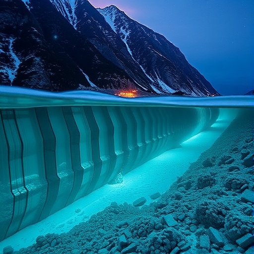
Beneath the vast expanse of the world’s oceans lie complex networks of underwater infrastructure critical to the modern energy landscape. These structures—comprising pipelines, anchors, risers, and cables—form the backbone of offshore operations such as oil rigs and increasingly prevalent wind farms. Despite their engineering sophistication, these subsea installations face constant threats from natural geohazards, particularly submarine landslides, which can severely disrupt or even obliterate these essential systems. The urgency of predicting such catastrophic events has spurred researchers at Texas A&M University to harness multidisciplinary underwater site characterization data to develop predictive models that enhance the safety and reliability of offshore infrastructure.
Submarine landslides represent a significant risk to offshore installations due to their potential to rapidly destabilize the seabed and cause deformation or failure of subsea infrastructure. Unlike terrestrial landslides where direct observation and monitoring are often feasible, underwater slope failures are notoriously difficult to detect and predict due to harsh oceanic environments and limited real-time data acquisition. The Texas A&M research team, led by Associate Professor Zenon Medina-Cetina, has tackled this challenge head-on by integrating data from multiple scientific and engineering disciplines. Their work demonstrates that the key to accurate landslide prediction lies not only in the types of data collected but also critically in the order and methodology by which these data are processed and interpreted.
Essential to understanding risk at offshore project sites is the comprehensive characterization of the seafloor and underlying geological strata. This process begins with geophysical surveys that utilize seismic reflection and refraction techniques to map subsurface features. These geophysical data reveal sediment layers, fault lines, and potential weak zones that could predispose an area to slope failure. Following this, geologists analyze sediment composition, stratigraphy, and historical geological events, providing context to the physical data. Geomatic technologists then translate these findings into spatially accurate maps and three-dimensional models, optimizing the positional accuracy critical for engineering assessments. Finally, geotechnical engineers test sediment samples and interpret their mechanical properties to predict how the seabed might respond to stresses such as those imposed by ocean currents, construction loads, or seismic activity.
What distinguishes the Texas A&M team’s approach is their emphasis on the sequential integration of these diverse datasets. Medina-Cetina draws an analogy likening the necessity of a systematic investigative sequence to training a child to walk before teaching them to run. In practical terms, initiating analyses with geophysical data, followed by detailed geological interpretation, spatial augmentation via geomatic techniques, and culminating in rigorous geotechnical assessment, results in a calibrated probabilistic model that significantly reduces uncertainty. Deviation from this methodical sequence, often a consequence of budget or time limitations, undermines prediction accuracy and can expose offshore projects to unforeseen hazards.
The probabilistic modeling framework adopted in this research utilizes Bayesian statistical methods, which are particularly well-suited for integrating disparate data sources and updating predictions as new information becomes available. Bayesian calibration provides a systematic approach that quantifies uncertainty and leverages prior knowledge along with newly acquired site characterization data. This continual refinement process enhances confidence in model predictions—an invaluable asset for engineers tasked with designing subsea structures that must withstand unpredictable natural events. Bayesian inference thus allows stakeholders to make informed decisions that balance risk and cost effectively.
One of the practical implications of this research lies in its potential to improve the design and installation phases of offshore structures profoundly. By incorporating dynamically calibrated landslide models into engineering workflows, project designers can identify optimal locations for infrastructure placement, assess foundation requirements more rigorously, and specify materials and construction techniques tailored to site-specific geohazard profiles. Such predictive capability is critical for developing resilient offshore energy systems that can endure the increasing challenges posed by climate change and expanding energy demands.
An additional benefit of Medina-Cetina’s model is its capacity to inform regulatory frameworks by providing scientifically robust risk assessments. Regulatory bodies overseeing offshore development require stringent geohazard analysis to grant permits and ensure compliance with environmental standards. The ability to predict submarine landslides with a high degree of certainty could streamline approval processes, mitigate environmental impacts from catastrophic failures, and foster sustainable energy development practices.
The research collaboration includes experts such as Patricia Varela from Geosyntec Consultants, Inc. and graduate student Billy Hernawan, reflecting the interdisciplinary nature of the project. Their joint efforts demonstrate how academia and industry can converge to tackle complex engineering challenges through innovative methodologies. The project receives critical support from key funders, including the Research Partnership to Secure Energy for America (RPSEA) and PLENUM Soft, emphasizing the strategic importance of securing energy infrastructure in the face of geotechnical uncertainties.
Beyond technical precision, the work undertaken by Medina-Cetina’s team underscores a philosophy that engineering solutions to natural threats must be adaptable and data-driven. Offshore installations are massive investments, and confidence in their stability underpins not just economic viability but also environmental stewardship and energy security. By advocating for a disciplined, sequenced approach to data acquisition and model calibration, this research invites the broader engineering community to rethink conventional geohazard practices and embrace holistic, statistically robust frameworks.
As offshore wind farms continue to expand globally and oil and gas operations persist in deepwater environments, the development of predictive tools such as Bayesian calibrated models will be indispensable. These tools help bridge the knowledge gap left by the opacity of underwater environments, transforming raw site data into actionable insight. The potential reduction in downtime, emergency repair costs, and environmental damages positions this research at the forefront of subsea risk management strategies.
In summation, the innovative model proposed by Texas A&M researchers represents a transformative step forward in predicting and managing submarine landslide hazards. Their rigorous emphasis on sequential multidisciplinary data integration combined with Bayesian probabilistic calibration provides a robust pathway for safe offshore infrastructure design and operation. This advancement not only holds promise to safeguard billions in energy investments but also enhances resilience in one of Earth’s most dynamic and least understood environments. The ocean floors, once perceived as inscrutable, are now progressively yielding their secrets under the lens of cutting-edge engineering and statistical science.
Subject of Research: Submarine landslide prediction and site characterization methodologies for offshore infrastructure safety
Article Title: Bayesian model calibration of submarine landslides
News Publication Date: 15-Mar-2025
Web References: https://link.springer.com/article/10.1007/s10346-025-02486-y, http://dx.doi.org/10.1007/s10346-025-02486-y
Keywords: Submarine landslides, offshore infrastructure, site characterization, geophysical surveys, geotechnical engineering, Bayesian statistics, probabilistic modeling, offshore wind farms, oil rigs, geohazard prediction
