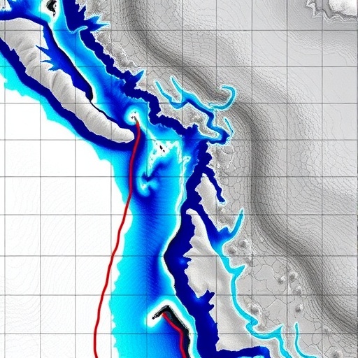
Advancements in Hydrological Mapping: Unveiling Small-Scale Flash Floods Through High-Resolution DEM Analysis
The increasing occurrence of flash floods across various geographic regions has prompted scientists to delve deeper into understanding these often unpredictable and devastating natural events. Recently, a pioneering study published in Environmental Earth Sciences has introduced a novel approach to identifying small-scale scattered flash floods using high-resolution Digital Elevation Models (DEMs). This innovative method offers new insights into flood dynamics, significantly enhancing the hydrological community’s ability to detect and assess localized flood risks.
Flash floods, characterized by their rapid onset and severe impacts, commonly occur in terrains where heavy precipitation overwhelms the natural drainage capacity. Historically, large-scale flood events have been the primary focus of hydrologists and disaster mitigation agencies. However, small-scale flash floods, which tend to be scattered and localized, have remained difficult to pinpoint due to their transient nature and the limitations of traditional spatial resolution in terrain data. The study spearheaded by Yang, Xiao, and Li addresses these challenges head-on by leveraging the fine detail afforded by high-resolution DEMs.
Digital Elevation Models have long been foundational tools in geomorphology and hydrology, offering quantitative topographical data essential for modeling surface water flow and watershed analysis. Standard DEMs, typically at resolutions ranging from tens to hundreds of meters, have been inadequate for capturing micro-scale terrain variations that influence localized hydrological phenomena. The introduction of ultra-high-resolution DEMs, often attainable through LiDAR (Light Detection and Ranging) and advanced photogrammetry, provides elevation data at meter or sub-meter scales. This granularity uncovers subtle landform features such as minor channels, depressions, and ridges that critically influence floodwater routing.
By integrating high-resolution DEMs with sophisticated spatial algorithms, the researchers developed a methodology capable of delineating potential flash flood initiation zones with remarkable precision. Their approach involves a detailed terrain analysis that computes flow accumulation, slope gradients, and surface roughness at microtopographic levels. These parameters are synthesized to identify patches within a landscape that are prone to sudden water concentration leading to rapid inundation—a hallmark of flash flood generation.
Beyond mere identification, this research yields critical implications for early warning systems and disaster preparedness. Small-scale flash floods often evade prediction models because of their rapid onset and discrete spatial footprints. By accurately mapping vulnerable locales, communities and emergency services can better prepare and deploy targeted flood mitigation strategies. Moreover, urban planners can utilize this detailed terrain information to design infrastructure resilient to flash flood impacts, particularly in rapidly urbanizing or topographically complex regions.
A key finding from this study lies in the recognition that small-scale flash floods are not merely scaled-down versions of larger flood events but possess unique hydrodynamic characteristics shaped by local terrain intricacies. The interplay between microtopography and rainfall intensity governs whether these floods remain localized or merge into larger flood systems. The high-resolution DEM-based identification method thus opens new pathways for nuanced hydrological modeling that encapsulates these localized dynamics.
The integration of this methodology with real-time hydrometeorological data presents an exciting frontier. Coupling high-resolution terrain data with precipitation inputs from radar or satellite sensors could facilitate near-instantaneous flash flood warnings at unprecedented spatial detail. This capability has the potential to revolutionize flash flood risk management by transforming static flood susceptibility maps into dynamic, real-time hazard models adaptable to evolving weather conditions.
From a broader geoscientific perspective, the application of high-resolution DEMs transcends hydrology alone. These data layers enable refined investigations into geomorphological processes such as sediment transport, erosion patterns, and landscape evolution. The methodological framework laid out by Yang and colleagues thus exemplifies a multidisciplinary toolset with extensive applicability across Earth science domains.
However, the successful adoption of this approach hinges on addressing challenges related to data acquisition, processing power, and algorithmic refinement. High-resolution DEMs generate massive datasets requiring robust computational infrastructures and efficient analytical workflows. Additionally, efforts to calibrate and validate the models with field observations are crucial to ensure reliability and accuracy. Future research must focus on optimizing data handling and integrating machine learning techniques to enhance predictive capabilities.
Crucially, the societal implications of this research extend beyond academic circles. Flash floods disproportionately impact vulnerable populations in mountainous and urban fringe areas, where early detection and warning systems are insufficient. By providing a detailed mapping mechanism for flood-prone microzones, this work empowers local authorities and stakeholders to enact preventive measures, ultimately reducing loss of life and property damage.
Furthermore, this study highlights the importance of cross-disciplinary collaboration, combining expertise in remote sensing, hydrology, geomatics, and disaster risk management. The convergence of these fields underpins innovative solutions to complex environmental challenges posed by climate change and urban development pressures.
In summary, the identification of small-scale scattered flash floods via high-resolution DEM constitutes a significant breakthrough in hydrological hazard detection. Through fine-scale terrain analysis, this method captures the intricacies of localized flooding phenomena that have eluded conventional approaches. The prospective applications—from disaster preparedness to urban planning and environmental management—underscore the transformative potential of integrating cutting-edge terrain data into flood risk assessment frameworks.
As climate change continues to alter precipitation patterns and increase the frequency of extreme weather events, the need for refined hydrological tools becomes ever more pressing. The work of Yang, Xiao, Li, and their team provides a timely and impactful advancement, equipping scientists and practitioners with the means to better understand, predict, and mitigate the threat posed by flash floods at scales both large and small.
The path forward involves not only technological enhancement but also the dissemination of these innovations to vulnerable communities worldwide. Building capacity for high-resolution terrain analysis and fostering international data-sharing networks will be key to amplifying the benefits of this research on a global scale.
Ultimately, this study exemplifies how frontier technologies in earth observation and data analysis can bridge gaps in environmental monitoring, opening new horizons for safeguarding human societies against natural hazards. The integration of high-resolution DEMs for identifying small-scale flash floods stands as a testament to the evolving synergy between science, technology, and social resilience in an uncertain climatic future.
Subject of Research: Identification and mapping of small-scale scattered flash floods through high-resolution Digital Elevation Models analysis.
Article Title: Identification of the small-scale scattered flash floods based on high-resolution DEM.
Article References:
Yang, H., Xiao, Y., Li, X. et al. Identification of the small-scale scattered flash floods based on high-resolution DEM. Environ Earth Sci 84, 283 (2025). https://doi.org/10.1007/s12665-025-12308-y
Image Credits: AI Generated
