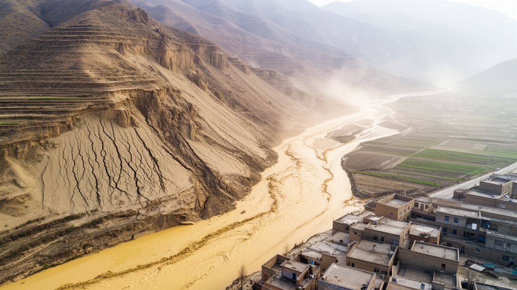
Shortly before midnight on 18 December 2023, a magnitude 6.2 earthquake struck Jishishan County in Gansu Province, northwestern China, and within minutes set off one of the deadliest single landslides of the event. The Caotan landslide, a loess landslide–mudflow that originated roughly 14.8 kilometers from the epicenter, killed 19 people, buried 74 houses, and damaged approximately 3.2 kilometers of roads and 13 hectares of farmland. A new open-access study in the journal Geoenvironmental Disasters now presents a detailed field-based reconstruction of how the slope failed and how the displaced mass traveled so far, so fast, across terrain so gentle that the event stands out even among the 3,767 coseismic landslides the earthquake triggered.
The earthquake itself was devastating. The mainshock occurred at approximately 23:59:30 local time, with its epicenter at 35.745°N, 102.827°E and a focal depth of about 10 kilometers. Researchers interpret the focal mechanism as a shallow thrust-fault event, and the China Earthquake Administration assigned a maximum seismic intensity of VIII. By 24 December 2023, twelve aftershocks with magnitudes greater than 3.0 had been recorded. In total, 151 people were killed and 983 injured, making this the deadliest earthquake in China since the 2014 Ludian event. The disaster destroyed 70,000 houses, damaged another 99,000, and caused an estimated direct economic loss of 14.612 billion yuan. Yet most of the coseismic landslides left small scars of less than 0.5 square kilometers and limited runout, and coseismic landslides caused few casualties except at Caotan.
The scale of the Caotan movement is what makes it exceptional. The landslide spanned a total length of 2,917 meters, reached a maximum width of about 650 meters, and descended only 81 meters from its source on the third terrace of the Yellow River, at roughly 1,753 meters above sea level, down to the first terrace. That geometry yields an angle of reach of just 1.6 degrees, calculated as the arctangent of the elevation drop divided by the horizontal travel distance. The authors stress that this figure is a bulk mobility index only and must not be read as the intrinsic or equivalent friction angle of the soil. Even so, the value documents extraordinary mobility: a mass of displaced loess and alluvial material crossed nearly three kilometers of ground while dropping the height of a modest hill.
Reconstructing the event required an intensive field campaign. Beginning on 23 December 2023, five days after the earthquake, and continuing through 6 January 2024, the team carried out UAV photogrammetric surveys, excavated two trenches, drilled two boreholes near the main scarp and the right flank of the sliding area, and conducted in situ testing including a standard penetration test. The landslide boundary was delineated by comparing pre-failure satellite imagery and a digital elevation model with post-failure UAV orthophotography. The total affected area came to approximately 476,880 square meters, subdivided into a sliding area of 127,130 square meters, a flow area of 83,810 square meters, and a deposition area of 265,940 square meters.
Eyewitness accounts collected during the investigation underline how fast the mass moved. Residents of Meiyi Village reported that the flow reached the vicinity of their homes shortly after the earthquake, and officials from Zhongchuan Town and residents of Jintian Village said it reached Caotan and Jintian villages within ten minutes.
The geological setting helps explain why this particular slope failed so catastrophically. The study area sits at the northeastern margin of the Tibetan Plateau, in the transition zone between the Loess Plateau and the Qinghai-Tibet Plateau, within the southern part of the South Qilian Block at the junction of the Qilian and West Qinling orogenic belts. The region contains strike-slip and thrust faults and fault-bounded rhombic basins, including the Lajishan Fault, the Daotanghe-Linxia Fault, and the West Qinling Fault. The Lajishan Fault, characterized by an imbricate thrust structure, is the principal fault traversing the region, and the Lajishan North Fault is considered the seismogenic fault for the 2023 earthquake. Although the fault was highly active during the Neogene and early Quaternary, its activity has decreased since the late Pleistocene, and only twenty historical earthquakes with magnitudes below 6.0 had been documented before the 2023 event, which is the largest recorded to date.
The strata around the landslide include Holocene alluvial and alluvial-proluvial deposits, Upper Pleistocene alluvial-proluvial deposits and loess, and Lower Pleistocene deposits, overlying Miocene sandstone and silty mudstone interbedded with conglomerate, Oligocene conglomerate and sandstone, Lower Cretaceous and Middle Jurassic rocks, and Caledonian igneous bodies. Paleogene and Neogene mudstone and sandstone, together with Upper Pleistocene loess, are the principal strata associated with landslide formation in the area. The climate is arid and continental, with a mean annual temperature of 9 degrees Celsius and mean annual precipitation of roughly 300 millimeters. Although the maximum daily precipitation on record is 142.5 millimeters, the earthquake struck in winter, when a pluviometer about 7.3 kilometers west of the landslide recorded only 10.6 millimeters of daily precipitation, and cumulative precipitation during the preceding month was less than 15 millimeters. The authors therefore conclude that antecedent rainfall made little contribution to initiation.
The sliding area lies on the nearly flat third terrace, where the mean slope is approximately 3.63 degrees. The main scarp is nearly straight, and most of the subtriangular source mass converged southward toward the head of the Qijia Valley while a smaller part moved eastward, leaving residual stripes that record these directions. In the frontal part of the source area, the preserved morphology is consistent with coherent displacement above a possible deep basal shear zone. The upper and lower intervals of this frontal mass collapsed, whereas part of the middle interval remained relatively intact on the sliding bed, and the authors note that these terms are morphological descriptors rather than formal stratigraphic units. Near the main scarp, the rear source mass underwent lateral spreading under traction from the front mass and came to rest in a wave-like pattern after a short displacement. Headward erosion was less extensive near the left flank than near the right flank, and the authors suggest that the higher moisture content near the right flank, where farmland had been continuously irrigated for three days before the earthquake, may have contributed to this difference.
Once the mass began moving, most of it traveled southeastward into the Qijia Valley and disintegrated as it descended the steep valley head. Interviews indicated a winter water depth of approximately 0.5 meters in the upstream valley, and water released by damaged irrigation ditches also entered the channel. Mixing with this water likely reduced the shear resistance of the fragmented mass and promoted its transition from sliding to highly mobile flow. The upstream valley slope is approximately 17 degrees, and comparison of pre- and post-failure imagery shows channel widening from substantial lateral erosion, which entrained additional solid material from both valley sides. The flow reached the dam near Meiyi Village roughly two minutes after the earthquake, where a mud mark on a house wall and the former dam geometry indicate a maximum surge height greater than 10 meters. The dam deflected the flow both northward and southward; the northward branch stopped after about 134 meters as the ground rose. A pre-existing pond, confirmed by pre-failure imagery and residents, supplied additional water when it was damaged. Downstream, the turning valley, blockage by the dam, a slope below 5 degrees, and relatively dry channel conditions progressively reduced the flow velocity, and the surge height at the memorial archway was approximately 4 meters.
In the deposition area, beyond the memorial archway and road X881, the flow spread at low velocity and buried houses in Caotan and Jintian villages. Most houses and roads remained in place and were buried or partly damaged rather than completely destroyed, and the upper stories of buried houses showed little impact damage. Nevertheless, the reported flow depth of 2 to 3 meters and the sudden midnight onset caused severe casualties. The deposit morphology is consistent with a transition from slurry to plastic flow in this reach. Most of the mass stopped upstream of an irrigation ditch south of Jintian Village, while a smaller portion received additional water from damaged ponds and ditches, reverted to a shallow slurry flow, and traveled approximately 772 meters farther across farmland. The proposed movement sequence comprises seven stages: coherent sliding above an inferred basal shear zone, lateral spreading, disintegration, slurry flow, plastic flow, renewed slurry flow, and final deposition.
The subsurface investigation revealed at least eight layers, from dark-gray humus and brick-red alluvial-proluvial clay near the surface, through dark loessial soil, a pebble layer, brick-red silty clay, and a thick loess unit extending from 2.2 to 21.0 meters, down to brownish-red silty clay and gravelly sand at depth. Because the second and third terraces of the Yellow River formed approximately 80,000 and 150,000 years ago respectively, the loess in the main source mass is Late Pleistocene in age. A standard penetration test near borehole 1, which recorded a groundwater-table depth of 11 meters, identified a low-resistance interval between 9 and 17 meters in an exploratory comparison against an empirical reference blow count, with a local minimum near the measured groundwater table. Trench measurements showed dry density of about 1.5 to 1.6 grams per cubic centimeter at 1.0 to 2.2 meters depth, decreasing to 1.3 to 1.4 grams per cubic centimeter in the underlying loess, where the void ratio rises above 0.97. Soil at 0.8 meters depth was nearly saturated, consistent with winter irrigation, and the loess was saturated at 3.6 meters, with seepage observed below 3.0 meters one day after trench excavation. Together with the penetration data, these measurements indicate a shallow, saturated, low-strength interval at approximately 2 to 5 meters depth that may be susceptible to cyclic weakening.
The authors emphasize that all water-level and moisture observations are post-event measurements rather than records of co-seismic conditions, and that the inferred liquefaction depth, basal shear surface, and movement sequence remain interpretations. The screening formula they applied was developed for saturated sands and silts excluding loess, and the subsurface coverage was limited to two boreholes, two trenches, and one penetration profile, with no direct pore-pressure or continuous velocity records. They conclude that the observations are consistent with localized cyclic weakening, potentially including liquefaction, in low-density, low-strength, highly saturated loess, and that laboratory cyclic testing, groundwater monitoring, additional subsurface investigation, and dynamic simulation are needed to test the proposed mechanisms. They also note that the event was initially described in media reports as a sand boil, but field evidence indicates the moving material should be classified as a landslide–mudflow, and that liquefaction potential in loess-covered regions should be systematically assessed using site-specific topographic, stratigraphic, geotechnical, and hydrological evidence.
Subject of Research: Field reconstruction of the initiation mechanism and long-runout movement of the earthquake-triggered Caotan loess landslide-mudflow in Gansu, China
Article Title: Initiation mechanism and movement characteristics of the catastrophic Caotan landslide triggered by the Ms 6.2 Jishishan earthquake on 18 December 2023 in Gansu, northwestern China
Article References: Li, R., Sun, P., Zhang, S., Sang, K., Ke, C., Wei, Z., Wang, T., & Li, Y. (2026). Initiation mechanism and movement characteristics of the catastrophic Caotan landslide triggered by the Ms 6.2 Jishishan earthquake on 18 December 2023 in Gansu, northwestern China. Geoenvironmental Disasters, 13(1), Article 68. https://doi.org/10.1186/s40677-026-00416-1
Image Credits: AI Generated
DOI: 10.1186/s40677-026-00416-1
Keywords: landslide, mudflow, loess, liquefaction, earthquake, Jishishan, Gansu, coseismic landslides, standard penetration test, groundwater, runout, Yellow River terraces
Cite Scienmag News
Violet Maxwell. (October 27, 2026). Deadly loess landslide-mudflow triggered by 2023 Jishishan earthquake reconstructed. Scienmag. https://scienmag.com/deadly-loess-landslide-mudflow-triggered-by-2023-jishishan-earthquake-reconstructed/
Violet Maxwell. "Deadly loess landslide-mudflow triggered by 2023 Jishishan earthquake reconstructed." Scienmag, 27 October 2026, https://scienmag.com/deadly-loess-landslide-mudflow-triggered-by-2023-jishishan-earthquake-reconstructed/. Accessed 28 October 2026.
Violet Maxwell. "Deadly loess landslide-mudflow triggered by 2023 Jishishan earthquake reconstructed." Scienmag. October 27, 2026. https://scienmag.com/deadly-loess-landslide-mudflow-triggered-by-2023-jishishan-earthquake-reconstructed/