


Marine geologists in China have compiled and released an open-access dataset of grain-size measurements for 744 surface sediment samples spanning the Bohai Sea, the Yellow Sea, and the East China Sea, the country’s three major continental shelf seas. The compilation, published as a data description article in Earth System Science Data, is notable less for any single measurement than for its uniformity: every sample was analyzed with the same instrument, in the same laboratory, under the same pretreatment protocol, over a collection period running from 2001 to 2019. That consistency, the authors argue, is what has been missing from a region whose sedimentological records have long been scattered across individual papers, institutional reports, and proprietary databases.
The dataset was assembled by researchers at the Qingdao Institute of Marine Geology, part of the China Geological Survey, led by corresponding authors Xiaoyong Duan, Bin Chen, Ping Yin, and colleagues. Their study area stretches across more than 14 degrees of latitude and 11 degrees of longitude, from the shallow, semi-enclosed Bohai embayment to the outer edge of the East China Sea shelf at water depths approaching 200 meters. The 744 samples break down as 107 from the Bohai Sea, 250 from the Yellow Sea, and 387 from the East China Sea, with sampling density highest in the South Yellow Sea and the inner East China Sea shelf and sparsest on the outer shelf and in parts of the northernmost Yellow Sea.
Why does grain size matter so much to sedimentologists? The size distribution of seafloor particles is a physical fingerprint of the environment that deposited them. It encodes information about sediment sources, transport pathways, the energy of tides and waves, and the conditions under which material settled out of suspension. On continental shelves, where river plumes, strong tidal currents, and open-ocean currents all compete, the spatial pattern of sand, silt, and clay on the seabed directly reflects that interplay. Systematic grain-size data feed into sediment budget estimates, numerical transport models, benthic habitat maps, paleoenvironmental reconstructions, and marine spatial planning, which is precisely why a fragmented record has been such an obstacle for regional synthesis.
The Chinese marginal seas are an especially compelling place to build such a record. The Bohai Sea receives substantial sediment discharge from the Yellow River, historically on the order of 1.1 billion tonnes per year, though greatly reduced in recent decades, and averages only about 18 meters in depth. The Yellow Sea, averaging 44 meters, hosts the Holocene-aged central South Yellow Sea mud deposit and is steered by the Yellow Sea Warm Current and coastal currents. The East China Sea absorbs the Yangtze River’s discharge of roughly 470 million tonnes per year and is swept by the Kuroshio Current, the Taiwan Warm Current, and a coastal current system, producing a shelf that juxtaposes fine inner-shelf muds near the Yangtze estuary with extensive relict sandy deposits on the outer shelf.
Collection followed China’s national marine survey standard, GB/T 12763.8–2007, with samples taken using box samplers during multiple cruises. After 2005 most samples came from the research vessel Yezhizheng, renamed R/V Marine Geology NO. 7 in 2020, while pre-2005 samples were collected from chartered vessels whose detailed records no longer survive. From each box core, the top 0 to 5 centimeters of sediment was subsampled, sealed in polyethylene bags, and stored at room temperature before analysis. Each sample carries a unique identifier, a station identifier, a sampling year, and WGS84 coordinates, giving the dataset a machine-readable structure that older compilations often lack.
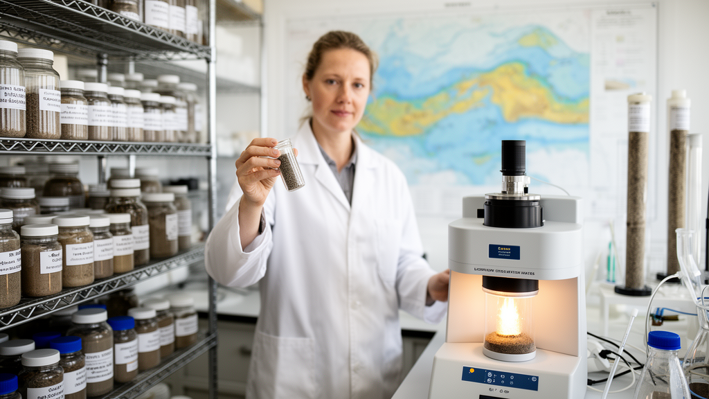
Laboratory work centered on a Malvern Mastersizer 2000 laser diffraction particle size analyzer, which measures particle sizes from 0.02 to 2000 micrometers with an accuracy of plus or minus 1 percent on the volume median diameter for standard reference materials. Before measurement, roughly 1 to 2 grams of homogenized sediment were digested with 30 percent hydrogen peroxide for 24 to 48 hours to strip out organic matter, then dispersed in deionized water with sodium hexametaphosphate as a dispersing agent and ultrasonicated for 60 seconds to break up aggregates. Every sample was measured in triplicate, and the average volume percentage for each size bin was reported. The instrument’s native output of 100 size bins was resampled to 45 bins at 0.25 phi intervals, spanning from minus 1 phi, equivalent to 2000 micrometers, to greater than 10 phi, below roughly 1 micrometer.
Beyond the raw distributions, the dataset provides Folk–Ward graphical statistical parameters, the de facto standard in sedimentological practice: mean grain size, the sorting coefficient, skewness, and kurtosis, calculated from percentiles of the cumulative distribution curve. The authors chose the graphical method over moment statistics because it is robust to outliers and to the truncated fine tail inherent in laser-diffraction data, and because it ensures comparability with most published shelf-sediment datasets; moment-method parameters are included in the files for cross-reference. Textural classes follow the Udden–Wentworth scale, with sand defined as 63 to 2000 micrometers, silt as 3.9 to 63 micrometers, and clay as finer than 3.9 micrometers. Two companion Excel files, one in phi units and one in micrometers, each hold 744 rows and 77 columns, accompanied by a README describing variables, methods, unit conventions, and quality flags.
The numbers reveal a shelf of striking textural diversity. Sand content ranges from 0 to 100 percent across the dataset, with a mean of 40.5 percent; silt ranges from 0 to 76.8 percent, averaging 41.1 percent; and clay ranges from 0 to 50.3 percent, averaging 18.4 percent. Mean grain size spans 1.51 to 8.13 phi, from very coarse sand to clay, with an overall mean of 5.23 phi, corresponding to roughly 27 micrometers. Sorting coefficients run from 0.41, indicating well-sorted material, to 3.30, indicating very poorly sorted sediment, with a mean of 2.14 that points to the predominantly poor sorting typical of fluvial-influenced shelf environments. Skewness ranges from minus 2.39, strongly coarse-skewed, to 3.06, strongly fine-skewed, with a mean of 1.53 reflecting the fine-skewed distributions characteristic of muddy shelf deposits.
The spatial patterns tell a coherent regional story. Bohai Sea samples are predominantly fine-grained, with a mean grain size of 5.82 phi and combined silt and clay fractions exceeding 70 percent at most stations, a signature the authors attribute to Yellow River-derived fine sediment. Yellow Sea samples in the survey area are likewise dominated by fine textures, with silt-rich sediments concentrated in the central South Yellow Sea mud deposit. The East China Sea shows the widest textural range of the three seas, from fine-grained inner-shelf muds near the Yangtze estuary, through transitional mixed sediments on the mid-shelf, to coarse relict sands on the outer shelf. Spatial maps of these fractions and parameters were produced by ordinary point kriging onto a 0.1-degree grid using a spherical variogram model, though the authors caution that because sand, silt, and clay are compositional data summing to 100 percent, the interpolated maps should be read as smoothed regional trends rather than precise local estimates.
The team also documents the method’s limits with unusual candor. Hydrogen peroxide removes labile organic matter, but refractory organics and biomineral aggregates may persist, so sediments with organic carbon above 2 percent may register slightly coarser than their mineral particles alone. Laser diffraction tends to underestimate the clay fraction relative to the classical pipette method, particularly for the platy clay minerals such as illite and smectite that dominate Chinese shelf sediments, so comparisons with historical pipette data warrant caution. The instrument cannot resolve material coarser than 2 millimeters, meaning gravel goes uncharacterized and the reported sand fraction covers only 63 to 2000 micrometers. No acid pretreatment was applied for carbonate removal, so locally elevated shell hash could bias distributions toward coarse sizes. Measurement precision was strong: the coefficient of variation for the median grain size was typically below 3 percent for silty and clayey samples and below 5 percent for sandy samples with bimodal distributions, with the median size showing the highest reproducibility and the distribution tails the lowest, as expected for laser diffraction.
Archived at Science Data Bank under a Creative Commons Attribution 4.0 license, the dataset is, by the authors’ assessment, the most comprehensive open-access compilation of uniformly measured grain-size data for surface sediments across all three Chinese marginal shelf seas, with previous regional datasets typically confined to single sea areas or specific transects. They anticipate uses ranging from sediment transport modeling and paleoenvironmental studies to benthic habitat mapping, calibration of remote sensing algorithms, and baselines for environmental monitoring, and they flag future updates that could add samples from under-represented areas and integrate geochemical and mineralogical data. For modelers of the East Asian marginal seas, the value lies in the single-instrument, single-laboratory protocol that makes 744 samples from nearly two decades of cruising directly comparable at basin scale.
Subject of Research: A unified laser diffraction grain-size dataset for surface sediments of the Bohai, Yellow, and East China seas
Article Title: Surface sediment grain-size characteristics of the Bohai, Yellow, and East China seas: a comprehensive survey based on unified laser diffraction analysis
Article References: Duan, X., Chen, B., Li, M., Wang, S., Yin, P., Chen, B., & Zhang, J. (2026). Surface sediment grain-size characteristics of the Bohai, Yellow, and East China seas: a comprehensive survey based on unified laser diffraction analysis. Earth System Science Data, 18(10), 7743-7750. https://doi.org/10.5194/essd-18-7743-2026
Image Credits: AI Generated
DOI: 10.5194/essd-18-7743-2026
Keywords: grain size, laser diffraction, Bohai Sea, Yellow Sea, East China Sea, continental shelf, sedimentology, open data, Folk-Ward parameters, marine geology, Yellow River, Yangtze River
Cite Scienmag News
Violet Maxwell. (October 26, 2026). One Laser, 744 Sediments: China’s Shelf Seas Mapped in a Single Grain-Size Dataset. Scienmag. https://scienmag.com/one-laser-744-sediments-chinas-shelf-seas-mapped-in-a-single-grain-size-dataset/
Violet Maxwell. "One Laser, 744 Sediments: China’s Shelf Seas Mapped in a Single Grain-Size Dataset." Scienmag, 26 October 2026, https://scienmag.com/one-laser-744-sediments-chinas-shelf-seas-mapped-in-a-single-grain-size-dataset/. Accessed 26 October 2026.
Violet Maxwell. "One Laser, 744 Sediments: China’s Shelf Seas Mapped in a Single Grain-Size Dataset." Scienmag. October 26, 2026. https://scienmag.com/one-laser-744-sediments-chinas-shelf-seas-mapped-in-a-single-grain-size-dataset/


