

Thursday, October 22, 2026
Science
No Result
View All Result
  • Login
  • HOME
  • SCIENCE NEWS
  • CONTACT US
  • HOME
  • SCIENCE NEWS
  • CONTACT US
No Result
View All Result
Scienmag
No Result
View All Result
Home Science News Earth Science

GIS Survey Maps 649 Springs in Two South Kashmir Districts

October 22, 2026
in Earth Science, Science News
Violet Maxwell
By Violet Maxwell Scienmag Editorial Profile - Natural Hazards
Reading Time: 3 mins read
0
GIS Survey Maps 649 Springs in Two South Kashmir Districts

GIS Survey Maps 649 Springs in Two South Kashmir Districts

65
SHARES
587
VIEWS
Share on FacebookShare on Twitter
ADVERTISEMENT

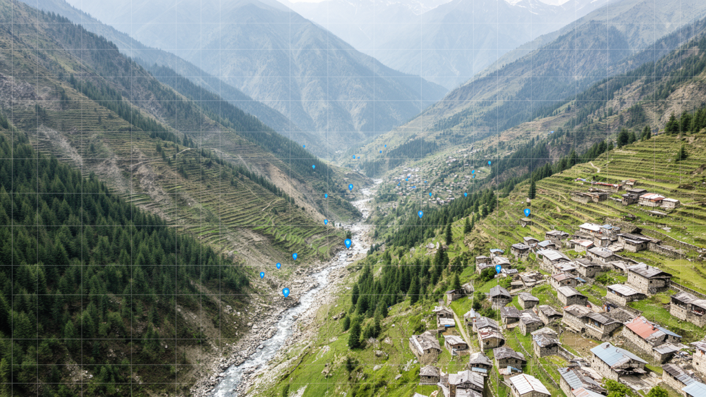
A field survey and geographic information system analysis identified 649 springs in the Anantnag and Kulgam districts of South Kashmir, establishing a geospatial baseline for a water source whose detailed records have been scarce. Researchers surveyed the area in 2021 and 2022, using GPS to record spring locations and documenting elevation, water flow, seasonality, ownership, use, dependency and conservation status. Of the springs included in the inventory, 79.8% were perennial, 8.5% were seasonal and 11.7% were dry when observed. The study covers a two-district area within the Kashmir Himalaya rather than the region’s full spring-resource network.

The spring inventory combined field observations with spatial analysis of physiographic conditions, land use and elevation. Each mapped site was assigned a geographic position and characterized by its measured discharge and reported seasonal behavior. Flow measurements showed that most springs had discharges corresponding to the fifth and sixth magnitudes in the Meinzer Classification. Most were also located below 1,700 meters, on flat landscapes and in horticultural regions. These spatial patterns identify where springs are concentrated within the surveyed districts, but they do not establish why the springs occur in those settings or whether their conditions have changed over time.

Local community members reported that spring discharge and reliability had decreased during the preceding 10 years. The report could not be confirmed as a measured trend because the study area lacked the long-term hydrological records needed to verify it. The researchers also did not demonstrate direct links between spring conditions and potential causes such as climate change, land-use change or groundwater use. Their assessment instead identifies areas where spring systems may face greater risk and provides a reference for future research, long-term monitoring and climate-adaptation planning. Because the findings are based on observations of 649 springs in Anantnag and Kulgam, they should not be treated as representative measurements for every spring across the Kashmir Himalaya.

The study’s utility lies in documenting both the physical characteristics of springs and information about their relationship with local communities. Recording ownership, use, dependency and conservation status alongside location, elevation and discharge makes the inventory a combined assessment of spring resources rather than a map of water points alone. The GIS framework also allows mapped springs to be examined against physiographic, land-use and elevation units. This spatial structure can support the prioritization of monitoring, conservation and restoration work, while the baseline observations provide a reference for future assessments of flow status, reliance and conservation needs.

Several limits constrain what the inventory can establish. The reported scarcity of long-term hydrological records prevents a verified comparison of spring discharge and reliability across the community-reported decade. The results also do not attribute observed seasonal availability or dry conditions to particular environmental or human drivers. Nevertheless, the survey documents where springs are located, how much they were flowing during fieldwork, whether they were perennial, seasonal or dry, and how local users characterized their dependence on and management of them. By converting an under-documented mountain resource into a georeferenced set of physical and social observations, the study provides a foundation for monitoring and conservation planning in South Kashmir.

Subject of Research: Geospatial inventory and utility assessment of springs in Anantnag and Kulgam districts

Article Title: GIS-based inventory and utility assessment of spring resources in the Kashmir Himalaya

Article References: Maqbool, U., Ahsan, S., Bhat, M. S., Alam, A., Wani, M. S., & Sheikh, H. A. (2026). GIS-based inventory and utility assessment of spring resources in the Kashmir Himalaya. Frontiers in Water, 8, 1913677. https://doi.org/10.3389/frwa.2026.1913677

Image Credits: AI Generated

DOI: 10.3389/frwa.2026.1913677

Keywords: Kashmir Himalaya, spring inventory, GIS, field survey, water resources, spring discharge, South Kashmir, hydrological monitoring, land use, climate adaptation, GIS-based, inventory

Cite Scienmag News

Violet Maxwell. (October 22, 2026). GIS Survey Maps 649 Springs in Two South Kashmir Districts. Scienmag. https://scienmag.com/gis-survey-maps-649-springs-in-two-south-kashmir-districts/

Violet Maxwell. "GIS Survey Maps 649 Springs in Two South Kashmir Districts." Scienmag, 22 October 2026, https://scienmag.com/gis-survey-maps-649-springs-in-two-south-kashmir-districts/. Accessed 22 October 2026.

Violet Maxwell. "GIS Survey Maps 649 Springs in Two South Kashmir Districts." Scienmag. October 22, 2026. https://scienmag.com/gis-survey-maps-649-springs-in-two-south-kashmir-districts/


Tags: Climate Adaptationfield surveygeospatial baseline for Kashmir water resourcesGISGIS-basedGIS-based water source analysisGPS survey of spring locationsHimalayan spring resource managementhydrological monitoringhydrological study of Kashmir Himalayaimpact of land use on spring flowInventoryinventory of perennial and seasonal springsKashmir Himalayaland usephysiographic and land use analysis of springsSouth Kashmirspatial distribution of springs in Anantnag and Kulgamspring dischargespring discharge and seasonality assessmentspring inventoryspring mapping in South Kashmirwater conservation status of Kashmir springswater resources
Share26Tweet16
Previous Post

Fijian native chicken crosses match meat quality under scavenging conditions

Next Post

Mixed-method study maps climate adaptation across seven northern Bangladesh farming sites

Related Posts

Real-Time Floc Monitoring Optimizes Dewatering of Fine Copper Tailings
Climate

Real-Time Floc Monitoring Optimizes Dewatering of Fine Copper Tailings

October 22, 2026
Staff identify practical barriers before measurement-based care rollout in Alberta youth mental health
Medicine

Staff identify practical barriers before measurement-based care rollout in Alberta youth mental health

October 22, 2026
Mixed-method study maps climate adaptation across seven northern Bangladesh farming sites
Climate

Mixed-method study maps climate adaptation across seven northern Bangladesh farming sites

October 22, 2026
Fijian native chicken crosses match meat quality under scavenging conditions
Biology

Fijian native chicken crosses match meat quality under scavenging conditions

October 22, 2026
Cross-sectional study links activity and self-esteem among Yi adolescents
Psychology & Psychiatry

Cross-sectional study links activity and self-esteem among Yi adolescents

October 22, 2026
Research report: Low prevalence of celiac disease in French children, a nationwide study
Technology and Engineering

Research report: Low prevalence of celiac disease in French children, a nationwide study

October 22, 2026
Next Post
Mixed-method study maps climate adaptation across seven northern Bangladesh farming sites

Mixed-method study maps climate adaptation across seven northern Bangladesh farming sites

  • Mothers who receive childcare support from maternal grandparents show more optimized

    Mothers who receive childcare support from maternal grandparents show more parental warmth, finds NTU Singapore study

    27656 shares
    Share 11059 Tweet 6912
  • University of Seville Breaks 120-Year-Old Mystery, Revises a Key Einstein Concept

    1061 shares
    Share 424 Tweet 265
  • Bee body mass, pathogens and local climate influence heat tolerance

    682 shares
    Share 273 Tweet 171
  • Researchers record first-ever images and data of a shark experiencing a boat strike

    546 shares
    Share 218 Tweet 137
  • Groundbreaking Clinical Trial Reveals Lubiprostone Enhances Kidney Function

    531 shares
    Share 212 Tweet 133
Science

Embark on a thrilling journey of discovery with Scienmag.com—your ultimate source for cutting-edge breakthroughs. Immerse yourself in a world where curiosity knows no limits and tomorrow’s possibilities become today’s reality!

RECENT NEWS

  • Real-Time Floc Monitoring Optimizes Dewatering of Fine Copper Tailings
  • Staff identify practical barriers before measurement-based care rollout in Alberta youth mental health
  • Mixed-method study maps climate adaptation across seven northern Bangladesh farming sites
  • GIS Survey Maps 649 Springs in Two South Kashmir Districts

Categories

  • Agriculture
  • Anthropology
  • Archaeology
  • Athmospheric
  • Biology
  • Biotechnology
  • Blog
  • Bussines
  • Cancer
  • Chemistry
  • Climate
  • Earth Science
  • Editorial Policy
  • Marine
  • Mathematics
  • Medicine
  • Pediatry
  • Policy
  • Psychology & Psychiatry
  • Science Education
  • Science News
  • Social Science
  • Space
  • Technology and Engineering

Subscribe to Blog via Email

Enter your email address to subscribe to this blog and receive notifications of new posts by email.

Join 5,151 other subscribers

© 2025 Scienmag - Science Magazine

Welcome Back!

Login to your account below

Forgotten Password?

Retrieve your password

Please enter your username or email address to reset your password.

Log In
No Result
View All Result
  • HOME
  • SCIENCE NEWS
  • CONTACT US

© 2025 Scienmag - Science Magazine

Discover more from Science

Subscribe now to keep reading and get access to the full archive.

Continue reading