


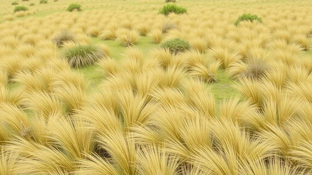
Hidden in the cold, windswept corners of Europe lies a botanical treasure trove that scientists have long struggled to catalogue. Now, a collaborative database is bringing the grasslands, heathlands, arctic-alpine communities and coastal dunes of the Nordic-Baltic region into sharper focus than ever before. The Nordic-Baltic Grassland Vegetation Database, known as NBGVD, has grown to 12,694 vegetation plots as of March 2024, according to a new report published in the journal Vegetation Classification and Survey. The database, registered under the Global Index of Vegetation-Plot Databases with the code EU-00-002, covers Belarus, Denmark, Estonia, the Faroe Islands, Finland, Iceland, Latvia, Lithuania, Norway, the Polish lowlands, northwestern Russia, Svalbard and Jan Mayen, and Sweden. Its expansion is quietly reshaping how ecologists can study vegetation across Europe and beyond.
The story of NBGVD begins more than a century ago, because the oldest records in the database date back to 1910. Most of the 12,694 plots were digitised from published literature, which accounts for 84 percent of the content, while the remaining 16 percent come from individual unpublished sources. This reliance on historical sources is a direct consequence of the region’s scientific history. Unlike central and western Europe, where the Zurich-Montpellier school of phytosociology encouraged researchers to collect large numbers of vegetation-plot records, called relevés, for broad-scale classification, the Nordic and Baltic countries followed the Russian and Nordic schools of vegetation ecology. These traditions never made mass collection of relevés a priority, leaving the region with a far lower density of historic vegetation plots than most of Europe.
That gap matters enormously for modern science. Large continental and global databases such as the European Vegetation Archive, the global database sPlot, and the specialised GrassPlot database for Palaearctic open habitats have enormous potential for vegetation ecology, macroecology and global-change studies, because they allow researchers to generalise beyond local or regional extents. Studies using EVA data, for example, have shed light on the broad-scale classification of dry grassland types, the frequency and distribution of neophytes in European grasslands, and the relationship between functional and phylogenetic diversity in grasslands. The sPlot database has been used to model how alpha-diversity patterns in grasslands and forests vary globally across grain sizes, and to test what drives stability in grasslands. But such analyses depend on balanced data coverage across regions, and the Nordic countries, northwestern Russia and Belarus have long been underrepresented, particularly for grasslands.
The consequences of sparse data are not merely statistical. Even for fen vegetation, one of the most typical vegetation types of the boreal zone, current data in EVA give the false impression that fens would be rare in middle and northern Sweden and Finland. Denmark and Poland appear reasonably well represented on the EVA map, but appearances deceive. The main source of Danish data, the NATURDATA.DK database, is represented in EVA only with presence-absence data, which cannot be used for studies requiring cover estimates, while data from the Polish Vegetation Database have repeatedly not been released for specific research projects. Models derived for the Nordic-Baltic region in many international studies therefore have weaknesses due to sparse grassland data. Most countries in the region, except Germany, Poland and Lithuania, still lack national vegetation-plot databases, and while forests and mires are partly covered by other databases, a major gap remained for grasslands and other open habitats.
NBGVD emerged from a narrower project focused on the dry grasslands of the region, originally managed in the software SORT before being transferred to TURBOVEG 2.0. Starting with 7,675 plots in 2012 and 9,839 plots in 2022, the database has now grown to 12,694 plots, a net gain of 5,019 plots over twelve years. The number of plots newly made available to EVA during this period was even higher, at 9,143, because more than 4,000 plots were excluded: all German plots were transferred to the sister database GrassVeg.DE, and plots now included in a specialised Latvian database were removed to avoid duplicates. The database is a self-governed consortium in which every data contributor becomes a member, regulated by a set of Bylaws. Members elect a Custodian and a Deputy Custodian for two-year renewable terms, with J. Dengler currently serving as Custodian and Ł. Kozub as Deputy.
The scope of NBGVD is deliberately broad. According to its Bylaws, the main focus is all natural and semi-natural grasslands in the broad sense, but the database collects any vegetation types except forests, shrublands, true aquatic communities and arable fields. Target vegetation classes include lowland grassland and heathland communities such as Calluno-Ulicetea, Festuco-Brometea, Koelerio-Corynephoretea canescentis, Molinio-Arrhenatheretea, Nardetea and Sedo-Scleranthetea; arctic-alpine communities including Salicetea herbaceae and Loiseleurio procumbentis-Vaccinietea; coastal communities such as Ammophiletea and Juncetea maritimi; wetland communities including Scheuchzerio palustris-Caricetea fuscae; as well as rocky, tall-herb and ruderal communities. Relevés must refer to contiguous plots with a specified area between 0.09 and 400 square metres, and while direct percent cover estimates are preferred, other cover or cover-abundance measures such as variants of the Braun-Blanquet or Hult-Sernander scales are accepted. Pure presence-absence data are not.
The geographic distribution of the plots is strikingly uneven. The Polish lowlands and Sweden dominate, each contributing roughly a quarter of the plots, at 24.8 and 24.6 percent respectively, followed by Belarus with 12.9 percent and Estonia with 10.3 percent. Plot density varies dramatically between territories, from a maximum of 515 plots per 1,000 square kilometres on the Faroe Islands to values below one plot per 1,000 square kilometres in Finland and northwestern Russia. Within territories, densities peak on Saaremaa on Estonia’s west coast and on the Faroe Islands. The database still contains very few plots from Russia and from the northern parts of Finland and Sweden north of the 62nd latitude. The records span 1910 to 2023, with a median year of 1997 and a peak in the two decades from 1990 to 2009.
One peculiarity of the region is the relatively small plot size. The overall median in NBGVD is just 4 square metres, with 1-square-metre plots accounting for 30 percent of the database and 4-square-metre plots for 17.1 percent. In six territories, including Belarus, Denmark, Estonia, the Faroe Islands, Latvia and Norway, plot sizes of 1 square metre or smaller prevail, while larger plots dominate only in Iceland, northwestern Russia, Poland and Latvia. This is well below the prevailing practice in most other European countries, which could pose a challenge when analysing Nordic-Baltic data together with data from the rest of Europe, since diversity measures depend strongly on plot size. The database contains datasets recorded with nine different cover or cover-abundance scales, dominated by the seven-step and nine-step variants of the Braun-Blanquet scale, followed by the Hult-Sernander scale, percent cover and the Londo scale. Four datasets used idiosyncratic scales defined for specific projects.
What sets NBGVD apart is its data quality, particularly regarding non-vascular plants. Bryophytes were treated in nearly 86 percent of the plots and lichens in 83 percent, meaning the database can provide real absences of these taxa, a level far above the EVA average. The most frequent vascular plant taxa include Festuca ovina in the aggregate sense, found in 30.6 percent of plots, Achillea millefolium aggr. at 28.9 percent, Galium verum at 25.2 percent, Hieracium pilosella aggr. at 23.5 percent and Festuca rubra aggr. at 23.4 percent. Among bryophytes, Ceratodon purpureus leads at 13.5 percent, while the lichen Cetraria islandica appears in 10 percent of plots with determined lichens. The database also stores 11 measured environmental variables referring to topography and soil characteristics, with elevation, slope aspect, slope inclination and pH in water available for at least a quarter of the plots. More than 75 percent of the plots are assigned to a vegetation class according to the standard Mucina et al. 2016 syntaxonomic reference, based on original assignments, expert interpretation or the EUNIS habitat classification run through the expert system implemented in JUICE.
In total, 35 vegetation classes are present, with Koelerio-Corynephoretea canescentis leading at 15.4 percent of plots, followed by Festuco-Brometea at 14.5 percent, Sedo-Scleranthetea at 8.3 percent, Molinio-Arrhenatheretea at 7.3 percent and Scheuchzerio palustris-Caricetea fuscae at 6.6 percent. The database contains data from 124 different sources contributed or digitised by 27 contributors, with four contributing more than 10 percent each. Coordinate precision varies widely, from GPS precision of five metres or less in 26 percent of plots to one kilometre in 42 percent and more than one kilometre in 32 percent, reflecting the coarse information often found in older literature. The team has taken great efforts to improve quality and consistency, correcting erroneous entries, filling in important header data fields such as vegetation class, and improving coordinate precision, which in the predecessor database under SORT was only given to 0.1 degrees.
The future of NBGVD depends on voluntary work, since the database has no funding. The team asks interested readers to contribute their own data or help find and digitise old data from the literature, with promising avenues including searching for the sources underlying the few synthetic vegetation overviews of the region and systematically screening regional botanical and ecological journals such as Acta Phytogeographica Suecica and Blyttia. Anyone with data matching the scope is welcome to contact the custodians, though data meeting the higher standards of the partner database GrassPlot, particularly those sampled on precisely delimited plots of standard sizes such as 0.1, 1, 10 or 100 square metres, are recommended for GrassPlot instead. Data from repeatedly sampled plots would likely be more beneficial if contributed to ReSurveyEurope. The team also aims to adjust the taxonomic backbone to current European standards, with the Euro+Med augmented standard for vascular plants and the Hodgetts et al. 2020 standard for bryophytes appearing particularly promising.
The payoff for this labour could be substantial. Having more high-quality plot data from the Nordic-Baltic region will not only improve the validity of future macroecological and global-change studies for the region, but will be particularly beneficial for the development of data-based broad-scale vegetation classification systems, of which only a few exist for the open habitats of the region so far, namely for fens, coastal dunes, bogs and springs across Europe, and for rocky outcrop communities in the Nordic-Baltic region. Data can be requested from the custodians directly or via EVA and sPlot, following their respective Bylaws. In early 2024, the database received its first direct data request, for a pan-European study combining European grassland data from sPlotOpen and GrassPlot while seeking data coverage in the Northern countries comparable to the rest of Europe. As climate change accelerates and grasslands face mounting pressures across the continent, the humble relevé, a small square of ground carefully catalogued by a patient botanist, may prove to be one of the most valuable scientific records of our time.
Subject of Research: Nordic-Baltic Grassland Vegetation Database (NBGVD) – current state and future prospects
Article Title: Nordic-Baltic Grassland Vegetation Database ( NBGVD ) – current state and future prospects
Article References: Skobel, N., Kozub, Ł., Dembicz, I., Boch, S., Bruun, H. H., Chusova, O., Golub, V., Helm, A., Iakushenko, D., Pawlikowski, P., Zaniewski, P., & Dengler, J. (2024). Nordic-Baltic Grassland Vegetation Database (NBGVD) – current state and future prospects. Vegetation Classification and Survey, 5, 75-84. https://doi.org/10.3897/vcs.119968
Image Credits: AI Generated
DOI: 10.3897/VCS.119968
Keywords: Nordic-Baltic, Grassland, Vegetation, Database, NBGVD, current, state, future, prospects, scientific research
Cite Scienmag News
Margaret Porter. (October 18, 2026). Nordic-Baltic Grassland Database Grows to 12,694 Vegetation Plots. Scienmag. https://scienmag.com/nordic-baltic-grassland-database-grows-to-12694-vegetation-plots/
Margaret Porter. "Nordic-Baltic Grassland Database Grows to 12,694 Vegetation Plots." Scienmag, 18 October 2026, https://scienmag.com/nordic-baltic-grassland-database-grows-to-12694-vegetation-plots/. Accessed 18 October 2026.
Margaret Porter. "Nordic-Baltic Grassland Database Grows to 12,694 Vegetation Plots." Scienmag. October 18, 2026. https://scienmag.com/nordic-baltic-grassland-database-grows-to-12694-vegetation-plots/


