


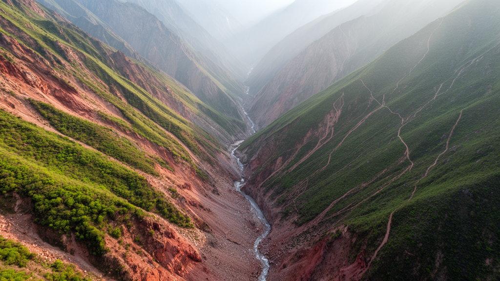
Deep in the Hengduan Mountains of northwestern Yunnan, where the Qinghai–Tibet Plateau plunges toward the Yunnan–Guizhou Plateau in a maze of deeply incised canyons, the landscape appears to be getting greener. A new analysis of twenty-four years of satellite data suggests, however, that this apparent recovery conceals a far more complicated and potentially precarious story—one in which rising human development pressure is quietly restructuring the ecology of one of the world’s most celebrated biodiversity hotspots.
The study, published in Humanities and Social Sciences Communications, was led by Tingyu Xiao and colleagues at Southwest Forestry University in Kunming. The team set out to answer a question that has long frustrated mountain ecologists: when a region’s vegetation cover improves over decades, is that improvement stable and durable, or is it a fragile surface trend masking hidden volatility? Their answer, drawn from remote-sensing records spanning 2000 to 2023, is that in this alpine canyon region the two conditions coexist—and that the mismatch between them carries substantial risk.
The researchers focused on fractional vegetation cover, or FVC, a core indicator of ecological health retrieved from a 250-meter normalized difference vegetation index dataset for China. FVC expresses the proportion of the ground, projected vertically, that is covered by leaves, stems, and branches. Using the pixel dichotomy model, each satellite pixel was treated as a mixture of fully vegetated and bare-soil endmembers, with the 2nd and 98th percentiles of each image’s NDVI distribution serving as the soil and vegetation reference values. The result is a continuous map of vegetation density, classified into five levels from very low to very high cover.
On the surface, the news is encouraging. Throughout the 24-year period, areas classified as high or very high vegetation cover together accounted for more than 65 percent of the region. The proportion of very high cover rose markedly, from 27.91 percent in 2000 to 34.50 percent in 2023, and transitions between cover classes occurred mainly between adjacent categories—a gradual expansion of high-quality vegetation rather than wholesale transformation. Spatially, the pattern remained remarkably stable, with extensive contiguous high-value coverage interspersed with localized low-value patches along deeply incised river valleys and near high-altitude margins.
Yet the vertical dimension of the landscape tells a sharper story. Because the region spans an elevation range exceeding 4000 meters, vegetation is strongly constrained by vertical zonation. The belt between 1500 and 3500 meters emerged as the core ecologically active zone: at 2500 to 3500 meters, the very high cover class dominated, accounting for more than half the area. Below 1500 meters, in the dry-hot canyon floors where the foehn effect on leeward slopes generates arid conditions, low and moderate cover increased and the distribution became more heterogeneous. Above 3500 meters, high-grade cover fell away sharply, and above 4500 meters the decline became abrupt—very low cover rose to roughly 90 percent of the area, becoming the dominant type in this extreme alpine zone, where cold and frequent freeze–thaw cycles exceed the tolerance thresholds of most vascular plants.
To capture the temporal character of these changes, the team combined two analytical approaches. The Theil–Sen median slope estimator, paired with the non-parametric Mann–Kendall test, provided the conventional linear trend assessment. But linear models struggle when ecosystems approach or cross ecological thresholds and undergo structural breaks, so the researchers also applied the BFAST01 model—Breaks For Additive Season and Trend—which decomposes each vegetation time series into trend, seasonal, and residual components, fits the seasonal signal with a third-order harmonic model matched to the 16-day MODIS sampling frequency, and then locates significant breakpoints in the trend using an ordinary least squares residuals-based moving sum stability test. The model automatically selects the optimal evolution scheme with the Bayesian information criterion and refines breakpoint trends into ten categories, from monotonic increases to interrupted and reversal patterns.
The comparison between the two methods proved revealing. In identifying stable vegetation areas, the linear and nonlinear approaches agreed exceptionally well, with a 92.65 percent overlap—strong evidence that the underlying analysis is robust. But among the areas that the linear method flagged as significantly increasing, only 18.59 percent represented purely monotonic growth. Roughly 80 percent of the significantly increasing areas actually displayed more complex nonlinear trajectories, such as interrupted increases or reversal-to-increase patterns. In other words, the apparent greening of northwestern Yunnan is substantially unstable: the study estimates a potential degradation risk of 73.3 percent of the study area when combining areas projected to degrade in the future (44.4 percent) with those already in continuous deterioration (28.9 percent), based on coupling the Hurst exponent with Sen’s slope. The Hurst analysis, which quantifies persistence in time series, revealed anti-persistent behavior in much of the region—meaning that areas currently stable or improving may reverse course.
The nonlinear model also recovered signals the linear approach missed. In 46.24 percent of pixels previously classified as significantly declining, BFAST01 detected positive breaks or reversal-to-increase patterns, indicating recent ecological recovery that linear trend analysis responds to only with a lag. The timing of abrupt changes showed a pronounced outbreak between 2009 and 2011, with 2011 recording the highest proportion of affected area at roughly 16 percent—a pattern the authors link to the lagged response of regional vegetation to the extreme drought of 2009–2010. The timing also varied systematically with elevation: high-altitude zones above 3500 meters experienced their dominant breakpoints early, with 2003 as the critical year, consistent with the greater sensitivity of alpine ecosystems to warming signals, whereas low-elevation valley areas below 1500 meters broke late and in concentrated fashion, with 2015 dominant—likely reflecting the cumulative effects of human activities such as slope farmland management and hydropower construction.
Attribution analysis added the study’s most striking quantitative finding. Using the optimal parameters-based geographical detector, or OPGD, which systematically searches five discretisation algorithms across classification intervals of 3 to 15 categories to maximize each factor’s explanatory q value, the team assessed natural and socio-economic drivers over the 2000–2020 window. Net primary productivity displayed the strongest individual explanatory power, with q values consistently exceeding 0.6, followed by temperature, elevation, and potential evapotranspiration. But the explanatory power of night-time light intensity—a satellite proxy for physical development activity such as hydropower construction, road networks, and expanding tourist towns—increased by 87.9 percent over the two decades, while the influence of GDP declined by 22.6 percent. Although socio-economic factors remained individually weak at the macro scale, their interactions with core natural drivers produced pronounced nonlinear enhancement: the interaction between temperature and NPP was the strongest pair, with q values stable between 0.77 and 0.79, and GDP combined with NPP reached 0.73 to 0.74. Human development, the authors conclude, tends to be nested within areas of optimal hydrothermal conditions, where it exerts a disproportionately strong restructuring influence on local vegetation patterns.
The findings carry direct implications for governance. The authors argue that a one-size-fits-all model risks both constraining appropriate development in valley areas and providing insufficient protection for high-altitude sensitive zones, and they propose elevation-differentiated strategies: strengthened development controls and ecological redlines below 1500 meters, a shift from incremental green expansion toward qualitative improvement of existing vegetation stands in the 1500–3500 meter core zone, and nature-based solutions with long-term monitoring above 3500 meters. They caution that the analysis identifies spatial associations rather than direct causality, and that terrain shadow effects and resampling uncertainty remain challenges in the Hengduan Mountains. Still, the central message stands: beneath the surface greening of this alpine canyon region lies a system of high volatility, where rising human pressure interacting nonlinearly with a natural hydrothermal baseline may be quietly pushing vegetation dynamics toward thresholds that conventional monitoring has yet to detect.
Subject of Research: Nonlinear fractional vegetation cover dynamics and their natural and socio-economic drivers in the alpine canyon region of northwestern Yunnan, China
Article Title: Nonlinear vegetation dynamics driven by socio-ecological coupling in the alpine canyon region of northwestern Yunnan, China
Article References: Nonlinear vegetation dynamics driven by socio-ecological coupling in the alpine canyon region of northwestern Yunnan, China. (n.d.). https://doi.org/10.1038/s41599-026-08776-7
Image Credits: AI Generated
DOI: 10.1038/s41599-026-08776-7
Keywords: vegetation dynamics, remote sensing, alpine ecology, socio-ecological systems, Yunnan, BFAST01, geographical detector, ecosystem resilience, Nonlinear, vegetation, dynamics, driven
Cite Scienmag News
Gavin Prescott. (October 16, 2026). Hidden instability beneath the greening: satellites reveal fragile vegetation recovery in Yunnan’s alpine canyons. Scienmag. https://scienmag.com/hidden-instability-beneath-the-greening-satellites-reveal-fragile-vegetation-recovery-in-yunnans-alpine-canyons/
Gavin Prescott. "Hidden instability beneath the greening: satellites reveal fragile vegetation recovery in Yunnan’s alpine canyons." Scienmag, 16 October 2026, https://scienmag.com/hidden-instability-beneath-the-greening-satellites-reveal-fragile-vegetation-recovery-in-yunnans-alpine-canyons/. Accessed 16 October 2026.
Gavin Prescott. "Hidden instability beneath the greening: satellites reveal fragile vegetation recovery in Yunnan’s alpine canyons." Scienmag. October 16, 2026. https://scienmag.com/hidden-instability-beneath-the-greening-satellites-reveal-fragile-vegetation-recovery-in-yunnans-alpine-canyons/


