


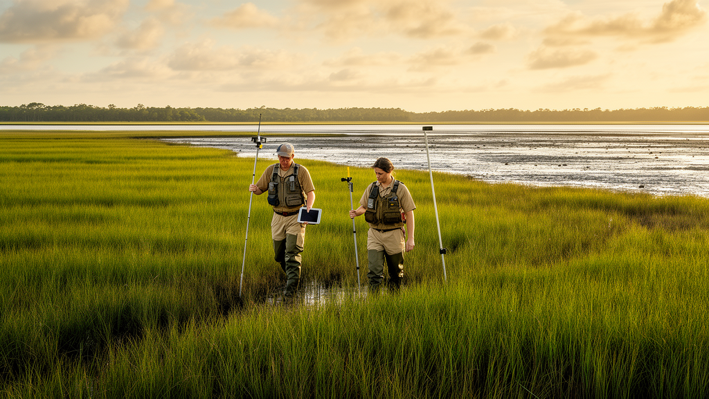
On a humid subtropical sea island off the coast of South Carolina, where tidal salt marshes meet pine flatwoods and the training grounds of the United States Marine Corps, a team of researchers has completed one of the most detailed vegetation surveys ever attempted for a rapidly changing barrier island landscape. The study, published in the journal Vegetation Classification and Survey, focused on the Marine Corps Recruit Depot Parris Island, a installation better known for forging new Marines than for advancing plant ecology. Yet the island’s mosaic of tidal marshes, maritime forests, and developed training areas has made it an ideal natural laboratory for understanding how coastal ecosystems respond to two of the most powerful forces reshaping the American Southeast: accelerating sea-level rise and intensifying storm surge.
The research team, led by Cody Goodson and colleagues including John Holloway, Zak H. Bartholomew, Anne C. Axel, Pamela Puppo, Peyton Debowsky, and Kyle A. Palmquist, set out to answer a deceptively simple question: what vegetation types exist on this sea island, where do they occur, and how can they be classified in a way that supports long-term monitoring? Their answer required months of fieldwork, sophisticated multivariate statistics, and a deep learning classifier trained on high-resolution satellite imagery. The result is a comprehensive vegetation map and classification framework that the researchers describe as fundamental baseline information for a region increasingly recognized as vulnerable to climate-driven transformation.
Parris Island occupies a distinctive position in the coastal landscape of the southeastern United States. Surrounded by tidal salt marsh and brackish waterways, the island is dominated by expansive salt marsh ecosystems that grade into inland forested areas and developed zones supporting Marine Corps training activities. The climate is humid subtropical, characterized by hot summers, mild winters, and rainfall distributed throughout the year. These conditions support a rich diversity of plant communities, from Spartina-dominated low marshes flooded twice daily by tides to upland forests of longleaf pine and live oak that have persisted for centuries. But the same geography that makes the island ecologically valuable also makes it exceptionally exposed. Sea-level rise along the southeastern Atlantic coast has been accelerating, and storm surge from hurricanes and tropical storms is becoming more intense, pushing salt water into areas where freshwater-dependent vegetation once thrived.
To capture this complexity, the researchers established 57 permanent vegetation plots distributed across all the major coastal vegetation types present on the island. At each plot, they made detailed measurements of plant community composition, recording every species present and estimating its abundance. They also characterized the main environmental variables associated with each vegetation type, including soil salinity, elevation, total exchange capacity, and other edaphic factors that influence which plants can survive in a given location. The permanent nature of these plots is critical: because they are marked and documented with precise coordinates, researchers can return to the same locations year after year, decade after decade, to detect shifts in species composition, changes in plant abundance, and the gradual landward migration of marsh vegetation as sea levels continue to rise.
With the field data in hand, the team employed two complementary analytical approaches to delineate vegetation types. Cluster analysis grouped plots with similar species composition into distinct community types, while non-metric multidimensional scaling ordination visualized the relationships among plots in a multidimensional space defined by species abundances and environmental gradients. These techniques revealed clear patterns: vegetation types on Parris Island are not randomly distributed but are organized along gradients of salinity and elevation. Low-elevation areas exposed to frequent tidal flooding and high soil salinity support salt marsh communities dominated by species such as smooth cordgrass, while slightly higher elevations support different assemblages of salt-tolerant plants. Further inland, where salinity drops and elevation rises, maritime forests and woodlands take over, dominated by species adapted to occasional salt spray but intolerant of waterlogged, saline soils.
The classification work did not stop at describing plant communities in the abstract. The researchers cross-walked their field-derived vegetation types onto existing associations within the United States National Vegetation Classification, the federal standard for documenting and naming plant communities across the country. This alignment is more than an academic exercise. By connecting Parris Island’s vegetation to the USNVC, the team ensured that their findings can be compared directly with vegetation data from other sites throughout the southeastern United States and beyond, enabling regional and national assessments of coastal ecosystem change. The cross-walk identified 11 existing USNVC vegetation types that are widely distributed in the southeastern USA, meaning that Parris Island’s plant communities are representative of broader regional patterns rather than isolated anomalies.
In total, the researchers identified four marsh associations and eight forest or woodland associations on the island, bringing the count of distinct vegetation types to 12. But the landscape contains more than just natural plant communities. Developed areas, roads, training grounds, and other human-modified surfaces also cover substantial portions of the island. To capture this full spectrum, the team mapped 11 additional land cover types, bringing the total number of distinct classes to 23. This comprehensive approach ensures that the resulting map reflects the entire landscape, not just its natural components, which is essential for land managers who must balance conservation goals with the operational requirements of a working military installation.
To translate the plot-level classifications into a wall-to-wall map of the entire island, the researchers turned to supervised deep learning classification applied to 0.5-meter high-resolution RGB imagery. This approach involved training a machine learning algorithm on regions of interest, or ROIs, where the vegetation type had been verified through field surveys. The algorithm learned to recognize the spectral and textural signatures of each vegetation type and land cover class in the imagery, then applied that knowledge to classify every pixel across the island. The results were striking: marsh types dominated the landscape, covering approximately 57 percent of the classified area, while forest types covered approximately 13 percent. The remaining area was distributed among the other mapped land cover classes, including developed surfaces, water bodies, and transitional zones.
Accuracy assessment, a critical step in any remote sensing study, yielded an overall classification accuracy of 62 percent and a Kappa statistic of 0.6. These figures indicate moderate agreement between the classified map and ground-truthed reference data, a respectable result given the inherent difficulty of distinguishing among closely related vegetation types in coastal environments where spectral signatures can overlap. The Kappa statistic, which corrects for chance agreement, suggests that the classification performs substantially better than random assignment, providing a defensible foundation for the management and monitoring applications the researchers envision. Still, the authors acknowledge that refining the classification, perhaps through additional training data or the integration of complementary remote sensing sources such as hyperspectral imagery or lidar, could improve accuracy in future iterations.
The implications of this work extend well beyond the boundaries of a single military installation. The region surrounding Parris Island has been identified as a global hotspot of salt marsh loss, a distinction that underscores the urgency of understanding and monitoring these ecosystems. Salt marshes provide enormous value to coastal communities: they buffer shorelines against storm surge, filter pollutants from runoff, sequester carbon at rates that rival or exceed those of terrestrial forests, and serve as critical nursery habitat for commercially important fish and shellfish species. When salt marshes disappear, these services disappear with them, leaving coastlines more exposed and communities more vulnerable. The permanent vegetation plots and vegetation map produced by this study provide the fundamental baseline information needed to monitor the effects of climate change on coastal vegetation, evaluate wildlife habitat use by species of conservation concern, and facilitate decision-making in a landscape undergoing rapid change. As sea levels continue to rise and storm surge intensifies throughout the southeastern United States, the framework established on Parris Island offers a replicable model for other coastal installations, parks, and conservation areas seeking to document and defend their own vegetation resources before they are lost to the advancing tide.
Subject of Research: Classification and mapping of coastal vegetation types on Parris Island, South Carolina, using permanent plots, multivariate analysis, and deep learning to support climate change monitoring
Article Title: Characterizing and mapping coastal vegetation on a sea island in the southeastern USA
Article References: Characterizing and mapping coastal vegetation on a sea island in the southeastern USA. (n.d.). Original publication
Image Credits: AI Generated
DOI: Not provided
Keywords: Parris Island, coastal vegetation, salt marsh, sea-level rise, vegetation classification, USNVC, deep learning, remote sensing, South Carolina, Marine Corps, storm surge, climate change
Cite Scienmag News
Thomas Green. (October 16, 2026). Mapping the Salt Marsh Frontier: Scientists Chart a US Marine Corps Island’s Vanishing Coastal Vegetation. Scienmag. https://scienmag.com/mapping-the-salt-marsh-frontier-scientists-chart-a-us-marine-corps-islands-vanishing-coastal-vegetation/
Thomas Green. "Mapping the Salt Marsh Frontier: Scientists Chart a US Marine Corps Island’s Vanishing Coastal Vegetation." Scienmag, 16 October 2026, https://scienmag.com/mapping-the-salt-marsh-frontier-scientists-chart-a-us-marine-corps-islands-vanishing-coastal-vegetation/. Accessed 16 October 2026.
Thomas Green. "Mapping the Salt Marsh Frontier: Scientists Chart a US Marine Corps Island’s Vanishing Coastal Vegetation." Scienmag. October 16, 2026. https://scienmag.com/mapping-the-salt-marsh-frontier-scientists-chart-a-us-marine-corps-islands-vanishing-coastal-vegetation/


