


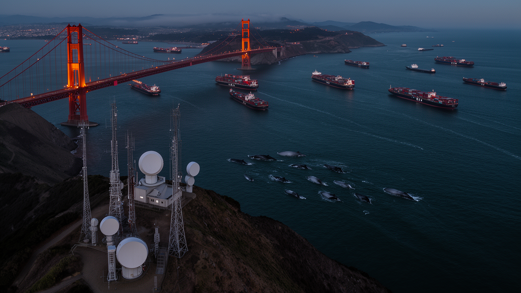
Every summer, humpback whales surge through the Golden Gate Strait to feed in San Francisco Bay, sharing shipping lanes with oil tankers, cargo ships, ferries, and thousands of small recreational boats. Conservation scientists trying to estimate the risk of deadly collisions have long relied on a single data source: the Automatic Identification System, or AIS, the radio broadcast that large commercial vessels are legally required to transmit. A new study published in Frontiers in Mammal Science reveals just how much that reliance has been hiding. Using a shore-based radar system overlooking the mouth of San Francisco Bay, researchers found that 81 percent of all vessel tracks they analyzed came from boats that were not transmitting AIS at all — an enormous, previously invisible slice of traffic in one of the most important whale habitats on the U.S. West Coast.
The findings strike at the foundation of modern whale-vessel strike risk assessments, which typically model collision danger by overlaying whale distribution maps with AIS-derived traffic data. AIS was designed for navigational safety, not conservation science. International and national rules mandate its use only for large commercial ships, towing vessels above a certain size, and passenger vessels carrying more than 150 people. Everything smaller — the speedboats, skiffs, sailboats, and small commercial craft that crowd urban waterways — can broadcast voluntarily, but most simply do not. Yet these vessels are fully capable of inflicting lethal force on a whale, and they operate without the route restrictions that constrain cargo ships and tankers.
To measure the gap, a team from The Marine Mammal Center, San Francisco State University, and the conservation technology group ProtectedSeas deployed the Marine Monitor, or M2, a compact, solar-powered, shore-based platform perched at Point Bonita in Marin County. The system combines three technologies: a commercial off-the-shelf X-band marine radar that detects and tracks vessels regardless of whether they broadcast AIS, an AIS receiver that captures the broadcasts of participating ships, and a pan-tilt-zoom camera that the software autonomously steers toward each detected target, snapping images roughly every two minutes. Because radar returns contain no identity information, the researchers manually reviewed thousands of camera images to classify each non-AIS vessel by type — recreational, sailing, commercial, fishing, or unknown.
The radar antenna had a nominal range of 16 nautical miles, but elevated coastal bluffs restricted the effective study area to roughly two to three nautical miles of the Golden Gate Strait. Within that zone, the radar updated vessel positions every two to six seconds, producing fine-grained tracks of speed, course, and duration that AIS broadcasts — spaced two to ten seconds apart for transiting vessels — could only partially match. The team’s software linked radar and AIS detections when they coincided within 100 meters, within 15 seconds, and with closely matching speed and course, allowing each vessel to be counted once and cleanly separated into AIS and non-AIS categories.
Over 47 sampled days spanning September 2021 through August 2022, the researchers manually classified 3,297 non-AIS tracks, discarding erroneous records and duplicates to leave 3,030 valid tracks. Those non-AIS vessels accounted for 81 percent of all daytime traffic through the strait. The composition was striking: no commercial fishing vessels transmitted AIS at all, 98 percent of pleasure craft went silent, and 82 percent of other vessel types did the same. In contrast, every cargo ship, tanker, and tug-and-tow in the study broadcast AIS, exactly as regulations require. The message is unambiguous — the vessels most visible to conventional risk models are precisely the ones least representative of actual traffic in this whale habitat.
Seasonal patterns deepened the concern. AIS traffic stayed remarkably stable across the year, with median daily counts hovering between 10 and 20 vessels in every season. Non-AIS traffic told a different story: daily counts surged significantly from spring into summer, when the median daily count reached 111 and the maximum hit 232 vessels. On the single busiest day, non-AIS boats made up 95 percent of all traffic. That timing matters enormously, because summer is exactly when humpback whales — listed as endangered or threatened under the U.S. Endangered Species Act depending on their breeding population — most frequently enter San Francisco Bay to feed. A risk model built on AIS alone would capture the steady drumbeat of cargo traffic while missing the seasonal wave of small boats that peaks precisely when whales are present.
The movement characteristics the team measured added further nuance. Non-AIS vessels, particularly small motorized and recreational craft, reached higher maximum speeds on average — 19.4 and 18.1 knots respectively — than any AIS category, with cargo ships topping out at 14.7 knots. Small motorized vessels also recorded the highest acceleration and deceleration rates, around 0.45 knots per second. These traits cut both ways: rapid speed changes demand faster operator reaction times to avoid a surfacing whale and make vessels less predictable to the animals themselves, yet they also grant small boats greater ability to maneuver out of a collision course — provided the operator sees the whale in time.
San Francisco’s notorious fog provided an unexpected natural experiment. Because radar penetrates fog while human eyes cannot, the researchers compared vessel behavior in clear versus foggy conditions using 991 and 346 tracks respectively. The result was sobering: the highest speeds reached by non-AIS vessels in clear weather remained essentially unchanged in dense fog. Median maximum speed dropped by less than one knot, and the 90th-percentile speeds — the most extreme values — showed no significant difference at all. Mariners apparently trust their onboard radar to navigate around other vessels and structures, but whales do not appear on radar screens. In reduced visibility, when a helmsman’s visual detection range collapses, maintaining high speed may substantially increase strike risk precisely when whales are hardest to see.
The study’s authors are careful about limitations. The camera-based classification worked only in daylight, so nighttime traffic — dominated by large commercial ships that do broadcast AIS — was excluded, meaning the true AIS share of 24-hour traffic is likely somewhat higher than 19 percent. Vessel classification from images was inherently subjective, mitigated by a standardized rubric and a single analyst reviewing all tracks. And the radar’s line-of-sight geometry confined the study to a narrow corridor at the strait’s mouth. Even so, the 81 percent figure aligns with a growing global literature: radar and visual surveys have found AIS transmission rates of just 72 percent in Boundary Pass on the Canada–U.S. border, 43 percent in coastal Scotland, 32 percent in the San Juan Islands, and 17 percent in Denmark — variation that means AIS-based risk maps can be dramatically wrong in some places and merely incomplete in others.
The stakes extend beyond fatal collisions. Vessel traffic of all sizes triggers acoustic, behavioral, and physiological responses in cetaceans that can drain energy reserves, interrupt feeding, displace animals, and interfere with communication. The gray whales that have taken up seasonal residence in San Francisco Bay since 2018 are particularly vulnerable: their Eastern North Pacific population lost more than half its members during the 2019–2023 Unusual Mortality Event, falling from roughly 27,430 to 12,950 animals, and a recent analysis found vessel strike was the leading determined cause of death among Bay-area carcasses. The M2 platform — mobile, cheap relative to military radar, and deployable anywhere with a coastline view — offers a practical path forward. By fusing radar, AIS, and camera data, coastal managers can finally see the whole fleet, build risk assessments that reflect reality, and target interventions such as speed reduction zones and outreach to recreational boaters, the demographic the data show is most likely to be sharing the water with whales entirely off the record.
Subject of Research: Shore-based radar monitoring of AIS and non-AIS vessel traffic to improve whale-vessel strike risk assessments at the entrance to San Francisco Bay
Article Title: Using a shore-based radar system to improve whale-vessel strike risk assessments at the entrance to San Francisco Bay
Article References: Rodriguez, P. N., King, S. C., Lane, R. S., O’Hern, J. E., George, K., Keener, W., Tougher, B., Zetterlind, V., & Hines, E. (2026). Using a shore-based radar system to improve whale-vessel strike risk assessments at the entrance to San Francisco Bay. Frontiers in Mammal Science, 5, Article 1888831. https://doi.org/10.3389/fmamm.2026.1888831
Image Credits: AI Generated
DOI: 10.3389/fmamm.2026.1888831
Keywords: whale-vessel strike, San Francisco Bay, AIS, marine radar, humpback whales, gray whales, vessel traffic monitoring, conservation technology, Golden Gate Strait, recreational boats, marine mammal conservation, fog
Cite Scienmag News
Margaret Porter. (October 15, 2026). Radar Reveals the Invisible Fleet: 81% of Vessels Near Golden Gate Are Whales’ Hidden Threat. Scienmag. https://scienmag.com/radar-reveals-the-invisible-fleet-81-of-vessels-near-golden-gate-are-whales-hidden-threat/
Margaret Porter. "Radar Reveals the Invisible Fleet: 81% of Vessels Near Golden Gate Are Whales’ Hidden Threat." Scienmag, 15 October 2026, https://scienmag.com/radar-reveals-the-invisible-fleet-81-of-vessels-near-golden-gate-are-whales-hidden-threat/. Accessed 15 October 2026.
Margaret Porter. "Radar Reveals the Invisible Fleet: 81% of Vessels Near Golden Gate Are Whales’ Hidden Threat." Scienmag. October 15, 2026. https://scienmag.com/radar-reveals-the-invisible-fleet-81-of-vessels-near-golden-gate-are-whales-hidden-threat/


