


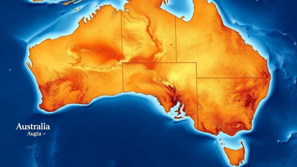
A team of researchers has built a machine learning framework that does something most artificial intelligence models for mineral exploration rarely attempt: it tells geologists not just where nickel might be hiding, but how much they should trust each prediction. In a study of the Yilgarn Craton in Western Australia, one of the world’s great nickel provinces, the researchers combined several statistical techniques to produce a prospectivity map that ranks ground into five practical exploration zones, each carrying an explicit measure of confidence. The work, published in Natural Resources Research, addresses a problem that has quietly undermined data-driven exploration for years: the uncomfortable fact that in most of the map, nobody actually knows whether mineralization is absent or merely undiscovered.
The challenge begins with how exploration data are collected. Traditional machine learning approaches to mineral prospectivity mapping treat every grid cell containing a known deposit as a positive example and every other cell as a negative one. But that assumption is geologically naive. Exploration has historically concentrated on accessible, well-mapped, and heavily prospected terrain, meaning that remote or poorly exposed areas may host substantial mineralization that simply has never been found. Treating those unexplored cells as confirmed barren ground biases the model against geological signatures resembling undiscovered deposits. The research team, led by Seongin Ahn of the Korea Institute of Geoscience and Mineral Resources, adopted positive-unlabeled learning, a statistical framework that treats the unlabeled background as a mixture of true negatives and unobserved positives rather than a homogeneous barren class.
Their implementation wraps the popular gradient-boosting algorithm XGBoost in a bagging procedure designed for positive-unlabeled data. Instead of training one model on the full dataset, the BaggingPU-XGBoost variant trains many base learners, each on a bootstrap subsample of the unlabeled cells combined with all known deposit cells, and averages their predictions. Because each subsample contains a different provisional negative set, the influence of any hidden positives accidentally labeled as negatives is diluted across the ensemble. The approach follows methods developed in computational biology and has been applied to prospectivity mapping before, but the Yilgarn study couples it with several other techniques rarely used together in exploration geoscience.
One of those techniques addresses a second, subtler source of bias: spatial autocorrelation. Geological units, geophysical responses, and mineral occurrences are strongly correlated over distance, so randomly splitting data into training and test sets places near-identical neighboring cells on both sides, inflating apparent model skill. The researchers instead used nested spatial block cross-validation. An empirical variogram of the deposit labels showed spatial autocorrelation dying out at roughly 31.5 kilometers, so they partitioned the study area into 702 blocks of 50 kilometers per side, well beyond the autocorrelation range, and assigned blocks to five folds. Within each outer training set, an inner fivefold spatial loop handled hyperparameter tuning, keeping the outer test folds completely untouched until final evaluation. The result is an honest estimate of how well the model transfers to genuinely new ground rather than to the neighborhood of deposits it has already seen.
The study area itself is demanding. The Yilgarn Craton is an Archean granite-greenstone terrane hosting world-class komatiite-hosted nickel sulfide deposits such as Kambalda, Perseverance, and Mount Keith, formed during peak ultramafic volcanism around 2.7 billion years ago. The researchers assembled 21 predictors from public datasets of the Geological Survey of Western Australia and Geoscience Australia, including distances to ultramafic units and major crustal structures, high-resolution magnetic and radiometric grids, gravity data, lithosphere thickness estimates, and multi-scale edge features derived from potential field data. Everything was harmonized onto a grid of 70,200 cells at 5-kilometer resolution, of which just 818 cells, or 1.17 percent, contain at least one known nickel deposit. That severe class imbalance shaped the entire analysis, from the choice of precision-recall area as the primary metric to the interpretation of predicted probabilities as relative favorability scores rather than literal odds of striking ore.
On the spatially independent outer test folds, the two models performed almost identically in aggregate: PR-AUC of 0.195 for XGBoost and 0.194 for BaggingPU-XGBoost, with both achieving ROC-AUC of 0.911. The positive-unlabeled approach showed an advantage during inner model selection, but that edge vanished on held-out ground, possibly because the mature exploration coverage of the Yilgarn has already located most large occurrences, leaving fewer hidden positives in the unlabeled pool than a frontier province would contain. The fold-level variation was striking, with outer PR-AUC ranging from about 0.11 to 0.32, a reminder that transferability across spatially distinct blocks varies enormously and that a single aggregate number can mask real geographic variability in model reliability.
The real innovation lies in how the framework converts raw probability into decision-ready guidance. Fifty bootstrap models were trained per fold, and the spread of their predictions was summarized by a relative interquartile range, a scale-independent measure of how much the ensemble disagrees about each cell. Cross-conformal calibration then translated the bootstrap mean probability into a coverage-controlled prediction set: using out-of-fold predictions and Platt scaling, the researchers set a threshold guaranteeing at least 85 percent of known deposits would fall inside the conformal set. In practice, empirical coverage exceeded the target, at roughly 91 percent for both models, while the conformal filter excluded more than half of the study area from immediate consideration. In exploration terms, the exclusion removed about one in ten known deposits while screening out a vast swath of low-support ground.
Combining the bootstrap mean probability, the uncertainty measure, and conformal membership, the framework assigns every cell to one of five zones, from immediate targets down to conformally excluded areas. Here the two models diverged dramatically despite their identical aggregate scores. In the top 1 percent of predicted probabilities, the median relative interquartile range was 18 percent for BaggingPU-XGBoost versus 48 percent for plain XGBoost, meaning the positive-unlabeled ensemble produced far more reproducible high-probability predictions. Under the 30 percent uncertainty cut-off, BaggingPU-XGBoost assigned 0.68 percent of the study area to the highest-priority Immediate zone, capturing 17.25 percent of known deposits there, while XGBoost managed only 0.73 percent of deposits in its tiny Immediate zone. The combined Immediate and Priority zones captured 33 percent of positive cells for BaggingPU-XGBoost against 23 percent for XGBoost, a redistribution driven by prediction stability rather than any difference in the underlying geological signal.
Interpretability analysis confirmed that both models learned similar regional controls, with proximity to ultramafic sources emerging as the dominant predictor, consistent with the established understanding that komatiite-hosted nickel sulfide mineralization is governed by deep ultramafic plumbing and craton-margin structures. The authors are careful about what their uncertainty measure does and does not capture: the bootstrap dispersion quantifies only model instability under resampling, not uncertainty from incomplete data, missing predictors, or unrepresented geological processes. Within the high-probability decile, low dispersion largely tracks high probability itself, so the uncertainty signal functions as a reproducibility filter that triages already-favored cells into immediate follow-up versus additional-evidence categories, rather than as an independent discovery tool. Sensitivity tests showed the zone output is robust to moderate changes in the tier boundaries and the uncertainty cut-off.
The framework’s limitations are acknowledged plainly. Validation covered a single craton, and the conformal guarantee remains approximate because spatial autocorrelation violates the strict exchangeability that conformal prediction assumes, even with 50-kilometer blocks. The thresholds are heuristic operating points, not universal rules, and would need recalibration for greenfield provinces where the positive-unlabeled formulation might deliver larger benefits. Whether the prioritization actually saves money requires prospective drilling with explicit cost accounting, which no retrospective study can provide. Still, the core message resonates across a discipline racing to explore under deep cover as near-surface deposits are exhausted: a probability map that cannot say how confident it is, or where its own support ends, is only half a map. By fusing positive-unlabeled learning, spatially honest validation, bootstrap stability, and conformal screening into a single decision layer, this work offers exploration geologists something genuinely new, a targeting product that knows the limits of its own knowledge and says so, cell by cell, before anyone commits a drill rig.
Subject of Research: Uncertainty-aware machine learning for nickel mineral prospectivity mapping in the Yilgarn Craton
Article Title: Uncertainty-Aware Mineral Prospectivity Mapping with Positive-Unlabeled Learning and Conformal Calibration: Ni Mineralization in the Yilgarn Craton
Article References: Ahn, S., Jo, H., Kwon, J., Park, G., & Lee, S.-H. (2026). Uncertainty-Aware Mineral Prospectivity Mapping with Positive-Unlabeled Learning and Conformal Calibration: Ni Mineralization in the Yilgarn Craton. Natural Resources Research. https://doi.org/10.1007/s11053-026-10778-w
Image Credits: AI Generated
DOI: 10.1007/s11053-026-10778-w
Keywords: mineral prospectivity mapping, positive-unlabeled learning, conformal prediction, uncertainty quantification, spatial cross-validation, XGBoost, nickel deposits, Yilgarn Craton, komatiite-hosted mineralization, exploration targeting, bootstrap ensembles, machine learning
Cite Scienmag News
Violet Maxwell. (October 13, 2026). AI Map of Australia’s Nickel Belt Tells Explorers When to Trust Itself. Scienmag. https://scienmag.com/ai-map-of-australias-nickel-belt-tells-explorers-when-to-trust-itself/
Violet Maxwell. "AI Map of Australia’s Nickel Belt Tells Explorers When to Trust Itself." Scienmag, 13 October 2026, https://scienmag.com/ai-map-of-australias-nickel-belt-tells-explorers-when-to-trust-itself/. Accessed 13 October 2026.
Violet Maxwell. "AI Map of Australia’s Nickel Belt Tells Explorers When to Trust Itself." Scienmag. October 13, 2026. https://scienmag.com/ai-map-of-australias-nickel-belt-tells-explorers-when-to-trust-itself/


