


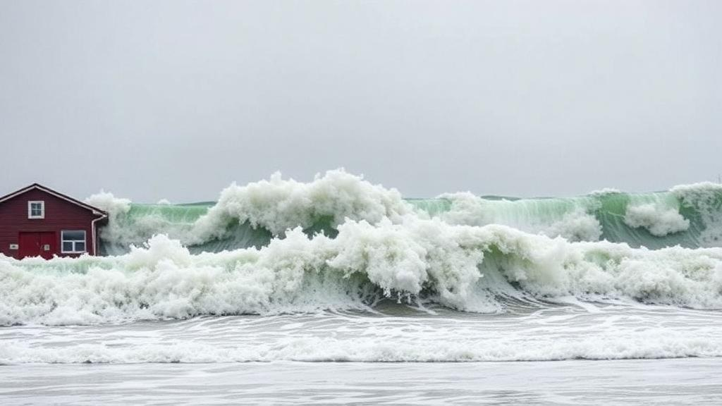
On the night of 29 October 2018, the Adriatic Sea delivered a rare and dangerous double blow. In the far north, gale-force southeasterly Sirocco winds and a plunging barometer pushed seawater into the shallow head of the basin, lifting sea level in Venice and Trieste by more than 1.4 metres above their long-term averages. At the same time, in the middle Adriatic, a very different phenomenon was unfolding: a meteotsunami, a train of long ocean waves generated by fast-moving atmospheric pressure disturbances, slammed into Vela Luka Bay on the island of Korčula with oscillations reaching nearly half a metre. A new open-access study in the journal Natural Hazards uses this event as a laboratory to answer a question that has long frustrated coastal scientists: can the deadliest kind of coastal flood, one in which slow storm surge and rapid meteotsunami waves arrive together, actually be forecast?
The researchers, led by Krešimir Ruić and Jadranka Šepić of the University of Split, together with colleagues from the University of Zagreb and the Croatian Meteorological and Hydrological Service, call such events compound extremes. Their definition is precise: a compound extreme occurs when low-frequency sea level oscillations with periods longer than two hours, typically storm surges, and high-frequency oscillations with periods shorter than two hours, including meteotsunamis, seiches and infragravity waves, both contribute significantly to the total water level. The two-hour threshold roughly separates surge-type processes from the tsunami-frequency band. Wind waves and swell, which oscillate on periods under a minute, fall outside the definition because existing tide gauges and models cannot resolve them.
The physics of the two components could hardly be more different. Storm surges are driven by synoptic-scale weather systems spanning hundreds of kilometres: a falling atmospheric pressure raises the sea through the inverse barometer effect, roughly one centimetre of sea level rise for every hectopascal of pressure drop, while sustained winds pile water against the coast, a mechanism amplified in shallow seas like the northern Adriatic. Meteotsunamis, by contrast, are born from much smaller atmospheric disturbances, typically 10 to 100 kilometres wide, that transfer energy to the ocean through Proudman resonance, when the disturbance travels at nearly the same speed as the long ocean waves it generates, or Greenspan resonance over sloping shelves. Even then, a destructive meteotsunami requires a chain of further amplifications: shoaling near the coast, narrowing of a bay, reflection at its closed end, and harbour resonance when reflected waves constructively interfere with incoming ones. This is why strong meteotsunamis cluster at specific hotspots such as the Balearic Islands, Nagasaki Bay, the Great Lakes and the Adriatic.
The 2018 event was a textbook case of both processes firing at once. ERA5 reanalysis data show an extratropical cyclone deepening over the western Mediterranean on 28 October, with warm air streaming north from Africa at the 850-hectopascal level and a powerful southwesterly jet of up to 40 metres per second at 500 hectopascals. By 29 October the cyclone centred near the Gulf of Genoa had tightened pressure gradients over the Adriatic, driving Sirocco winds of 20 metres per second that pushed water northward. Crucially, the same synoptic pattern, low surface pressure to the west, warm dry inflow aloft, a strong mid-tropospheric jet and unstable atmospheric layers, is exactly the recipe previously identified for Adriatic meteotsunamis. High-frequency pressure oscillations intensified first in the northern Adriatic on 28 October, then spread to the middle Adriatic during the afternoon of 29 October, where the station at Vela Luka recorded pressure changes of 1.57 hectopascals per ten minutes.
The sea level record tells the story of the superposition. Analysing one-minute data from 14 tide gauges, detided using seven harmonic constituents and split into components with a two-hour Kaiser-Bessel filter, the team found that at nine stations both the residual and the high-frequency signal exceeded their extreme thresholds simultaneously, with maxima occurring between 18:00 UTC on 29 October and 02:00 UTC on 30 October. The residual maximum reached 152 centimetres in Venice and 146 centimetres in Trieste, while high-frequency oscillations peaked at 46.9 centimetres in Vela Luka, where spectral analysis revealed a dominant broad peak at periods of 11 to 18 minutes, matching the bay’s natural seiche. At nearly every station the high-frequency maximum coincided with the residual maximum, meaning the total flood was a genuine sum of the two components. The team also identified the fundamental Adriatic seiche, a basin-wide standing wave of about 21.2 hours, ringing after the cyclone’s passage.
The first forecasting attempt was the obvious one: run a fully numerical chain. The researchers used the Weather Research and Forecasting model at three nested resolutions of 9, 3 and 1 kilometre, with 97 vertical levels, to simulate the atmosphere, and fed its output into SCHISM, an unstructured-grid ocean model covering the entire Adriatic with more than 134,000 elements. For the storm surge, the approach worked well. SCHISM reproduced the shape, magnitude and timing of the surge at most stations, with the best agreement at Venice, Bakar and Ancona, and root-mean-square errors for the raw pressure fields of only 1 to 1.48 hectopascals. But for the high-frequency sea level component, the coupled chain failed. In Vela Luka the observed meteotsunami reached 46.9 centimetres, while the model managed only 13.3 centimetres; at Ancona the observed 15 centimetres shrank to 5.4 in the simulation.
The diagnosis is illuminating. The WRF model did reproduce high-frequency pressure oscillations of comparable intensity, up to about 3 hectopascals, propagating along narrow corridors roughly 10 to 20 kilometres wide, consistent with earlier measurements of tsunamigenic disturbances. But the modelled corridors were slightly displaced from the real ones. Because the disturbances are so narrow, a small error in their path means the strongest pressure forcing misses the tide gauge location entirely, and the ocean model, which the study shows is actually capable of simulating large high-frequency oscillations when correctly forced, produces nothing where the meteotsunami was observed. In several unobserved locations such as Vasto, the model generated oscillations exceeding 50 centimetres precisely where its pressure disturbances passed, confirming that the ocean physics was sound and the atmospheric pathways were the weak link.
The solution the team tested is elegantly hybrid. Instead of relying on modelled pressure fields for the short-period component, they forced SCHISM with real, measured high-frequency air pressure time series, assuming the disturbances propagate unchanged at the speed and direction of the 500-hectopascal wind, here 30 metres per second toward the north-northwest, an assumption grounded in decades of research showing that mid-tropospheric winds steer tsunamigenic disturbances. In the first experiment, pressure measured at Vieste on the Italian coast drove the model; in the second, pressure from Vela Luka itself. The Vieste experiment reproduced 34 centimetres of the 46.9-centimetre observed meteotsunami, more than 70 percent of the real amplitude, with the timing of intensification closely matching observations. Remarkably, the distant station outperformed the local one, suggesting that real-time pressure measurements from upwind stations can genuinely anticipate a meteotsunami before it strikes.
The implications for early warning are concrete. A disturbance travelling at 30 metres per second from the Italian coast to Vela Luka needs about 70 minutes, and for propagation speeds between 20 and 50 metres per second the potential warning lead time ranges from 105 down to 42 minutes, enough to move people and boats out of harm’s way. The authors sketch a four-step operational system: high-resolution atmospheric modelling with minute-level output; ocean modelling forced by that output to capture the surge; repeated meteotsunami-focused simulations, roughly every ten minutes, forced by real-time pressure measurements from suitably distant upwind stations; and summation of the two components into a total forecast sea level. The main engineering challenge is that each meteotsunami simulation must complete in under ten minutes, and the method requires careful pairing of pressure stations with threatened locations, close enough that disturbances do not deform in transit but far enough to preserve lead time.
Compound extremes remain one of the least forecast hazards in coastal science. Operational storm surge systems exist for the northern Adriatic and Venice, and the Balearic Islands host the world’s only running meteotsunami warning service, but no system anywhere predicts surge and meteotsunami together. The Venice flood of 12 November 2019 shows what is at stake: surge and meteotsunami contributed 47 and 28 centimetres respectively to the record 189-centimetre flood, and in Venice the difference between 110 and 140 centimetres means the difference between flooding 12 percent and 59 percent of the historic city. By demonstrating that measured pressure, steered by mid-tropospheric winds and fed into a cross-scale ocean model, can recover both the magnitude and the timing of a meteotsunami that pure numerical modelling missed, the study offers a realistic blueprint for site-specific compound flood warnings, not only in the Adriatic but at meteotsunami hotspots worldwide.
Subject of Research: Forecasting compound sea level extremes combining storm surge and meteotsunami in the Adriatic Sea
Article Title: Forecasting compound sea level extremes: the 29–30 October 2018 Adriatic storm surge and meteotsunami extreme
Article References: Ruić, K., Šepić, J., Telišman Prtenjak, M., Horvath, K., & Kvakić, M. (2026). Forecasting compound sea level extremes: the 29–30 October 2018 Adriatic storm surge and meteotsunami extreme. Natural Hazards, 122(21), Article 672. https://doi.org/10.1007/s11069-026-08434-w
Image Credits: AI Generated
DOI: 10.1007/s11069-026-08434-w
Keywords: compound extremes, storm surge, meteotsunami, Adriatic Sea, Vela Luka, WRF, SCHISM, sea level forecasting, early warning system, Proudman resonance, coastal flooding, harbour resonance
Cite Scienmag News
Courtney Benton. (October 11, 2026). When a Storm Surge Meets a Meteotsunami: New Hope for Forecasting Compound Coastal Floods. Scienmag. https://scienmag.com/when-a-storm-surge-meets-a-meteotsunami-new-hope-for-forecasting-compound-coastal-floods/
Courtney Benton. "When a Storm Surge Meets a Meteotsunami: New Hope for Forecasting Compound Coastal Floods." Scienmag, 11 October 2026, https://scienmag.com/when-a-storm-surge-meets-a-meteotsunami-new-hope-for-forecasting-compound-coastal-floods/. Accessed 11 October 2026.
Courtney Benton. "When a Storm Surge Meets a Meteotsunami: New Hope for Forecasting Compound Coastal Floods." Scienmag. October 11, 2026. https://scienmag.com/when-a-storm-surge-meets-a-meteotsunami-new-hope-for-forecasting-compound-coastal-floods/


