


Two centuries ago, the rivers of Saxony still carried Atlantic salmon from the North Sea deep into the heart of central Europe. Today, despite decades of expensive reintroduction programmes, the fish remain scarce in the Mulde River system, one of the largest tributaries of the Elbe. A new study published in E&G Quaternary Science Journal has now traced the decline back to its roots, using an unexpected archive: meticulously drawn military maps from the late eighteenth and early nineteenth centuries. By comparing these pre-industrial documents with modern topographic surveys, researchers from Leipzig University and their collaborators have reconstructed, kilometre by kilometre, how human activity transformed the river’s structure, connectivity, and floodplains, and how those transformations track the fate of one of Europe’s most iconic migratory fish.
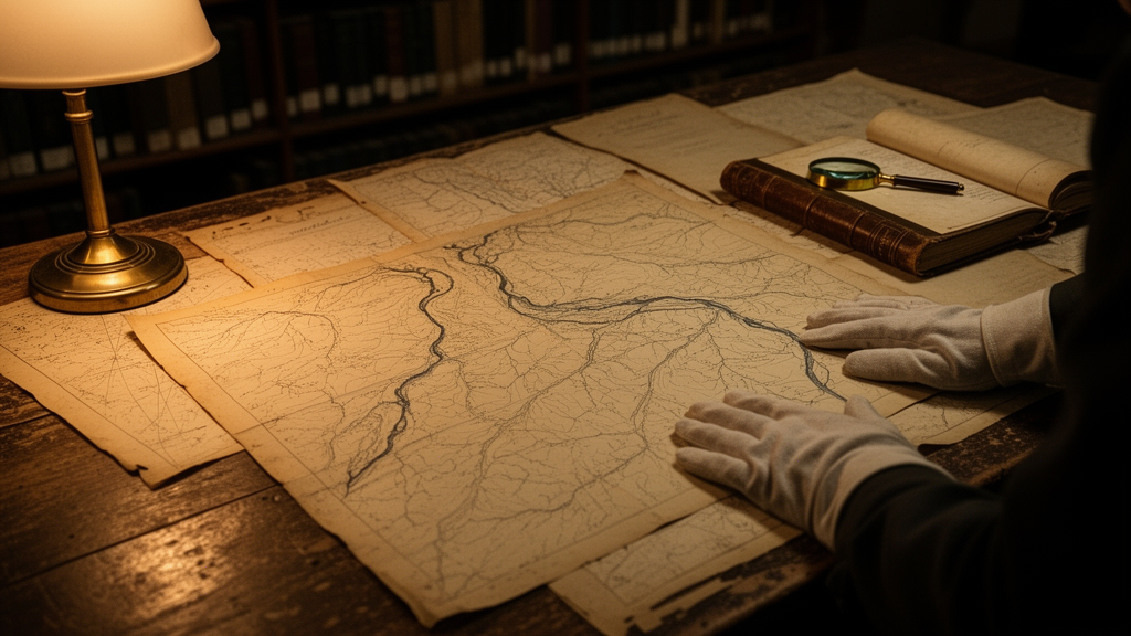
The team, led by Martin Offermann and Christoph Zielhofer, exploited the Sächsische Meilenblätter, a state-wide topographic survey begun in 1780 by engineer major Friedrich Ludwig Aster on the orders of the Saxon military. Drawn at a scale of 1:12,000 on the basis of a rigorous triangulation network, these maps record waterbodies, weirs, mills, woodland, and even individual houses with remarkable precision. Because the material was military and secret, the researchers argue, the positioning of river barriers can be assumed to be highly reliable. For the stretch of the united Mulde that had already passed to Prussia, the team supplemented the Saxon sheets with the contemporaneous Von Deckersche Quadratmeilenblätter, mapped between 1816 and 1821. Together, these sources provide a snapshot of the river system at the very threshold of industrialisation.
From the 25 parameters of the standard German waterbody structure assessment, the researchers selected three that could be reliably read from old maps and are directly relevant to salmon: channel pattern, floodplain land use, and barriers. Each parameter was recorded in a standardised one-square-kilometre grid covering the entire Mulde and its main tributaries, the Chemnitz, Zschopau, and Flöha. This semi-quantitative grid approach, developed within the German Research Foundation’s priority programme On the Way to the Fluvial Anthroposphere, allows heterogeneous sources, from handwritten archival records to satellite-era maps, to be synthesised on a common spatial footing. The result is a dataset that can be compared across two centuries and, potentially, across entire river systems.
The comparison is stark. In 1822, nearly 97 percent of the mapped river kilometres followed natural channel patterns: confined and moderately confined single-thread courses in the bedrock valleys of the Ore Mountains, giving way downstream to sinuous and meandering reaches across the soft sediments of the Leipzig lowland basin. By 2024, the share of anthropogenic patterns had exploded to 38.4 percent. Grid cells classified as dammed-up increased by a staggering 5,350 percent, and arched regulated sections by 772 percent. The great reservoirs of the twentieth century, including the 57-metre-high Eibenstock dam, drowned formerly confined and incised-meander reaches, while urban straightening homogenised the lower course. The sinuous, self-organising river of the pre-industrial era has largely disappeared.
That loss matters for salmon because channel pattern is an integrator of habitat quality. Meandering and sinuous rivers exhibit high width variance, and width governs depth, flow velocity, and the grain-size composition of the bed. Together these produce the mosaic of riffles, pools, and channel bars that different salmon life stages demand: gravel beds for spawning, shallow turbulent riffles for yolk-sac larvae, fine-sediment-free nursery margins for juveniles, and deep pools where adults wait before spawning. Channel bars, formed by grain-selective sedimentation, are particularly valuable, offering spawning substrate and calm refuges during floods. Straightened and dammed reaches compress this diversity, and the study found that grid cells with salmon presence, both historically and today, contain a markedly higher proportion of meandering and sinuous channels.
Floodplain land use tells a parallel story. In 1822, woodlands and grasslands dominated the Mulde floodplains, accounting for nearly 70 percent of mapped cells, with intensive settlement confined to textile centres such as Chemnitz, Zwickau, and Grimma and to ore-mining districts in the upper catchment. By 2024, the natural classes had collapsed by more than 60 percent, and intensively used cells, those with heavy agriculture or built-up area, had risen from 9.3 to 45.3 percent, with fully built-up floodplain cells increasing by 1,387 percent. Because floodplain land use drives nutrient inputs, suspended sediment, wastewater discharge, and mining-related contamination, the researchers use it as a proxy for pollution pressure. Salmon, which imprint on the chemical signature of their natal river and are acutely sensitive to heavy metals and oxygen depletion, correlate negatively with land-use intensity in both the nineteenth and twenty-first century datasets.
Barriers complete the triad of pressures. The old maps record 104 weirs and dams in 1822, already an average of one every 6.3 kilometres, with the densest concentrations linked to mining hydropower on the Freiberger Mulde and Zschopau. Today, modern databases list 329 barriers, one every 2 kilometres, and the number has tripled overall, rising by 455 percent on the Zschopau alone. The cumulative barrier count, the number of obstacles a fish must pass to reach a given cell, shows that formerly barrier-free headwaters of the Zwickauer Mulde, Zwönitz, Flöha, and Freiberger Mulde are now largely dammed. Meanwhile, the 1960 weir at Geesthacht on the Elbe has pushed the fully accessible river front far downstream. The study found that salmon presence declines noticeably as cumulative barrier counts rise, in both the well-documented nineteenth century and the reintroduction era after 1996.
The biological evidence comes from an open-access database of 1,607 Atlantic salmon reports spanning 1432 to 2021 in the Elbe system, compiled from secondary written sources and recent records. Modelled on a 16-kilometre grid, the data show salmon range peaking between 1851 and 1900, when the fish reached the headwaters of the Elbe, Vltava, and Otava and penetrated the Zwickauer Mulde as far as Aue. Extinction followed in the mid-twentieth century, coinciding with the era when the Mulde ranked among the most polluted rivers in Europe, its industrial and mining legacy, including one of the world’s largest uranium mining operations at Aue, Schneeberg, and Bad Schlema, still archived in contaminated floodplain deposits that are reactivated during floods. A micro-historical check of archival records from the electoral salmon weir at Leisnig, built in 1617 for Sophie of Brandenburg, suggests that early modern primary sources could substantially enrich the pre-1850 record.
The authors are careful to frame their results as a first stage rather than a definitive verdict. The catch data before 1850 are patchy, the land-use classes cannot distinguish industrial from urban pollution sources, and barrier passability cannot be reconstructed for historical weirs. Yet the convergence of three independent parameters, channel pattern, land use, and connectivity, on the same negative signal for salmon is difficult to dismiss. It suggests that reintroduction programmes launched in the 1990s have been fighting a river that is structurally poorer, more fragmented, and more intensively used than the one salmon knew two centuries ago, and that habitat restoration must address the full eco-morphological legacy of industrialisation.
Methodologically, the study demonstrates that pre-industrial military cartography, combined with a transferable grid framework, can turn centuries-old paper into quantitative ecological baselines. As European countries work to meet the Water Framework Directive’s goal of good ecological status, and as freshwater biodiversity loss accelerates worldwide, such historical reconstructions offer something restoration ecology rarely has: a measured picture of what a river looked like before the Anthropocene remade it. For the salmon of the Mulde, the maps make clear that the road back runs through re-meandered channels, reconnected headwaters, and cleaner floodplains, a transformation measured not in years but in the same centuries it took to undo.
Subject of Research: Historical eco-morphological change and Atlantic salmon habitat suitability in the Mulde River system since pre-industrial times
Article Title: Eco-morphological changes and potential salmon habitat suitability since pre-industrial times in the Mulde River system (Germany)
Article References: Offermann, M., Hein, M., Hegemann, R., Gödecke, K., Hegner, L., Henke, Y., Schäfer, N., Shelukhina, H., Liebscher, E., Opel, S., Rabiger-Völlmer, J., Werther, L., & Zielhofer, C. (2025). Eco-morphological changes and potential salmon habitat suitability since pre-industrial times in the Mulde River system (Germany). E&G Quaternary Science Journal, 74(2), 325-354. https://doi.org/10.5194/egqsj-74-325-2025
Image Credits: AI Generated
DOI: 10.5194/egqsj-74-325-2025
Keywords: Atlantic salmon, Mulde River, river connectivity, channel patterns, floodplain land use, historical maps, river barriers, habitat suitability, Elbe River system, water pollution, river restoration, fluvial geomorphology
Cite Scienmag News
Violet Maxwell. (October 9, 2026). Old military maps reveal why salmon vanished from a German river system. Scienmag. https://scienmag.com/old-military-maps-reveal-why-salmon-vanished-from-a-german-river-system/
Violet Maxwell. "Old military maps reveal why salmon vanished from a German river system." Scienmag, 9 October 2026, https://scienmag.com/old-military-maps-reveal-why-salmon-vanished-from-a-german-river-system/. Accessed 9 October 2026.
Violet Maxwell. "Old military maps reveal why salmon vanished from a German river system." Scienmag. October 9, 2026. https://scienmag.com/old-military-maps-reveal-why-salmon-vanished-from-a-german-river-system/


