


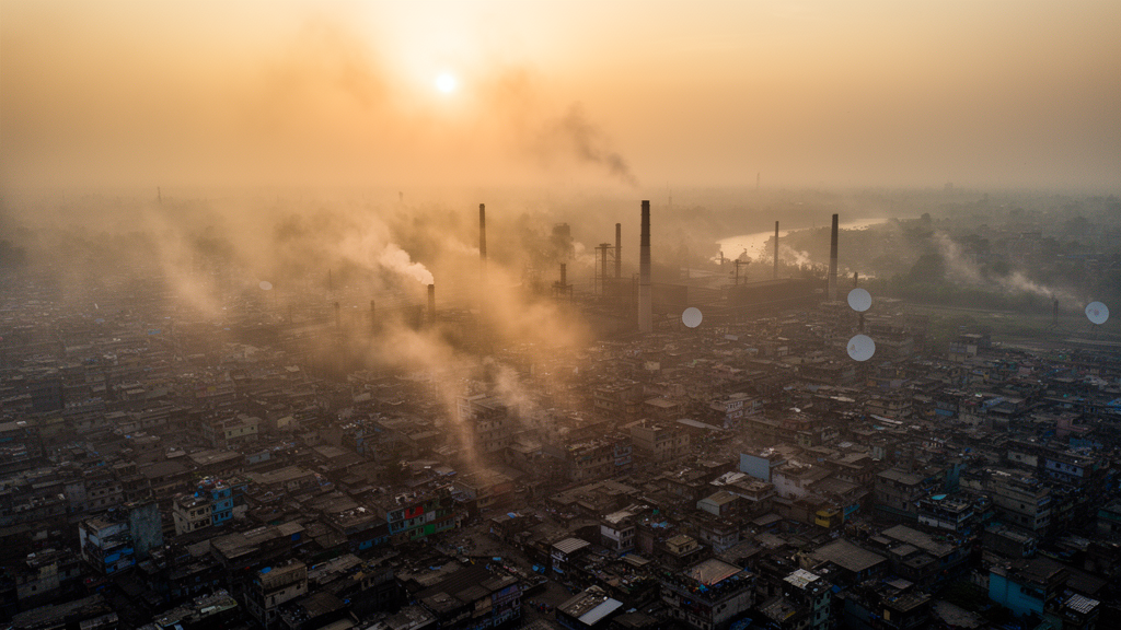
In the sprawling industrial belt that surrounds Dhaka, the air itself follows a seasonal rhythm that scientists can now track from space. A new study published in Theoretical and Applied Climatology has used data from the Sentinel-5P satellite’s TROPOMI instrument to map how six major air pollutants—carbon monoxide, nitrogen dioxide, ozone, formaldehyde, sulfur dioxide, and related trace gases—fluctuate across four of Bangladesh’s most densely industrialized cities: Dhaka, Narayanganj, Gazipur, and Narsingdi. The research, led by Md. Aminul Haque Laskor of Shahjalal University of Science and Technology together with colleagues in Bangladesh and China, connects those pollution patterns to weather variables and, ultimately, to questions of fairness: who breathes the dirtiest air, and what that means for the country’s pursuit of the United Nations Sustainable Development Goals.
The technical foundation of the study is the TROPOspheric Monitoring Instrument, or TROPOMI, which flies aboard the European Space Agency’s Sentinel-5P satellite launched in 2017. TROPOMI measures the sunlight reflected from Earth’s atmosphere in narrow spectral bands, allowing researchers to retrieve column concentrations of gases such as nitrogen dioxide and carbon monoxide with spatial resolution fine enough to distinguish one urban district from another. Because ground-based air quality monitoring networks in rapidly industrializing countries are often sparse, satellite retrievals have become an indispensable tool for environmental scientists. The approach has already proven its worth in contexts ranging from tracking the European lockdown-related drop in nitrogen dioxide in 2020 to mapping pollution inequality in New York City, and the Bangladeshi team adapted the same logic to a region where industrial growth has dramatically outpaced monitoring infrastructure.
The study’s central finding is a pronounced seasonal cycle. Pollutant concentrations reach their lowest levels during the monsoon, when heavy rainfall scavenges aerosols and gases from the atmosphere and strong convective mixing disperses emissions vertically. In contrast, the winter and post-monsoon periods emerge as the most hazardous times of year. During winter, cooler temperatures and temperature inversions trap pollutants near the surface, while reduced wind speeds limit horizontal transport. The researchers’ hotspot analysis—built on spatial autocorrelation statistics that identify statistically significant clusters of high values—pinpointed severe carbon monoxide pollution in winter across central, northern, and southern Dhaka. Nitrogen dioxide, a gas closely tied to vehicle exhaust, brick kilns, and industrial combustion, showed notably elevated levels in Dhaka, Narayanganj, and Gazipur during both the post-monsoon and winter seasons. Some pollutants also peaked during the pre-monsoon months, adding a third seasonal window of concern.
What distinguishes this work from a simple pollution inventory is its use of Geographically Weighted Regression, a spatial statistical technique that allows the relationship between pollutant concentrations and meteorological drivers to vary from place to place rather than assuming a single city-wide average. Conventional global regression would collapse these local dynamics into one coefficient, masking the fact that the same weather variable can suppress pollution in one district while amplifying it in another. The GWR analysis revealed precisely such spatial non-stationarity. Ozone displayed a strong positive relationship with precipitation in Gazipur during the monsoon, with local coefficients ranging from 0.79 to 2.15, while showing a negative relationship with temperature in Narsingdi during the pre-monsoon season, with coefficients between −2.23 and −1.88.
Nitrogen dioxide told an equally nuanced story. In Gazipur and Dhaka during the monsoon, the gas showed a positive local coefficient with temperature, ranging from 1.02 to 1.47, suggesting that warmer conditions in those industrial cores coincided with higher nitrogen dioxide levels—possibly reflecting enhanced photochemical activity and industrial output. In Narsingdi during the pre-monsoon period, however, nitrogen dioxide was negatively associated with precipitation, with coefficients between −1.66 and −1.38, consistent with rainfall washing the pollutant out of the boundary layer. Formaldehyde, sulfur dioxide, and carbon monoxide each exhibited their own patchwork of relationships with humidity, atmospheric pressure, temperature, wind speed, and precipitation, shifting in sign and magnitude across seasons and locations. For policymakers, this means that a single national control strategy calibrated to average conditions will inevitably miss the mark in specific cities and specific months.
The health implications of these patterns are far from abstract. Carbon monoxide binds to hemoglobin in the blood with an affinity hundreds of times greater than oxygen, reducing the body’s capacity to deliver oxygen to tissues and organs; chronic exposure is linked to cardiovascular strain and neurological effects. Nitrogen dioxide inflames the airways and aggravates asthma, particularly in children. Ozone at ground level is a potent oxidant that damages lung tissue, and formaldehyde is classified as a hazardous air pollutant with carcinogenic potential. Sulfur dioxide, emitted largely from industrial boilers and brick kilns burning sulfur-containing fuel, contributes to both respiratory disease and acid deposition. In the industrial cities examined here, the people living closest to factory clusters—often the workers themselves and low-income communities who cannot afford to move away—face the highest cumulative exposures, a textbook case of environmental injustice.
This justice dimension is where the study’s framing becomes most pointed. Environmental justice research has long documented that the burdens of industrialization fall disproportionately on those who benefit least from it, and satellite data have increasingly been used to document such disparities in the United States and elsewhere. The Bangladeshi analysis extends that evidence base to South Asia, where the scale of industrial expansion—textile dyeing, steel re-rolling, brick manufacturing, and chemical processing—has transformed the urban atmosphere within a single generation. The authors emphasize that workers and residents near industrial zones face significant health risks, and that this unequal exposure obstructs progress toward Sustainable Development Goal 3 on health and well-being, Goal 7 on affordable and clean energy, and Goal 11 on sustainable cities and communities. Clean air, in other words, is not merely an environmental issue but a prerequisite for the entire development agenda.
The meteorological findings also carry a warning about climate change. Previous research has established that a warming climate can alter air quality through changes in temperature, precipitation, and circulation patterns, and the strong local coefficients documented here suggest that such effects will not be uniform. If monsoon rainfall patterns shift, the natural cleansing mechanism that currently keeps summer pollution in check could weaken. If winter inversions intensify or become more prolonged, the seasonal pollution peaks that already endanger public health could grow worse. Understanding the precise, location-specific sensitivity of each pollutant to each weather variable—as the GWR framework makes possible—is therefore a critical input for any forward-looking air quality management plan in Bangladesh or in other rapidly industrializing nations facing similar conditions.
The practical value of the study lies in its ability to guide targeted intervention. Because the hotspot analysis identifies exactly where and when pollution clusters form—central, northern, and southern Dhaka for winter carbon monoxide, for example, and the Dhaka–Narayanganj–Gazipur corridor for post-monsoon and winter nitrogen dioxide—regulators can prioritize inspections, fuel switching, and emission controls in those areas during those seasons rather than spreading resources thinly across the year and the map. Brick kiln modernization, stricter enforcement of effluent and emission treatment requirements in the textile sector, and expansion of the ground-based monitoring network to validate satellite retrievals all follow naturally from the evidence. The authors note that their findings can inform Bangladesh and other industrialized nations in identifying pollution sources and implementing effective mitigation strategies for healthier, more sustainable urban environments.
Ultimately, the study is a demonstration of how a single satellite instrument, combined with rigorous spatial statistics, can illuminate problems that ground-level monitoring alone would miss. It transforms air pollution in Bangladesh’s industrial cities from an invisible, ambient grievance into a mapped, measured, and seasonally predictable phenomenon—one whose burdens can be traced to specific neighborhoods and specific months. That transformation matters, because pollution that can be measured precisely can be regulated precisely, and regulation that respects the geography of exposure is the first step toward the environmental justice that the Sustainable Development Goals promise. For the millions of people living in the shadow of Dhaka’s factories, the winter air they breathe is now documented in numbers, and those numbers make a compelling case for action.
Subject of Research: Seasonal air pollution patterns, meteorological drivers, and environmental justice in the industrial cities of Bangladesh
Article Title: Impact of air pollution on sustainable development and environmental justice: Insights from industrial cities of Bangladesh
Article References: Laskor, M. A. H., Kadir, A., Ahmed, Z., Zhang, F., & Al-Rezoan, H. (2026). Impact of air pollution on sustainable development and environmental justice: Insights from industrial cities of Bangladesh. Theoretical and Applied Climatology, 157(9), Article 604. https://doi.org/10.1007/s00704-026-06555-7
Image Credits: AI Generated
DOI: 10.1007/s00704-026-06555-7
Keywords: air pollution, Bangladesh, Sentinel-5P, TROPOMI, environmental justice, Sustainable Development Goals, nitrogen dioxide, carbon monoxide, geographically weighted regression, industrial cities, Dhaka, seasonal variation
Cite Scienmag News
Russell Cooper. (October 9, 2026). Satellites Reveal Seasonal Pollution Hotspots in Bangladesh’s Industrial Cities. Scienmag. https://scienmag.com/satellites-reveal-seasonal-pollution-hotspots-in-bangladeshs-industrial-cities/
Russell Cooper. "Satellites Reveal Seasonal Pollution Hotspots in Bangladesh’s Industrial Cities." Scienmag, 9 October 2026, https://scienmag.com/satellites-reveal-seasonal-pollution-hotspots-in-bangladeshs-industrial-cities/. Accessed 9 October 2026.
Russell Cooper. "Satellites Reveal Seasonal Pollution Hotspots in Bangladesh’s Industrial Cities." Scienmag. October 9, 2026. https://scienmag.com/satellites-reveal-seasonal-pollution-hotspots-in-bangladeshs-industrial-cities/


