


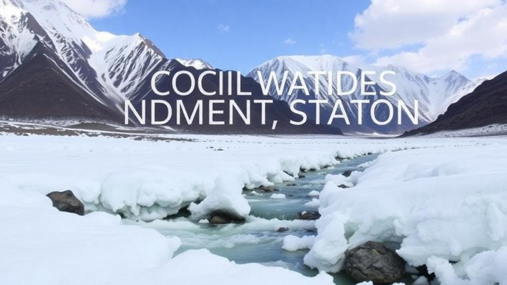
High in the mountains of northern Pakistan, where the Himalayan, Karakoram, and Hindu Kush ranges converge, the water that sustains more than 200 million people downstream begins its journey as snow and ice. Roughly 80 percent of the region’s freshwater supply is derived from glaciers and seasonal snowmelt, making these frozen reserves one of the most climate-sensitive water systems on Earth. A new meta-analysis published in Theoretical and Applied Climatology has now pulled together decades of scattered research on temperature, precipitation, and runoff across this rugged terrain, offering the most integrated picture yet of how climate change is altering the hydrological heartbeat of the Upper Indus Basin.
The research team, led by Mukhtar Ahmad of the University of Lahore, screened approximately 1,500 published studies and distilled them down to 29 that met strict consistency criteria for the three key parameters: temperature, precipitation, and runoff. This kind of meta-analysis is a powerful statistical tool because individual field studies, conducted in different valleys with different methods and time windows, often produce seemingly contradictory results. By pooling effect sizes across studies and quantifying the direction and magnitude of climate-hydrology relationships, the researchers could separate genuine regional signals from the noise of local variability.
The technical toolkit extended beyond classical statistics. The team employed forest plot analysis, a standard meta-analytic visualization that displays each study’s estimated effect alongside a combined estimate with confidence intervals, to quantify how climate change influences snowfall patterns. They also harnessed Google Earth Engine, the cloud-based geospatial computing platform, to process digital elevation models of the study region. From these high-resolution terrain data, they derived primary topographic characteristics including elevation, slope, and aspect, which were then integrated into the analytical framework. This matters because in mountain hydrology, terrain is destiny: the orientation of a slope determines how much solar radiation it receives, and elevation dictates whether precipitation falls as rain or snow.
One of the study’s most striking findings concerns the relationship between precipitation and runoff. Across the pooled studies, precipitation showed a statistically significant positive effect on runoff, with a 95 percent confidence interval of 0.01 to 0.44 and a p-value of 0.038. In plain terms, when more precipitation falls, more water flows into the rivers, and this relationship holds with statistical confidence. The result aligns neatly with fundamental hydrological theory: all else being equal, when soil is saturated, land cover is unchanged, and slopes are fixed, additional precipitation translates directly into additional surface runoff.
The temperature story proved far more complicated. The meta-analysis found that runoff was not significantly affected by temperature across the pooled dataset, and precipitation itself was only mildly affected. This may seem counterintuitive in a warming world, particularly in a region where ice and snow are so central to the water supply. But the researchers attribute this apparent decoupling to catchment-specific factors and the enormous heterogeneity among individual studies. Regional differences and methodological choices strongly influenced outcomes, meaning that a study in one glacierized valley might report strong temperature sensitivity while a neighboring basin shows none, and averaging across them can wash out the signal.
At the same time, the authors emphasize that temperature does significantly shape runoff and precipitation dynamics when examined through the right analytical lens. The apparent contradiction reflects a deeper truth about mountain hydrology: the Indus Basin is not a single system but a mosaic of contrasting hydrological regimes. In some catchments, meltwater from glaciers and snowpack dominates streamflow, so warming accelerates melt and shifts the timing of peak flows. In others, rainfall drives the hydrograph, and temperature matters mainly through evaporation and the phase of precipitation. A single pooled estimate cannot capture this diversity, which is precisely why the study calls for stratified analyses that partition the data by geographical, climatic, and hydrological variables.
The region’s glaciological quirks add another layer of complexity. In the 1990s, glaciologists noticed that glaciers in the Karakoram Range, which straddles the borders of Pakistan, India, Afghanistan, Tajikistan, and China, were holding steady or even gaining modest ice mass while glaciers elsewhere outside the polar regions shrank. This phenomenon, nicknamed the Karakoram Anomaly, has been linked to the region’s unique seasonal cycle and atmospheric circulation. Research cited in the study suggests that snowfall in the Karakoram is less sensitive to warming than in the Himalayas proper, and that regional circulation variability drives local temperature and melt patterns in ways that global averages do not capture. Any honest assessment of climate impacts in northern Pakistan must therefore grapple with a landscape where neighboring ranges can behave in opposite ways.
The stakes could hardly be higher. Pakistan has repeatedly appeared among the countries most vulnerable to climate change, and the 2022 monsoon floods, which World Weather Attribution scientists concluded were likely intensified by climate change, demonstrated how quickly hydrological extremes can overwhelm a nation’s defenses. Upstream in the mountains, declining snow cover has been documented in valleys such as Passu and Ghulkin between 1995 and 2022, while glacial lake outburst floods pose growing risks throughout the Hindu Kush Himalaya. Downstream, the Indus River irrigates one of the largest contiguous irrigation systems in the world. Shifts in the timing or volume of meltwater-driven flows ripple directly into agriculture, hydropower, and drinking water supplies for hundreds of millions of people.
Methodologically, the study’s authors argue that their approach offers several advantages over previous syntheses. The use of standard, high-resolution analyses, combined with terrain-informed modeling through Google Earth Engine, allowed better capture of climate-driven hydrological responses across spatially variable landscapes. They also report low publication bias, a persistent worry in meta-analyses where studies with dramatic findings are more likely to be published than null results. The heterogeneity statistics used in such work, including the widely applied I-squared measure, help quantify how much of the variation among studies reflects true differences between catchments rather than statistical chance, and the authors point to meta-regression approaches as the natural next step for explaining that variation.
The broader lesson extends well beyond Pakistan’s borders. Mountain water towers across Asia, from the Hindu Kush to the Tibetan Plateau, supply billions of people, and hydrologists worldwide are wrestling with the same challenge of translating local studies into reliable regional projections. The Pakistani meta-analysis underscores that climate impacts on water resources are not uniform, that precipitation remains the most direct lever on runoff even in glacierized basins, and that careful, region-specific analysis is indispensable for planning reservoirs, irrigation schedules, and flood defenses. As the authors conclude, future research that embeds geographical, climatic, and hydrological variables into stratified and meta-regression frameworks will be essential for predicting how these frozen water towers will behave as the planet continues to warm. For the communities clinging to the slopes of the Karakoram and the farmers tending fields on the Indus plain, that predictive precision is not an academic luxury but a matter of survival.
Subject of Research: Climate change impacts on runoff, temperature, and precipitation in northern Pakistan's Himalayan-Karakoram-Hindu Kush region
Article Title: Impact of climate change on runoff, temperature, and precipitation dynamics in northern areas of Pakistan: an integrated meta-analysis
Article References: Ahmad, M., Irshad, M. A., Nasim, I., Anwar, M., Nawaz, R., Ahmad, B., & Irfan, A. (2026). Impact of climate change on runoff, temperature, and precipitation dynamics in northern areas of Pakistan: an integrated meta-analysis. Theoretical and Applied Climatology, 157(10), Article 631. https://doi.org/10.1007/s00704-026-06561-9
Image Credits: AI Generated
DOI: 10.1007/s00704-026-06561-9
Keywords: meta-analysis, northern Pakistan, Upper Indus Basin, runoff, precipitation, temperature, glaciers, Karakoram Anomaly, snowmelt, Google Earth Engine, water security, Hindu Kush Himalaya
Cite Scienmag News
Violet Maxwell. (October 7, 2026). Meta-Analysis Reveals How Warming Is Reshaping Water Flows in Pakistan’s Frozen Mountains. Scienmag. https://scienmag.com/meta-analysis-reveals-how-warming-is-reshaping-water-flows-in-pakistans-frozen-mountains/
Violet Maxwell. "Meta-Analysis Reveals How Warming Is Reshaping Water Flows in Pakistan’s Frozen Mountains." Scienmag, 7 October 2026, https://scienmag.com/meta-analysis-reveals-how-warming-is-reshaping-water-flows-in-pakistans-frozen-mountains/. Accessed 7 October 2026.
Violet Maxwell. "Meta-Analysis Reveals How Warming Is Reshaping Water Flows in Pakistan’s Frozen Mountains." Scienmag. October 7, 2026. https://scienmag.com/meta-analysis-reveals-how-warming-is-reshaping-water-flows-in-pakistans-frozen-mountains/


