


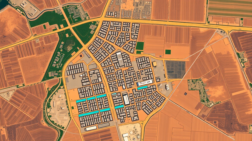
In the fast-growing city of Adama, Ethiopia, the landscape has been rewritten in a single generation. A new study published in Discover Cities has tracked twenty years of urban expansion using satellite imagery, and the picture it paints is one of a city trading its farmland, wetlands and vegetation for concrete, asphalt and heat. Between 2004 and 2024, built-up areas in Adama surged by roughly 43 percent, ultimately covering nearly 55 percent of the city, while agricultural land fell by almost 15 percent and wetlands were nearly wiped out. The consequences, measured in degrees Celsius at the surface, show how rapidly urbanizing cities in the Global South are reshaping their own microclimates.
The research, led by Dagim Hailu Hurisa and Abebe Tufa Angessa of Ambo University, relied on Landsat satellite images from 2004, 2014 and 2024, processed through a rigorous chain of remote sensing techniques. The team classified the land into six categories—agricultural land, bare land, built-up areas, vegetation, wetlands and water bodies—using a supervised maximum likelihood classification algorithm, and validated the results with hundreds of field-collected GPS points and high-resolution Google Earth imagery. The classified maps achieved overall accuracies above 92 percent in every year, with Kappa coefficients between 0.87 and 0.91, lending strong credibility to the land change story that emerged.
That story is striking. In 2004, Adama was still a largely agrarian landscape: agricultural land covered 38.65 percent of the study area and vegetation nearly 26 percent, while built-up surfaces occupied just under 12 percent. By 2014, agriculture had ballooned to almost 68 percent of the mapped area—a figure the authors caution may partly reflect classification uncertainties tied to the damaged Landsat 7 sensor of that era—before collapsing to about 24 percent by 2024. Meanwhile, built-up land exploded to become the dominant class, absorbing farmland, vegetation, barren ground and even the last fragments of wetland. The transition matrix shows agricultural land alone contributed the largest share of new urban surface, underscoring how peri-urban farmland has become the primary fuel of the city’s growth.
The ecological toll is equally visible. Nearly all of the wetlands mapped in 2004 had been converted to other uses by 2024, with farming and settlement expansion consuming these moisture-rich, flood-buffering landscapes. Vegetation experienced fragmentation and loss in many locations, although the study also detected gains in 2024, likely reflecting urban greening programs, roadside plantations and corridor development initiatives. Water bodies remained small but relatively stable. The net effect, the authors argue, is a city whose natural cooling and hydrological buffers have been steadily dismantled.
To translate these land changes into thermal terms, the researchers retrieved land surface temperature (LST) from the satellites’ thermal infrared bands, converting raw digital numbers into radiance, then brightness temperature, and finally applying emissivity corrections based on vegetation cover. The results reveal a subtle but consequential shift: maximum LST actually declined from 48.78 degrees Celsius in 2004 to 44.08 degrees in 2024, but minimum LST rose steadily from 22.91 to 24.83 degrees. This narrowing of the temperature range signals what the authors call thermal homogenization—the entire urban landscape warming from below as impervious surfaces store heat by day and release it slowly by night, weakening the contrast between hot cores and cool peripheries.
The spectral index analysis reinforces the same narrative from three independent angles. The Normalized Difference Vegetation Index (NDVI), which tracks vegetation health by comparing near-infrared and red reflectance, showed declining and fragmenting green cover, though with localized recovery in 2024. The Normalized Difference Built-up Index (NDBI), which highlights impervious surfaces through shortwave infrared reflectance, climbed steadily, with its maximum value rising to 0.47 by 2024 as development spread into the city’s western, northwestern and southeastern fringes. Most ominously, the Normalized Difference Water Index (NDWI) revealed a progressive drying of the landscape: peak positive values fell from 0.42 in 2004 to just 0.12 in 2024, and moisture-rich zones shrank into scattered fragments in the city’s south.
The statistical relationships between these indices and LST quantify the physics behind the warming. In 2004, NDVI explained about 33.5 percent of the spatial variation in surface temperature, with a regression slope indicating that each unit increase in vegetation greenness corresponded to roughly 23 degrees of cooling. By 2024, that explanatory power had weakened to under 18 percent and the slope had flattened to about 15 degrees—evidence, the authors suggest, that fragmented and shrinking vegetation patches are losing their capacity to regulate the city’s heat. Conversely, NDBI showed a consistent positive relationship with LST across all three years, explaining roughly 29 to 34 percent of temperature variation, confirming that concrete and asphalt are the city’s principal heat engines. NDWI’s cooling influence, mediated by evaporation and moisture retention, remained real but comparatively weak throughout.
These findings place Adama squarely within a broader pattern documented across Ethiopian cities such as Addis Ababa, Hawassa, Mekelle and Bahir Dar, and across the rapidly urbanizing Global South more generally, where urban areas are expanding at roughly 4 percent per year. What makes the Adama study notable is its integration: rather than examining land cover, temperature and spectral responses in isolation, it weaves them into a single causal picture in which land conversion drives surface change, which drives thermal change. The rising minimum temperatures, the authors emphasize, are a more telling indicator of urban heat island intensification than peak values, because they reflect stored heat in building materials and reduced nighttime cooling efficiency—conditions most dangerous for human health during heat waves.
The study is not without limitations, which the authors candidly acknowledge. The 30-meter resolution of Landsat imagery blurs fine-scale urban features and creates mixed pixels; the anomalous 2014 agricultural peak may partly stem from sensor artifacts; and no ground-based meteorological data were incorporated to complement the satellite-derived temperatures. Socioeconomic drivers of expansion, from population growth to land policy, were also outside the analytical frame. Yet the consistency of the three spectral indicators, each independently corroborating the others, strengthens confidence in the central conclusion: Adama’s growth is dismantling the ecological infrastructure that once kept it cool.
The prescription the authors offer is blue-green infrastructure—protected wetlands, expanded parks, roadside vegetation, water-sensitive design and controlled expansion of the urban footprint—woven into climate-responsive planning before the thermal trajectory becomes locked in. For a city of Adama’s size and speed, the satellite record delivers a warning that is hard to ignore: every hectare of farmland or wetland converted to impervious surface is a small bet against the city’s future livability, and after two decades, the ledger is beginning to show the interest coming due.
Subject of Research: Urbanization-driven land use and land cover change and its effects on land surface temperature and spectral indices in Adama City, Ethiopia
Article Title: Urbanization induced LULC transformation, its effects on land surface temperature and spectral index responses in Adama city, Ethiopia
Article References: Urbanization induced LULC transformation, its effects on land surface temperature and spectral index responses in Adama city, Ethiopia. (n.d.). https://doi.org/10.1007/s44327-026-00358-1
Image Credits: AI Generated
DOI: 10.1007/s44327-026-00358-1
Keywords: urbanization, land use land cover change, land surface temperature, remote sensing, Landsat, spectral indices, NDVI, NDBI, NDWI, urban heat island, Ethiopia, blue-green infrastructure
Cite Scienmag News
Courtney Benton. (September 23, 2026). Two Decades of Satellite Images Reveal How an Ethiopian City Is Quietly Cooking Itself. Scienmag. https://scienmag.com/two-decades-of-satellite-images-reveal-how-an-ethiopian-city-is-quietly-cooking-itself/
Courtney Benton. "Two Decades of Satellite Images Reveal How an Ethiopian City Is Quietly Cooking Itself." Scienmag, 23 September 2026, https://scienmag.com/two-decades-of-satellite-images-reveal-how-an-ethiopian-city-is-quietly-cooking-itself/. Accessed 23 September 2026.
Courtney Benton. "Two Decades of Satellite Images Reveal How an Ethiopian City Is Quietly Cooking Itself." Scienmag. September 23, 2026. https://scienmag.com/two-decades-of-satellite-images-reveal-how-an-ethiopian-city-is-quietly-cooking-itself/


