


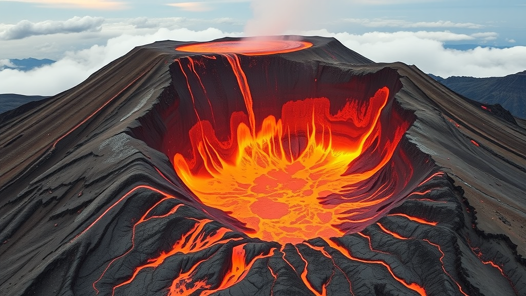
Deep in the East African Rift of northern Tanzania, one of the world’s most unusual volcanoes has been quietly offering scientists a rare preview of how its underground plumbing behaves between eruptions. Ol Doinyo Lengai, a steep-sided stratovolcano that towers above the arid plains near Lake Natron, is the only active volcano on Earth that erupts carbonatite lava, a cold, dark, unusually fluid lava rich in carbonate minerals. In 2024, a research team led by D. Sarah Stamps of Virginia Tech detected and tracked a short-lived bulge in the land surface around the volcano. Now, in a study published in Frontiers in Earth Science in September 2026, the team has identified the cause of that deformation: an intrusion of roughly one million cubic meters of magma pouring into an existing reservoir approximately three kilometers, or about 1.8 miles, beneath the surface.
The magnitude of the intrusion is modest by volcanic standards. Stamps compares the volume to about 400 Olympic-size swimming pools, an amount that is not in itself a cause for alarm. The magma, according to the team’s numerical modeling, does not appear to be migrating closer to the crater, and the reservoir it is entering already existed prior to the event. Yet the significance of the finding extends well beyond the volume of rock involved. It demonstrates that the monitoring infrastructure installed on the volcano can detect subtle, transient deformation signals and, more importantly, that the team can interpret those signals with sufficient confidence to attribute them to specific subsurface processes. That capability lies at the heart of any credible early-warning effort for a volcano that alternates between gentle and violent behavior.
The detection itself was made possible by a ground-based geodetic network that Stamps’ group began building a decade ago. In 2016, the team installed six Global Navigation Satellite System instruments on the flanks and surroundings of Ol Doinyo Lengai. These continuously operating stations track the horizontal and vertical motions of the ground surface to a precision of about one millimeter, a level of sensitivity that allows researchers to distinguish genuine deformation of the volcanic edifice from noise introduced by atmospheric effects or equipment drift. The GNSS network is complemented by two broadband seismic stations that record earthquake activity across a wide range of frequencies, and the continuous instrumentation is supplemented by episodic benchmark measurements taken during field campaigns.
The combination proved decisive in 2024. When the GNSS stations recorded an uplift signal around the volcano, the team turned to numerical modeling to determine what subsurface source could reproduce the observed pattern of surface movement. By fitting deformation models to the geodetic data, the researchers concluded with a high degree of certainty that the signal was generated by an influx of magma into an already existing magma reservoir roughly three kilometers underground. The result validated both the sensitivity of the network and the interpretive framework the team has developed over more than ten years of observation at the site. The work was published on September 18, 2026, in Frontiers in Earth Science, with the DOI 10.3389/feart.2026.1881885.
Ol Doinyo Lengai occupies a singular position in volcano science. Its carbonatite lavas erupt at temperatures far lower than the silicate lavas produced by virtually every other volcano on the planet, and during quiet periods the volcano maintains an active lava lake that bubbles and flows effusively within its summit crater. This effusive behavior, however, is only half of the volcano’s personality. On average, Ol Doinyo Lengai produces an explosive eruption every 10 to 15 years, and these explosive episodes can pose serious hazards to the communities that live on and around its slopes. Stamps notes that the team expects another explosive eruption within their lifetime, and the central motivation of the research program is to give residents and authorities enough lead time to prepare and respond to evacuation decisions made by the Tanzania Geological Survey.
Understanding what distinguishes a benign magma intrusion from a precursor to violence is the crux of the forecasting problem, and the 2024 event provided a valuable calibration point. According to Stamps, the last time the volcano erupted explosively, the event was preceded by a magnitude 5.9 earthquake. That historical sequence suggests a set of warning indicators that the team now watches for: a significant earthquake followed by observable changes in surface deformation, and, most critically, evidence that magma is moving from a deeper storage zone to a shallower one over time. Such upward migration indicates that magma is ascending the volcanic conduit, and it is precisely the kind of progression that would elevate concern. The 2024 intrusion, by contrast, showed magma entering an existing reservoir without any sign of ascent toward the crater, which is why the team assessed it as low risk.
One of the most stubborn uncertainties in volcanology is timing. Some volcanoes erupt explosively every time they erupt, making their behavior relatively predictable once unrest is detected. Ol Doinyo Lengai is more complicated, alternating between effusive and explosive eruptions in a pattern that is not fully understood. A key reason the team continues to monitor the volcano intensively is to constrain this particular volcano’s time delay, the interval between detectable precursory activity and an actual explosive eruption. Every additional episode of recorded deformation, seismicity, and magma transport adds to a decade-long baseline of observations that gradually reveals how the volcano’s subsurface system transitions from storage to ascent to eruption. The longer and richer the record becomes, the more skillfully the team can match patterns of surface observation to processes occurring underground.
The monitoring effort at Ol Doinyo Lengai is also notable for its ground-based character. Satellite-based observations, including those contributed through NASA, provide valuable context and broad spatial coverage of deformation across the region. But Stamps emphasizes that her team is currently the only group conducting continuous ground-based GNSS monitoring and consistent ground-based seismic monitoring at the volcano. Ground instruments offer continuous temporal sampling and millimeter-level precision that orbital observations alone cannot match, particularly for small, short-lived deformation episodes like the 2024 bulge, which might be missed or ambiguously characterized by intermittent satellite acquisitions. The redundancy and complementarity of the two approaches strengthen the overall early-warning picture.
The practical payoff of this work accrues directly to the people who live in the shadow of the volcano. More than a decade of observations has given the team a substantially better understanding of which underground magma movements correspond to which surface signals, and that empirical link is the foundation of any effort to anticipate when the volcano is edging closer to an explosive eruption. For residents of the surrounding area, the difference between a well-instrumented volcano and a poorly instrumented one can be measured in the time available to act. The Tanzania Geological Survey, which holds formal responsibility for evacuation decisions, now has access to a continuously refreshed, quantitatively interpreted stream of deformation and seismicity data from one of the rift’s most active and most unpredictable volcanoes.
The 2024 bulge may have been modest, equivalent to 400 swimming pools of magma settling into a reservoir it already knew, but as a test of scientific and operational readiness it was passed convincingly. A transient deformation signal was detected in near real time, modeled rigorously, attributed to a specific source at a specific depth, and correctly evaluated as non-threatening. Each such episode sharpens the interpretive tools that will be needed when the volcano’s behavior changes in more consequential ways. Given the volcano’s average recurrence interval of 10 to 15 years between explosive eruptions, the question is not whether the next one will come but whether the warning signs will be recognized in time. On the evidence of this study, the instruments are in place, the baseline record is deepening, and the science of translating millimeters of ground motion into meaningful forecasts is steadily maturing at one of Earth’s most remarkable volcanoes.
Subject of Research: Magma intrusion and surface deformation monitoring at Ol Doinyo Lengai volcano in Tanzania
Article Title: Interpreting a volcano’s ‘bulges’ and predicting the next explosive eruption
Article References: Interpreting a volcano’s ‘bulges’ and predicting the next explosive eruption. (n.d.). Original publication
Image Credits: AI Generated
DOI: Not provided
Keywords: Ol Doinyo Lengai, volcano monitoring, magma intrusion, GNSS, Tanzania, explosive eruption, East African Rift, surface deformation, carbonatite lava, seismic monitoring, early warning system, Frontiers in Earth Science
Cite Scienmag News
Violet Maxwell. (September 20, 2026). Magma bulge at Tanzanian volcano refines forecasts of explosive eruptions. Scienmag. https://scienmag.com/magma-bulge-at-tanzanian-volcano-refines-forecasts-of-explosive-eruptions/
Violet Maxwell. "Magma bulge at Tanzanian volcano refines forecasts of explosive eruptions." Scienmag, 20 September 2026, https://scienmag.com/magma-bulge-at-tanzanian-volcano-refines-forecasts-of-explosive-eruptions/. Accessed 20 September 2026.
Violet Maxwell. "Magma bulge at Tanzanian volcano refines forecasts of explosive eruptions." Scienmag. September 20, 2026. https://scienmag.com/magma-bulge-at-tanzanian-volcano-refines-forecasts-of-explosive-eruptions/


