


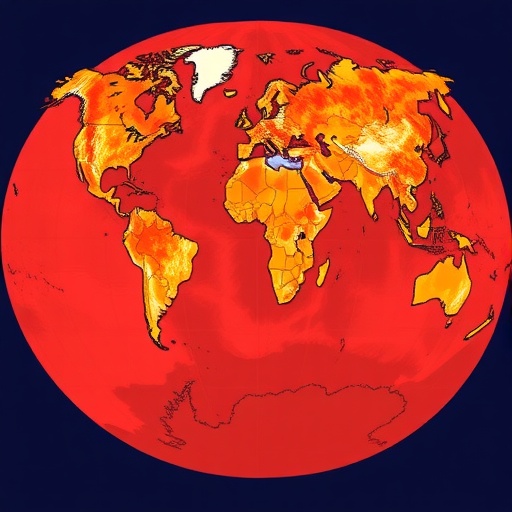
As wildfires grow larger, more frequent, and more destructive across every inhabited continent, a team of researchers in India has delivered the most comprehensive accounting yet of how artificial intelligence is being pressed into service to forecast these disasters before they ignite. In a sweeping systematic review published in the journal Discover Forests, Alisha Sinha and Laxmi Kant Sharma of the Central University of Rajasthan analysed 143 peer-reviewed studies drawn from the Web of Science database, spanning more than two decades of research from 2000 to 2023. Their verdict: artificial intelligence has transformed wildfire susceptibility mapping from an exercise in expert guesswork into a data-driven science, but the field is riddled with geographic imbalance, inconsistent evaluation practices, and an alarming absence of uncertainty assessment that threatens to undermine the reliability of the models on which firefighting agencies increasingly depend.
The stakes could scarcely be higher. The review opens with a sobering catalogue of recent catastrophes. Australia’s 2019-2020 “Black Summer” fire season burned roughly 46 million acres, an area comparable to the nation of Syria, killing 33 people, destroying more than 3,100 homes and an estimated one billion animals. The 2020 California fire season devastated 1.74 million hectares, statistically more than double the previous state record set just two years earlier. Greece witnessed fires in August 2021 that consumed nearly 130,000 hectares, while Chile endured its worst fire season in history, with more than 600,000 hectares destroyed over three months. The average annual global burned area between 2002 and 2016 stood at approximately 4,225,000 square kilometers. Beyond the immediate destruction, wildfire smoke contributes to more than 300,000 premature deaths annually, with the burden falling disproportionately on tropical regions. Fire suppression alone costs Canada around US$500 million per year and the United States between US$1 and 2 billion.
Against this backdrop, the authors distinguish carefully between concepts that earlier reviews have often conflated. Wildfire susceptibility, the focus of their analysis, refers to the spatial probability of fire occurrence under relatively stable predisposing conditions such as topography, vegetation, land cover, and human pressure, without a specific temporal dimension. Wildfire prediction or forecasting, by contrast, addresses when and how intensely fires will occur, depending on dynamic variables like weather and fuel moisture. Wildfire hazard describes the physical probability and intensity of ignition, while wildfire risk incorporates the vulnerability of people, infrastructure, and ecosystems. This conceptual clarity, the researchers argue, is long overdue in a literature where the terms have too often been used interchangeably, obscuring what different models actually deliver.
The methodology underlying the review was deliberately rigorous. The authors searched the Web of Science using a query combining machine learning and deep learning terms with “forest fire” and “prediction,” initially retrieving 985 articles. Through a multi-stage screening process modelled on the PRISMA protocol, titles and abstracts were filtered, duplicates removed, and full texts assessed against predefined inclusion criteria, ultimately yielding 143 articles for in-depth analysis. This corpus covered the full spectrum of AI approaches, from rule-based expert systems and fuzzy logic to neural networks, tree-based algorithms, support vector machines, and complex hybrid ensembles, providing a portrait of a field that began cautiously in the 1990s and has accelerated sharply since 2016.
What emerges most clearly is the dominance of tree-based methods. Random forest, an ensemble technique that aggregates the votes of many decision trees trained on random subsets of data, proved the single most frequently used algorithm across the reviewed studies, prized for its robustness to noisy and heterogeneous inputs, its relative insensitivity to data scaling, and its modest hyperparameter tuning requirements. Boosting methods such as gradient boosted decision trees and XGBoost, which build trees sequentially with each correcting the errors of its predecessor, have surged in popularity for the same reasons. In one representative study in Antalya Province, Turkey, XGBoost outperformed random forest, artificial neural networks, and gradient boosting machines to produce the most accurate susceptibility map using fifteen conditioning factors ranging from annual temperature and rainfall to topographic wetness index and tree cover density. In Iran’s Khuzestan Province, random forest bested maximum entropy, support vector machines, and boosted regression trees for regional fire susceptibility.
Deep learning, however, is mounting a serious challenge. Convolutional neural networks, designed to exploit the spatial structure of gridded data, have proven especially effective when fused with remote sensing imagery. Zhang and colleagues applied a CNN to Yunnan Province in China and achieved an area under the curve, or AUC, of 0.86, crediting the architecture’s ability to incorporate neighbourhood information and extract deep features through weight sharing and pooling. Long short-term memory networks and spatiotemporal architectures such as LSTNet capture sequential dependencies in fire-weather interactions, with Lin and co-authors demonstrating in China’s Chongli district that such models outperform conventional machine learning when datasets are large. Hybrid ensembles push performance further still. Razavi-Termeh and colleagues found that an ANFIS model optimized with genetic algorithms and simulated annealing achieved an accuracy of 0.903 in susceptibility mapping, while a random forest-frequency ratio hybrid topped five competing hybrids in northern Morocco. An ensemble combining logistic regression, random forest, support vector machines, and gradient boosting delivered superior accuracy across China, and a deep neural network paired with autoencoders and data balancing outperformed ANN, SVM, and RF alone in predicting devastating fires.
Yet the review’s most pointed criticism concerns how these models are judged. The authors document a field overwhelmingly reliant on overall accuracy and AUC, metrics that can be dangerously misleading when datasets are imbalanced, as wildfire datasets almost invariably are, with “no-fire” samples vastly outnumbering fire occurrences. A model that simply predicts “no fire” everywhere can achieve high accuracy while identifying nothing of value, and ROC-AUC can remain impressively high even when a model generates excessive false alarms. The researchers call for a standardized evaluation framework that includes threshold-dependent and threshold-independent metrics in combination, such as sensitivity and specificity, precision and the F1 score, and imbalance-aware measures like the Matthews correlation coefficient and true skill statistic. For models producing probability surfaces, calibration assessment through reliability curves and Brier scores is essential, since well-calibrated probabilities underpin effective risk communication and evacuation decisions. They further urge spatiotemporal cross-validation to counter spatial autocorrelation and explicit testing of transferability across regions and years.
The geographic distribution of research is equally troubling. China leads global output with 23 publications, roughly 16 percent of the corpus, followed by Iran at 11 percent, with the United States close behind. The authors attribute this concentration not to differences in fire risk, which is severe across Africa, South America, and much of South and Southeast Asia, but to structural factors: the availability of extensive fire inventories, high-resolution remote sensing and climate datasets, sustained funding, and robust computational infrastructure. Regions where wildfire consequences are often most severe simultaneously lack the data and institutional capacity to build reliable AI models. Models trained in data-rich environments encode region-specific associations among vegetation, land use, and climate that may simply fail when transplanted, producing degraded performance and misleading susceptibility assessments. The authors advocate transfer learning, domain adaptation, and uncertainty-aware modelling as bridges, alongside open-access fire inventories, cloud-based platforms, and international collaboration.
Promising signposts exist. The California Wildfire Inventory, or CAWFI, comprising more than 37 million data points, has demonstrated the value of large open-source training datasets, supporting wildfire prediction accuracies of 85 percent. Explainable AI is also gaining ground: in New South Wales, Australia, researchers combined random forest, XGBoost, AdaBoost, and support vector machines with SHAP values to identify the key environmental and anthropogenic drivers of fire, while comparable work in Brunei leveraged Google Earth Engine and globally available satellite data to make susceptibility modelling interpretable across tropical ecosystems. The most influential conditioning factors across studies consistently include drought, human activity, elevation, temperature, the normalized difference vegetation index, and proximity to roads, confirming that wildfire is as much a human phenomenon as a natural one.
The reported performance figures are striking: every AI algorithm reviewed achieved at least 70 percent accuracy in wildfire prediction, with random forest reaching up to 98 percent and artificial neural networks, ANN-SVM hybrids, RF-frequency ratio combinations, and PSO-optimized neuro-fuzzy models all exceeding 90 percent. But the authors caution that these figures come from studies with different datasets, regions, and conditions, and cannot be directly compared. Fair benchmarking, they insist, requires standardized community challenge datasets, minimum reporting standards documenting class prevalence, sampling methodology, and validation strategy, and reproducible open-source workflows. The review also points to the integration of unmanned aerial vehicles, cloud computing, and Internet of Things sensor networks as a path toward real-time early warning capabilities, complementing the static susceptibility maps that dominate the literature.
Ultimately, Sinha and Sharma frame their synthesis as a call to move artificial intelligence in wildfire science from experimental success to operational decision support. The technology, they conclude, has proven itself capable of reducing false alarms, enabling timely evacuations, and easing the burden on firefighting services, but only if the community confronts the gaps that current practice has left open: uncertainty quantification, cross-regional validation, interpretable architectures, and equitable access to data and computing. Roughly 2.5 billion people, including well over two thousand indigenous groups, depend directly or indirectly on forest ecosystems for food, medicine, fuel, and shelter. As climate change and land-use pressures continue to reshape global fire regimes, the difference between a well-calibrated model and an overconfident one may be measured in ecosystems, livelihoods, and lives.
Cite Scienmag News
Blake Davidson. (September 10, 2026). Spatiotemporal AI models reviewed for global wildfire prediction. Scienmag. https://scienmag.com/spatiotemporal-ai-models-reviewed-for-global-wildfire-prediction/
Blake Davidson. "Spatiotemporal AI models reviewed for global wildfire prediction." Scienmag, 10 September 2026, https://scienmag.com/spatiotemporal-ai-models-reviewed-for-global-wildfire-prediction/. Accessed 10 September 2026.
Blake Davidson. "Spatiotemporal AI models reviewed for global wildfire prediction." Scienmag. September 10, 2026. https://scienmag.com/spatiotemporal-ai-models-reviewed-for-global-wildfire-prediction/


