


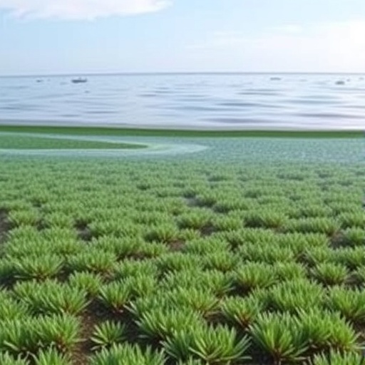
On a windswept Scottish island where the land is never more than a kilometre from the sea, scientists have mapped seagrass meadows for the very first time—thanks largely to the memories of local residents. A new study published in the journal Ambio describes how researchers combined participatory mapping workshops with drone surveys, satellite imagery and ground-truthing to reveal two previously unknown meadows of eelgrass (Zostera marina) around Sanday, one of Orkney’s North Isles. The work goes beyond ecology, however: by mapping where people fish, swim, remember and care, the team has produced what they describe as a “missing layer” for marine spatial planning—placing human activities and values on the map alongside the biophysical seascape.
Seagrasses are among the ocean’s most valuable coastal ecosystems, yet they are also among the most imperilled. These flowering plants form underwater meadows that stabilise sediment, attenuate waves and protect coastlines from erosion, sequester carbon, improve water quality by reducing turbidity and even suppress pathogens through antimicrobial metabolites. They support biodiversity that underpins fisheries and food security, from nursery grounds for commercial species to foraging habitat for wading birds. Globally, seagrass populations are in steep decline, and the United Kingdom has fared worse than most: historic losses have been estimated at up to 92 percent of former extent, with a further 39 percent lost since the 1980s. Low water quality, elevated nitrogen and physical disturbance continue to threaten the remaining meadows.
Scotland, and Orkney in particular, remains a stronghold for UK seagrass, making it a critical region for both protection and restoration. Yet Orkney’s subtidal Zostera marina distributions are poorly mapped, hampering efforts to assess status, change, threats and conservation priorities. Sanday sits within the Sanday Special Area for Conservation—10,977 hectares where destructive fishing methods are banned to protect seals and habitat features—alongside the East Sanday Ramsar site, which covers 1,515 hectares of coastal and intertidal bird habitat. Despite abundant predicted seagrass habitat and a deep maritime culture, almost none of the island’s seagrass had been scientifically surveyed.
The research team, led by Joseph S. Boyle of the University of Oxford’s School of Geography and the Environment together with colleagues from Project Seagrass, GEOMAR, Universitas Indonesia, Sound Seas and Oxford, framed their approach around a theoretical distinction drawn from human geography. Building on Yi-Fu Tuan’s concept of space versus place and Henri Lefebvre’s triad of perceived, conceived and lived space, they treated the biophysical distribution of seagrass as “space,” the spatial pattern of human activities as “social place,” and the emotional and cognitive values people attach to locations as “experiential place.” Conventional mapping, they argue, captures space but not place, producing what they call “thin” maps that marginalise place-based knowledge.
To capture both, the researchers ran ten participatory mapping workshops between May and June 2023, reaching 32 participants through purposive snowball sampling—roughly one in fifteen of Sanday’s adult residents. Each workshop lasted between 59 and 156 minutes and produced large A1 paper maps of the island’s coastline. Participants first amended a blank map in deference to their own expertise, then marked biophysical features as points, drew current and past seagrass distributions as polygons with felt-tip pens (dotted lines for former meadows), and collectively freelisted and colour-coded 39 distinct coastal and marine activities. Finally, they spatialised personal values as points using sticky notes, often anchored to places or memories, with workshop audio recorded to capture the stories behind them.
The technical mapping that followed was equally rigorous. Digitised activity polygons were buffered using fuzzy GIS methods—scale-appropriate buffers of 25, 50 and 75 percent of each polygon’s area square root were applied every five percent increments from the polygon edge—to accommodate the non-crisp logic of hand-drawn maps, then clipped to the coastline at the relevant tide state and rasterised onto a 400-square-metre grid to produce heatmaps for each activity. Workshop dialogue was coded deductively against Stephen Kellert’s 2005 typology of coastal relational values using NVivo software.
The biophysical side of the study combined local knowledge with field survey and remote sensing. Guided by workshop-derived information, strandline surveys, satellite imagery at 1.2-metre resolution and a 2014 habitat suitability model based on sediment, bathymetry and wave exposure, the team walked 119 person-kilometres of strandline, then verified seagrass presence by snorkelling along 39 kilometres and kayaking 12 kilometres more. Drone surveys with a WingtraOne carrying an RGB61 camera flew at 75 metres—yielding a one-centimetre ground sampling distance—covering 668 hectares over 379 kilometres of flight and capturing 13,500 images, which were processed into orthomosaics with Pix4Dfields and analysed in QGIS.
The results were striking. The team “found” or rediscovered two meadows absent from all prior records and from the 2014 habitat model: a 2.7-hectare meadow at Backaskaill Bay and an 18.2-hectare meadow at Otterswick, totalling 20.9 hectares. Crucially, the model overpredicted seagrass, suggesting unfeasibly large areas with unsuitable substrate and wave exposure—parameters that local residents understood well—while field surveys confirmed seagrass precisely where local knowledge indicated it. Protection coverage, however, is incomplete: the Otterswick meadow and its historic extent fall entirely within the Special Area for Conservation, but 56 percent of the Backaskaill Bay meadow—1.5 hectares, or 7.2 percent of Sanday’s total seagrass—lies outside its boundaries and therefore remains unprotected from destructive fishing practices, with no Ramsar protection from terrestrial runoff either.
The activity mapping revealed a seascape far richer than the commercial fisheries that typically dominate marine spatial planning data. Of 39 recorded activities, 15 were consumptive and 24 non-consumptive, ranging from fishing, crabbing and shellfish gathering to swimming, watersports, wildlife watching, archaeology and even playing the recorder to seals. Overall activity—both consumptive and non-consumptive—corresponded with seagrass distributions, with crabbing and spoot gathering (razor clams, Ensis ensis or Ensis siliqua) showing particularly strong co-location. Notably, commercial activities such as creeling, scalloping and shell sand mining showed little to no overlap with seagrass, occurring instead in deeper waters, rocky areas or on beaches—a finding that underscores how MSP’s usual economic focus can miss broader social–ecological interactions. The researchers also note that green crab, associated with seagrass beds, can damage seagrass, meaning that crabbing may indirectly suppress a potential stressor and link a consumptive activity to restoration benefit.
Place values proved varied and abundant but spatially diffuse overall, with every value in Kellert’s typology expressed in at least 70 percent of workshops. When analysed individually, however, two value types clustered near seagrass: humanistic values, reflecting strong emotional bonds with nature, and scientific values, concerning understanding of living systems through both formal and informal observation. The humanistic clustering at Backaskaill Bay was driven in part by the 1994 mass sperm whale stranding, mentioned in four workshops and commemorated by a new picnic area with a life-size whale sculpture. At Saville, adjacent to the Otterswick meadow, residents spoke of peace and calm in Sanday’s most sheltered bay, alongside years of biodiversity and erosion monitoring—including the sudden disappearance and reappearance of an entire beach at nearby Whitemill Bay.
Synthesising seagrass extent, habitat protection, compatible activities and co-located values, the team proposes three restoration priority sites as a starting point for community deliberation. Otterswick, sheltered and best protected, hosting Sanday’s largest meadow and dense humanistic and scientific values, is deemed most suitable for large-scale restoration. Backaskaill Bay offers a smaller, more exposed and deeper meadow with strong shellfishing links but requires Special Area for Conservation extension and careful collaboration with fishers; the authors suggest high-density planting over the small area may mitigate disturbance risks. Kettletoft Bay, near Sanday’s largest settlement, has no extant meadow but seemingly suitable habitat in a value-dense location, historically hosting the island’s highest concentrations of spoot gathering—a potentially higher-risk, higher-reward site that could support dwindling shellfisheries and eco-cultural restoration.
The study’s deeper contribution lies in its methodology. By integrating local knowledge and social data throughout all stages of social–ecological mapping, the researchers demonstrate a transferable methodology for restorative marine spatial planning—the practice of designating ocean space to promote social–ecological recovery with justice and sociocultural considerations at its core. Local knowledge proved cost-effective, replicable and reliable even where participants expressed low confidence and limited seagrass awareness, with the plant known locally as “mallow” and featuring in placenames and historic thatching practices. The authors caution that their findings are a first step: participation should ideally begin at the normative stage of planning, before deciding whether restoration is even desirable, and broader engagement will be needed. But as global biodiversity targets demand equitable and effective restoration, this small island’s blend of memory, drone imagery and community knowledge offers a template for how the ocean’s missing human layer might finally be mapped.
Cite Scienmag News
Violet Maxwell. (September 10, 2026). Memories fill missing layers in seagrass maps for ocean restoration. Scienmag. https://scienmag.com/memories-fill-missing-layers-in-seagrass-maps-for-ocean-restoration/
Violet Maxwell. "Memories fill missing layers in seagrass maps for ocean restoration." Scienmag, 10 September 2026, https://scienmag.com/memories-fill-missing-layers-in-seagrass-maps-for-ocean-restoration/. Accessed 10 September 2026.
Violet Maxwell. "Memories fill missing layers in seagrass maps for ocean restoration." Scienmag. September 10, 2026. https://scienmag.com/memories-fill-missing-layers-in-seagrass-maps-for-ocean-restoration/


