


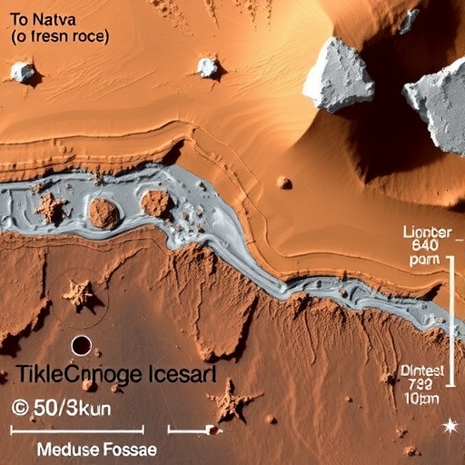
In a discovery that has captured the imagination of planetary scientists and space enthusiasts alike, a team of Czech researchers has independently confirmed that the Medusae Fossae Formation (MFF) on Mars—one of the most enigmatic geological provinces on the Red Planet—almost certainly harbors vast deposits of water ice hidden beneath its dusty surface. The finding, published in the journal Astrophysics and Space Science, arrives at a moment when the race to identify accessible water resources on Mars has never been more intense, both for unraveling the planet’s climate history and for enabling future human exploration.
The Medusae Fossae Formation is no small feature. Stretching roughly 5,500 kilometers along the Martian equator, southwest of the towering volcanoes of Olympus Mons and the Tharsis Montes, this sprawling province of soft, easily eroded deposits has puzzled scientists since the Viking orbiters first imaged it in the 1970s. Its origin has been debated for decades, with researchers invoking volcanic ashfall, wind-blown sediments, and water-related processes to explain its distinctive layered appearance. Now, a study by Jaroslav Klokočník of the Astronomical Institute of the Czech Academy of Sciences, together with Jan Kostelecký and Aleš Bezděk, offers a fresh and remarkably elegant line of evidence: the gravity field of Mars itself.
The story begins with radar. In 2024, a team led by Thomas Watters analyzed data from the Mars Advanced Radar for Subsurface and Ionospheric Sounding instrument (MARSIS) aboard the European Space Agency’s Mars Express orbiter. Those radargrams revealed subsurface reflectors beneath the MFF whose dielectric properties pointed strongly toward layered deposits rich in water ice. Watters and colleagues proposed that the formation may constitute the largest known reservoir of water ice on Mars outside the polar ice caps—a claim with profound implications, because ice near the equator would be far easier for future crewed missions to access than polar ice.
But radar, however powerful, is not infallible. The interpretation of subsurface reflectors depends on assumptions about the dielectric constant of the material, and alternative explanations—such as dense dust, compacted ash, or porous rock—have historically been difficult to exclude. That is precisely why the new study matters. Klokočník and his colleagues used a completely independent method, one that never touches radar data at all. Instead, they interrogated Mars’ gravity field, looking for subtle signatures that betray the presence of low-density, porous material buried underground.
The technique relies on what the authors call “gravity aspects”—a family of mathematical descriptors derived from the static disturbing gravitational potential of the planet, which is itself encoded in a set of harmonic potential coefficients known as Stokes parameters. The team used NASA JPL’s JGMRO_120F gravity model, constructed from long series of observations of orbiting spacecraft and published to degree and order 120, though the researchers truncated their analysis at degree and order 80. This truncation corresponds to a ground resolution of roughly 130 kilometers—coarse compared to the roughly 10-kilometer resolutions achievable for the Earth and the Moon, but entirely adequate for studying a formation as vast as the MFF, which spans 1,000 to 3,000 kilometers.
At the heart of the method are the “strike angles,” which are the principal directions of the Marussi tensor—the tensor of second derivatives of the disturbing gravitational potential. In most places, these strike angles point in a chaotic jumble of directions. But in certain geologically special locations, they align dramatically, almost like iron filings around a magnet. The researchers call this phenomenon “combed” strike angles, and they quantify it with a comb coefficient that ranges from zero to one, reaching unity only when the orientation vectors in a neighborhood are perfectly aligned.
Here is the crucial physical insight: highly combed strike angles of enormous spatial extent are characteristic of porous, low-density material buried in the subsurface. On Earth, the same team previously discovered that such alignments correlate with known oil and gas fields, including deposits in the Caspian Sea and the Ghawar belt of Saudi Arabia. Reservoir rocks—whether saturated with hydrocarbons, groundwater, or, on a cold planet like Mars, ice—are porous, and their density contrast with the surrounding crust leaves an unmistakable fingerprint in the orientation structure of the gravity field.
When the team applied this “comb metric” to the Medusae Fossae Formation, the results were striking. The strike angles over the MFF are clearly and strongly aligned, organized into segments sharing a single common orientation, with features much larger than the 130-kilometer ground resolution of the gravity model—which means the signal is statistically significant and cannot be dismissed as noise or a modelling artifact. Such alignment, the authors write, is typical of porous material, subsurface water ice, groundwater sources, light constituents in sedimentary layers, or mixtures of these. For the MFF specifically, the signal indicates material of lower density or higher porosity than the surrounding rocks—exactly what one would expect if the formation contains ice-rich deposits interleaved with ice-poor dust, as the radar studies suggested.
The study is careful about what it does and does not claim. The authors emphasize several important caveats. Gravity data reveal the presence of density anomalies but cannot uniquely determine their cause; combed strike angles are not a direct signature of ice, water, or any other specific substance, and the interpretation must be constrained by context from other datasets. Correlation, as they note, does not establish causation, and gravity modelling is always vulnerable to artifacts. Yet the convergence of two entirely independent methods—radar sounding, which detects dielectric contrasts, and gravity analysis, which detects density variations—on the same conclusion is difficult to ignore. The two techniques measure fundamentally different physical properties, which makes their agreement all the more persuasive.
The new results also fit into a broader research program by the same group. In earlier work, Klokočník and colleagues identified large “plates” of highly combed strike angles in the northern lowlands of Mars, regions believed to be remnants of a hypothetical ancient paleoocean. Those findings prompted speculation about sediments saturated with water ice—or even hydrocarbons—across the northern hemisphere, along the coastlines of that vanished sea and at considerable depths near the polar cap. The MFF, notably, does not display the same gigantic plate structure seen in the paleoocean zones, but its strike angles are nonetheless highly combed, marking it as a distinct and remarkable province.
The distinction between the equatorial MFF and the polar regions carries practical weight. While the polar caps are known to contain enormous quantities of ice, they lie at extreme latitudes, where harsh cold, long seasons of darkness, and difficult landing geometry complicate any human mission. The MFF, straddling the equator, offers a potentially far more accessible reservoir. If the ice-rich interpretation is correct, it would be an attractive target for landers seeking to demonstrate in-situ resource utilization—the extraction of drinking water, oxygen, and rocket propellant from local materials.
Curiously, the team’s virtual deformation analysis—a gravity-based quantity that reveals patterns of dilation and compression—also yielded some intriguing if ambiguous results around the MFF region, including north–south oriented “stripes” west of Olympus Mons. The authors candidly admit they cannot rule out that some of these narrow features are artifacts of the gravity modelling, since their widths are comparable to the model’s ground resolution. The larger features, however, exceeding the resolution limit by wide margins, are judged to be real.
What makes this study particularly compelling is its methodological modesty. The researchers do not claim to resolve the long-standing debate over the MFF’s geological origin, whether volcanic, aeolian, or sedimentary. They simply set out to test whether their gravity-based approach, applied blind to the problem, would corroborate the radar-based identification of ice. It did. The method is identical to the one they previously applied in searches for water at the Moon’s south pole in support of NASA’s Artemis program, lending it a track record on another world.
The implications ripple outward. The MFF’s ice-rich deposits record the history of Mars’ water—how it was deposited, transformed, and preserved over billions of years—and may hold clues to whether the planet’s equatorial regions ever hosted habitable environments. And for mission planners, every new confirmation of accessible near-surface ice reshapes the map of possible landing sites for the first human expeditions. A formation once dismissed as mere wind-scoured dust, it turns out, may be one of the most valuable pieces of real estate on Mars. As the authors put the matter plainly: their results constitute evidence of the presence of ice in the Medusae Fossae Formation. On a planet where water means survival, that is news worth taking seriously.
Cite Scienmag News
Violet Maxwell. (September 5, 2026). Independent study confirms ice-rich deposits in Mars’ Medusae Fossae Formation. Scienmag. https://scienmag.com/independent-study-confirms-ice-rich-deposits-in-mars-medusae-fossae-formation/
Violet Maxwell. "Independent study confirms ice-rich deposits in Mars’ Medusae Fossae Formation." Scienmag, 5 September 2026, https://scienmag.com/independent-study-confirms-ice-rich-deposits-in-mars-medusae-fossae-formation/. Accessed 5 September 2026.
Violet Maxwell. "Independent study confirms ice-rich deposits in Mars’ Medusae Fossae Formation." Scienmag. September 5, 2026. https://scienmag.com/independent-study-confirms-ice-rich-deposits-in-mars-medusae-fossae-formation/


