


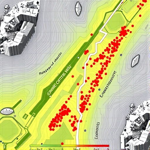
In the steep, rain-battered valleys of the Italian Alps, a team of researchers has demonstrated that landslide hazard maps should no longer be treated as fixed documents etched in stone, but as living predictions that breathe with the weather. A new study published in Environmental Earth Sciences introduces a dynamic landslide susceptibility mapping framework built on a spatiotemporal Generalized Additive Model (GAM), tested across the Cordevole Basin in the Belluno province of northeastern Italy. The work shows that when the timing of rainfall is folded into the mathematics of slope stability, the resulting maps become markedly better at identifying where and when the mountains are most likely to let go.
The research, led by Rajeshwari Bhookya and Sansar Raj Meena of the Machine Intelligence and Slope Stability Laboratory at the University of Padova, together with colleagues from institutions in Italy, the United States and India, addresses a long-standing weakness in landslide science. Most susceptibility models in use today are static: they relate past landslides to terrain attributes such as slope angle, elevation and rock type, and then produce a single map that assumes the danger never changes. In reality, mountain slopes exist in a perpetually shifting balance. Rainfall raises pore pressures within soils, snowmelt saturates shallow layers, vegetation is damaged by storms, and land use evolves year by year. A map frozen in time cannot capture any of this.
To build a more responsive model, the team first assembled an unusually detailed record of past failures. The backbone came from Italy’s national landslide database, the Inventario dei Fenomeni Franosi in Italiano (IFFI), which contains more than 620,000 mapped landslides nationwide. Within the 539-square-kilometer Cordevole Basin alone, the historical inventory records 2,517 landslide points predating 2006, dominated by rotational and translational slides (49 percent) and flows (34 percent). The researchers then extended this record through careful visual interpretation of very high-resolution orthophotos, each pixel representing just 50 centimeters of ground, to catalog new landslides across four additional periods: 2006–2012, 2012–2015, 2015–2018 and 2018–2021. These periods added 305, 393, 150 and 371 landslide points respectively, producing a five-epoch inventory that traces instability through time.
The choice of study area is far from arbitrary. The Cordevole Basin rises from roughly 550 meters to 3,325 meters above sea level, and its geology spans formations from the Ordovician to the Quaternary. Carbonate rocks such as limestone and dolomitic limestone cover about 40 percent of the basin, volcanites another 29 percent, and loose gravels, alluvium and moraine deposits around a quarter of the landscape. Forest blankets 58 percent of the terrain, and the region receives an average of 1,100 millimeters of precipitation each year, often delivered in short, violent autumn bursts. Two recent catastrophes sharpened the urgency of the work: the Vaia windstorm of October 2018, which flattened vast swaths of forest and destabilized slopes across northeastern Veneto, and an intense rainfall event in early December 2020 with an exceptionally high return period, both of which were followed by renewed landslide activity.
Rather than treating the landscape as a grid of pixels, the team divided the basin into 534 slope units, terrain compartments bounded by ridges and drainage lines that behave as relatively homogeneous physical entities. Each unit was assigned a binary label, one if a landslide originated within it during a given period, zero otherwise. Predictors fell into two categories. Static factors, sixteen in total, were derived from a 10-meter digital elevation model and included elevation, slope gradient, aspect, planar and profile curvature, the Topographic Wetness Index, the Terrain Ruggedness Index, the Stream Power Index and the Topographic Position Index, supplemented by soil and lithological maps and distances to roads and rivers. Dynamic factors consisted of cumulative rainfall over antecedent windows of 2, 7, 14, 21 and 30 days, computed from daily gauge records spanning 1991 to 2021 and interpolated across the basin using inverse distance weighting. Only rainfall exceeding the 95th percentile within each window was retained, deliberately emphasizing the intense episodes most capable of triggering failure.
The modeling itself proceeded in deliberate steps of increasing sophistication. As a baseline, the researchers fitted a conventional logistic regression, the workhorse of susceptibility studies, in which the log-odds of landslide occurrence are expressed as a linear combination of predictors. They then relaxed the assumption of linearity with a logistic Generalized Additive Model, replacing fixed coefficients with flexible smooth functions estimated by restricted maximum likelihood. Next came a longitudinal GAM that added a random intercept for each slope unit, acknowledging that the same slope observed across multiple periods shares unmeasured characteristics. Finally, the full spatiotemporal GAM introduced a Markov Random Field smoother, treating neighboring slope units that share a boundary as statistically dependent within a conditional autoregressive framework, capturing the spatial contagion of instability across the landscape.
The results were unambiguous. In the primary random cross-validation comparison, the spatiotemporal GAM achieved the highest discrimination between landslide and non-landslide units, with area under the receiver operating characteristic curve (AUC-ROC) values between 0.843 and 0.856 across rainfall windows. The longitudinal GAM followed closely, the cross-sectional GAM performed moderately, and plain logistic regression trailed far behind with AUC values of just 0.49 to 0.64. The spatiotemporal model also explained the largest share of variance, with Nagelkerke R² values around 0.40 to 0.45, and produced the lowest Brier scores, roughly 0.126 to 0.133, indicating well-calibrated probability estimates. For context, AUC values near 0.85 exceed the 0.72 to 0.76 range typically reported for logistic regression in comparable alpine settings and rival the performance of machine-learning methods such as random forests, which nevertheless usually operate on static datasets.
The inner workings of the GAM offered insights that a linear model could never reveal. Among static factors, mean elevation, slope aspect and slope gradient emerged as the dominant controls. The smooth response curves showed a bimodal relationship with aspect, reflecting the asymmetric influence of solar radiation and moisture on opposing valley sides, and a unimodal response to slope, with susceptibility peaking at moderate to steep gradients before declining on the very steepest terrain, where shallow failures become less frequent. The dynamic predictors proved especially revealing. Susceptibility rose sharply with 2-day cumulative rainfall, confirming that intense, recent precipitation is a primary trigger of shallow soil slips and debris flows through rapid pore-pressure increase. Seven- and 14-day accumulations displayed nonlinear, threshold-like behavior with multiple peaks, suggesting that moderate-duration rainfall pushes slopes past critical saturation levels. By contrast, 21- and 30-day accumulations plateaued beyond roughly 75 to 100 millimeters, indicating that once soils approach saturation, additional prolonged rain contributes comparatively little to triggering.
The resulting dynamic susceptibility maps visualized the danger expanding and contracting in step with the weather. High-susceptibility zones clustered persistently in steep, geomorphically complex terrain, but swelled markedly during periods of heavy cumulative rainfall, particularly under the 14-day window. Notably, land-use and land-cover variables contributed little at the regional scale, implying that anthropogenic influences, while locally important near roads and disturbed slopes, are not the dominant drivers of basin-wide susceptibility. A stricter sensitivity analysis, in which all observations from the same slope unit were kept in the same validation fold to prevent information leakage, confirmed the longitudinal GAM as the strongest transferable model, achieving an AUC-ROC of 0.770 for the 14-day rainfall period, with the spatiotemporal model unable to extrapolate to completely unseen slope units because its spatial structure is tied to unit identifiers.
The authors are careful to frame the contribution accurately. The framework yields susceptibility estimates rather than event-based forecasts and does not yet support operational early warning. Interpolated rainfall fields from ten gauges approximate, rather than perfectly resolve, alpine precipitation patterns, and the spatial gauge network may underrepresent localized cloudbursts. Future refinements could incorporate satellite-derived soil moisture and vegetation indices, Bayesian hierarchical structures, explicit path-dependency effects whereby previous failures precondition later ones, and hybrid models blending empirical statistics with process-based slope mechanics.
Even with those caveats, the message of the study resonates well beyond the Dolomites. Italy’s May 2023 Emilia-Romagna crisis, in which a single rainfall episode triggered more than 80,000 landslides, illustrates how quickly terrain can transition from stable to catastrophic. As climate change intensifies both rainfall extremes and temperature across the Alps and other mountain belts worldwide, the tools used to anticipate slope failure must evolve as fast as the hazards themselves. By proving that landslide susceptibility is a process in motion rather than a property fixed in the ground, this research offers a template for mapping danger not as a snapshot, but as a film.
Cite Scienmag News
Violet Maxwell. (September 4, 2026). Dynamic landslide susceptibility mapping using multi-temporal inventories in the Belluno Alps. Scienmag. https://scienmag.com/dynamic-landslide-susceptibility-mapping-using-multi-temporal-inventories-in-the-belluno-alps/
Violet Maxwell. "Dynamic landslide susceptibility mapping using multi-temporal inventories in the Belluno Alps." Scienmag, 4 September 2026, https://scienmag.com/dynamic-landslide-susceptibility-mapping-using-multi-temporal-inventories-in-the-belluno-alps/. Accessed 4 September 2026.
Violet Maxwell. "Dynamic landslide susceptibility mapping using multi-temporal inventories in the Belluno Alps." Scienmag. September 4, 2026. https://scienmag.com/dynamic-landslide-susceptibility-mapping-using-multi-temporal-inventories-in-the-belluno-alps/


