


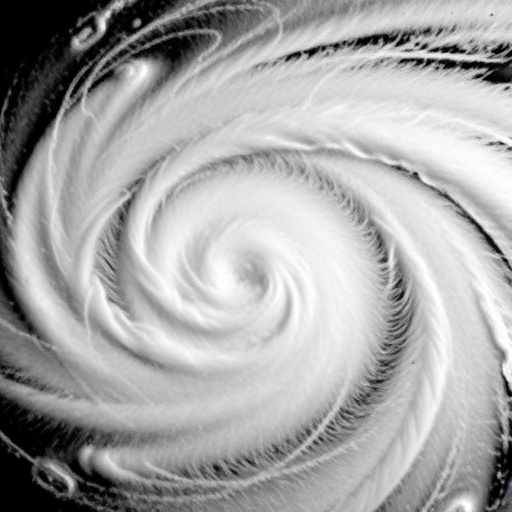
Stanford researchers have discovered that instruments built to detect earthquakes can also “listen” to hurricanes, revealing how turbulent winds and shifting air pressure behave as a storm approaches land. In a study published in Science, the team showed that seismometers and infrasound microphones captured a detailed signature of Hurricane Isaac as it struck Louisiana in 2012. The recordings identified the storm’s calm eye, the violent eyewall surrounding it, and the turbulent atmospheric conditions that preceded and followed landfall. The finding could open a new way to monitor hurricanes and improve forecasts of how quickly they strengthen or weaken.
The discovery emerged from an unexpected encounter between a hurricane and a network of geophysical instruments. Louisiana is not known for frequent earthquakes, so relatively few seismic stations were operating in the region when Isaac approached the coast. However, several stations had been installed as part of a National Science Foundation-supported project designed to map Earth’s interior. When the Category 1 hurricane passed over the sensors, it generated a rare natural experiment: researchers could compare seismic and acoustic recordings with conventional measurements of the storm’s atmosphere.
Seismometers are designed to detect tiny movements of the ground, including the vibrations produced by earthquakes. Hurricanes can create similar signals through a combination of intense wind, fluctuating air pressure, and the weight and movement of atmospheric systems pressing on the surface. As powerful gusts interact with the ground and nearby structures, they generate vibrations that travel into the Earth. Although the resulting motion may be far too small for people to feel, sensitive instruments can record it continuously. During Isaac, the ground moved by only a fraction of a millimeter over roughly 100 seconds, yet the signal was strong enough to reveal the storm’s passage.
The researchers also used infrasound microphones, which detect sound waves below the lower limit of human hearing. These very low-frequency waves can travel long distances through the atmosphere and are produced by major natural events, including volcanic eruptions, explosions, meteor entries, and severe storms. In the case of Isaac, the microphones recorded pressure fluctuations associated with turbulence in the hurricane’s atmospheric boundary layer—the lowest part of the atmosphere, where winds interact directly with the surface. Because the measurements were continuous, they offered a moving record of the storm’s internal structure rather than a brief snapshot.
Hurricanes are enormous rotating engines powered by warm ocean water. Most span hundreds of miles and contain a low-pressure eye surrounded by the eyewall, where winds and rainfall reach their greatest intensity. Spiral rainbands extend outward from the center, carrying thunderstorms and bursts of turbulent air. As Isaac crossed the Louisiana stations, the instruments recorded the transition from increasingly violent conditions into the relatively quiet eye, followed by the return of the eyewall and its powerful winds. The resulting seismoacoustic pattern effectively traced the storm’s structure as it moved over the region.
The work builds on an earlier study by Qing Ji and Eric Dunham, which challenged the assumption that a hurricane would produce an overwhelming mixture of seismic waves arriving from across the entire storm. Instead, the researchers found that the seismic signal was dominated by turbulence near each station, over distances of only a few kilometers. That result was important because it indicated that seismometers were not merely recording the combined force of a distant storm. They were responding to local conditions in the boundary layer, where small-scale wind fluctuations can influence the storm’s behavior and energy exchange with the surface.
Ji later worked with Ipshita Dey, who studied hurricane boundary layers in the laboratory of atmospheric scientist Morgan O’Neill. Their collaboration connected the geophysical recordings to the fine-scale wind structures that develop inside hurricanes. By combining seismic vibrations with infrasound data, the researchers obtained two complementary signals: one showing how turbulence shook the ground and another documenting the pressure changes produced in the air. The agreement between these recordings and conventionally collected boundary-layer observations strengthened the case that the instruments were capturing meaningful atmospheric processes rather than random background noise.
Understanding the boundary layer is central to predicting hurricane intensity. Heat, moisture, and momentum move through this region, influencing whether a storm gains or loses energy. Current observations come from aircraft that fly into hurricanes, parachuted instruments, ocean buoys, wind towers, radar, and other systems. Each method has limitations. Buoys and towers measure conditions close to the surface, radar provides intermittent views, and aircraft missions are expensive and expose crews to dangerous conditions. Seismic and infrasound stations could provide continuous, ground-based monitoring in places where other instruments are sparse, although the researchers emphasize that the approach must be tested across many more storms.
The prospect is especially compelling for stronger hurricanes. Isaac reached the coast as a Category 1 storm, yet it produced a measurable signal in the ground and atmosphere. More powerful storms, such as Hurricanes Andrew in 1992 or Michael in 2018, would be expected to generate larger and potentially clearer signatures. Existing seismic networks could therefore become multipurpose observation systems, supporting earthquake monitoring while also collecting data on severe weather. Additional instruments might be installed at strategic locations near coastlines and vulnerable communities, creating a wider observational network without requiring every measurement to come from aircraft or ocean platforms.
The Stanford researchers say the method could eventually help scientists understand not only hurricanes but also other storms and atmospheric events driven by strong winds. Better measurements of turbulence could improve models that forecast rapid intensification, landfall timing, and changes in storm structure. More accurate predictions could influence evacuation decisions, infrastructure planning, emergency communications, and preparations for dangerous wind and storm surge. What began as a fortunate overlap between a 2012 hurricane and a geophysics experiment has now revealed that Earth’s seismic and acoustic networks may contain an overlooked source of real-time information about some of the planet’s most destructive storms.
News Publication Date: 6-Aug-2026
Web References: https://doi.org/10.1126/science.adt7323; https://profiles.stanford.edu/eric-dunham; https://sustainability.stanford.edu/
References: Science, “Turbulent seismoacoustic imprints during a hurricane landfall,” DOI: 10.1126/science.adt7323
Cite Scienmag News
Violet Maxwell. (August 6, 2026). Earthquake Sensors Reveal New Clues About Hurricanes. Scienmag. https://scienmag.com/earthquake-sensors-reveal-new-clues-about-hurricanes/
Violet Maxwell. "Earthquake Sensors Reveal New Clues About Hurricanes." Scienmag, 6 August 2026, https://scienmag.com/earthquake-sensors-reveal-new-clues-about-hurricanes/. Accessed 4 September 2026.
Violet Maxwell. "Earthquake Sensors Reveal New Clues About Hurricanes." Scienmag. August 6, 2026. https://scienmag.com/earthquake-sensors-reveal-new-clues-about-hurricanes/


