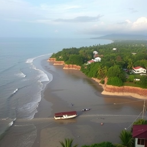
A groundbreaking study published in the prestigious journal Science Advances has unveiled a pressing revelation about the future of coastal flooding on Indonesia’s Java Island, one of the most densely populated regions in the world. Contrary to widespread assumptions that rising sea levels due solely to global climate change pose the principal risk to coastal communities, the research highlights that land subsidence — the gradual sinking of the ground — is poised to eclipse oceanic rise as the dominant factor driving flood hazards. This paradigm shift calls for urgent reconsideration of flood risk management and climate adaptation strategies on local and global scales.
Java Island’s intricate relationship with water has long shaped its geography, culture, and economy. However, this study, led by Virginia Tech geoscientist Manoochehr Shirzaei and team, shows that human activities deeply affecting the subsurface environment are accelerating land sinking at unprecedented rates. Utilizing state-of-the-art satellite radar interferometry combined with sophisticated machine learning algorithms, the research maps subsidence phenomena at an exceptional spatial resolution, revealing subsidence rates ranging from one to fifteen centimeters annually across various urban and rural landscapes. These rates significantly surpass the projected mean sea level rise globally within the same timeframe, signaling an alarming amplification of flood risk.
The root causes behind this rapid subsidence are multifaceted but converge on unsustainable extraction of groundwater, agricultural irrigation practices, and industrial resource use. In coastal deltaic environments, natural sediment compaction also contributes to land lowering, further compounding the problem. Groundwater withdrawal, in particular, was identified as a key driver, leading to the compaction of aquifer systems and soil layers, thereby triggering irreversible land loss. This insight underscores the importance of integrating hydrogeological dynamics into coastal risk assessments, an aspect often overlooked in traditional sea-level rise models.
One of the study’s most compelling findings is the projection that by the year 2050, land subsidence could constitute as much as 85 percent of the relative sea-level rise experienced along the majority of Java’s coastline. Such a disproportionate contribution radically shifts the understanding of future flooding scenarios and brings to light the critical role of land management policies. Additionally, over the next quarter-century, more than three-quarters of the island’s coastal edges are expected to experience flooding largely influenced by subsidence rather than oceanic conditions, further intensifying the vulnerabilities of communities, infrastructure, and ecosystems.
Addressing the challenge of limited in-situ tide gauges and subsurface monitoring across Java, the researchers innovatively harnessed satellite data to establish a network of “virtual tide gauges” spaced every five kilometers along the coastline. This breakthrough methodology enables continuous, high-resolution monitoring of land elevation changes and relative sea-level trends without dependence on conventional ground stations, which are often sparse or absent in developing regions. Such technological advancement opens new frontiers for subsidence surveillance worldwide, particularly in similarly vulnerable but data-poor coastal zones.
The interplay between global climate factors and local anthropogenic activities unleashed a complex threat to Java’s coastal resilience. While ocean waters undeniably rise due to thermal expansion and melting ice caps, the accelerated sinking of landmass due to groundwater extraction injects a powerful multiplier effect into flood risks. This dual mechanism demands nuanced policy interventions that marry global emissions reductions with localized resource management strategies, emphasizing sustainable water use, groundwater recharge initiatives, and infrastructural adjustments to accommodate both components.
The implications of the Java case study extend far beyond Indonesia’s shores. Globally, millions of inhabitants occupy deltas, estuaries, and coastal lowlands where the delicate balance between land elevation and sea level is fragile and susceptible to human impacts. The study’s lead author Leonard Ohenhen, a former Virginia Tech graduate now at the University of California, Irvine, cautions that Java’s experience could foreshadow emerging crises elsewhere if land subsidence remains under-recognized and unstewarded. Regions facing similar hydrogeological and developmental pressures will likely encounter compounded flood hazards if proactive monitoring and mitigation efforts are not established promptly.
Conventional approaches to climate adaptation often prioritize mitigating greenhouse gas emissions and designing infrastructure for anticipated sea-level rise. However, this research advocates for a critical extension of such frameworks to incorporate active land subsidence management. Unlike global warming, subsidence is largely a localized, actionable phenomenon that can be influenced through policy reforms, sustainable groundwater governance, and technological interventions such as artificial aquifer recharge and improved land-use planning. This realization offers a vital lever for enhancing coastal resilience in a tangible and cost-effective manner.
The study not only advances scientific understanding but also delivers an urgent message to policymakers, urban planners, and resource managers. Addressing land subsidence requires cross-sector collaboration, encompassing water resource management, urban development regulation, and environmental conservation. The fusion of satellite remote sensing and data science demonstrated in the study provides valuable tools to inform decision-making, monitor the success of interventions, and anticipate future hotspots of subsidence-driven flooding.
As the climate crisis intensifies, nuanced and multidimensional frameworks for coastal risk assessment must replace overly simplistic narratives focusing exclusively on oceanic rise. Java’s subsidence challenge exemplifies the complexity of coastal dynamics and the necessity to integrate geomorphological, hydrogeological, and human factors for an accurate risk portrayal. Investment in monitoring infrastructure, community engagement, and adaptive governance are critical to safeguarding vulnerable populations and ensuring sustainable development along coastal margins worldwide.
This research marks a transformative step toward comprehensive climate adaptation that acknowledges the profound consequences of subsurface dynamics on sea-level hazards. It underscores the imperative for regional and global coordination, innovative technology deployment, and sustainable resource use to confront the intertwined challenges of land subsidence and ocean rise. Ultimately, managing subsidence emerges as a powerful and attainable strategy to buffer coastal communities against the advancing tides.
The revelation that human-induced land sinking, driven principally by groundwater exploitation, will dominate future coastal flooding in Indonesia’s Java Island serves as a clarion call for immediate action. It urges a departure from narrowly focused climate resilience efforts by spotlighting a critical yet overlooked element of coastal risk that is measurable, manageable, and mitigable at the local level. The integration of remote sensing innovations, scientific insight, and policy engagement outlined in this study sets a new standard for confronting one of the most pressing environmental challenges of our era.
Subject of Research: Coastal Flooding Risk, Land Subsidence, Sea Level Rise, Java Island, Groundwater Extraction, Remote Sensing
Article Title: Land Subsidence Outpaces Sea-Level Rise as Primary Driver of Coastal Flooding Risk on Indonesia’s Java Island
News Publication Date: Not specified in the provided content
Web References:
https://www.science.org/doi/10.1126/sciadv.aec0172
References:
Original study DOI: 10.1126/sciadv.aec0172
Image Credits: Courtesy of Virginia Tech
Keywords: Land Subsidence, Coastal Flooding, Sea Level Rise, Groundwater Withdrawal, Remote Sensing, Satellite Radar, Machine Learning, Java Island, Climate Adaptation, Coastal Resilience, Hydrogeology, Environmental Risk
