In a groundbreaking advancement that bridges atmospheric science and sustainable development, a team of researchers has unveiled a comprehensive national-scale spatial model that maps dust storm pollution and assesses the vulnerability of tourism destinations and infrastructure. This pioneering study delves into the complex dynamics of dust storms—an environmental hazard with far-reaching consequences for human health, ecosystems, and socio-economic sectors, particularly tourism, a crucial industry for many regions. The integration of cutting-edge spatial modeling techniques with environmental risk assessment provides an unprecedented lens through which policymakers, scientists, and urban planners can foresee and mitigate the dangers imposed by these natural phenomena.
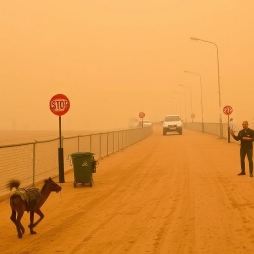
Dust storms, often perceived as mere weather anomalies, are gaining recognition for their profound ecological and economic impacts. Comprising fine particulate matter lifted from arid surfaces, these storms transport vast quantities of dust and pollutants across extensive geographical areas, affecting air quality and visibility. Moreover, dust storms carry microbial life and chemical contaminants, exacerbating health risks upon inhalation. The research team’s national-scale approach transcends localized studies, offering a macroscopic understanding of dust storm patterns, pathways, and intensities, which is critical for regions where tourism infrastructure and heritage sites are particularly sensitive to environmental stressors.
The study’s implementation of spatial modeling harnesses the power of geostatistical algorithms and remote sensing data to simulate the genesis, trajectory, and deposition of dust particles over time and space. By integrating topographical features, climatic variables, land use patterns, and urban density, the model achieves a high resolution of predictive accuracy. This enables stakeholders to visualize hotspots of dust storm activity and forecast temporal changes in pollution levels. Importantly, the model’s ability to contextualize dust pollution within the framework of tourism infrastructure vulnerability represents a novel interdisciplinary achievement, linking atmospheric science with socio-economic resilience.
One of the technical pillars of this study is the utilization of advanced remote sensing technologies, including satellite imagery and ground-based lidar systems, which contribute real-time data to calibrate and validate the spatial outputs. These technologies allow for monitoring particulate matter concentrations and dust cloud movements with unprecedented precision. The researchers employed machine learning techniques to analyze these datasets, identifying patterns and anomalies that traditional statistical methods might overlook. This fusion of data science and environmental monitoring transcends conventional approaches, setting a new standard for atmospheric hazard modeling.
The implications of dust storm pollution on tourism destinations are multifaceted and profound. Dust particles can cause physical degradation of cultural heritage sites, corroding ancient structures and monuments, many of which constitute the backbone of regional tourism. Beyond the structural damage, reduced air quality and visibility deter visitor numbers, inflicting economic losses. The model’s vulnerability assessment quantifies these impacts by correlating dust exposure indices with the spatial distribution of tourism assets. This enables targeted interventions aimed at enhancing the resiliency of vulnerable sites through engineering solutions or strategic urban planning.
Furthermore, the researchers emphasize the interconnectedness between dust storm frequency and broader climatic changes. Increasing aridity in some regions, compounded by land mismanagement and desertification, contributes to more frequent and severe dust events. The model incorporates climate projections to simulate future scenarios, offering foresight into how dust pollution might evolve under various environmental policies and socio-economic developments. This forward-looking perspective is key for crafting adaptive tourism management strategies and infrastructure design capable of withstanding future atmospheric challenges.
A striking feature of this spatial model is its capacity to integrate multisectoral data streams, including transportation networks, accommodation hubs, and recreational areas, thereby generating a holistic vulnerability map. This map serves as a decision-support tool for emergency management, enabling rapid response to dust storm events and minimizing disruptions to tourism services. By factoring in infrastructure characteristics, such as building materials and design standards, the model informs tailored risk mitigation efforts that reduce maintenance costs and enhance public safety.
On a methodological level, the research introduces novel algorithms for simulating dust storm genesis in heterogeneous landscapes. These algorithms consider soil moisture levels, wind shear forces, and vegetative cover, refining the prediction of dust uplift sources. Coupled with meteorological models that predict wind patterns and storm duration, the framework offers a robust predictive platform that can be adapted to different national contexts. The versatility of the model means it can be deployed globally, aiding regions beyond the initial study area in safeguarding their tourism economies.
Health impacts form another significant dimension of the study. Dust storm pollution comprises particulate matter (PM10 and PM2.5) capable of penetrating deep into the respiratory system, posing acute and chronic health risks to both residents and tourists. The spatial model overlays pollution exposure data with population density and health infrastructure locations, highlighting vulnerable communities and tourism-dependent populations. Such detailed exposure mapping aids public health officials in issuing timely warnings, optimizing medical resource allocation, and implementing preventive measures during high-risk periods.
Crucially, this research brings to light the economic vulnerability of the tourism sector by incorporating cost-benefit analyses into the spatial assessment. The model estimates potential revenue losses stemming from reduced tourist footfall, infrastructure repair costs, and health-related expenditures. By associating dust storm events with economic indicators, policymakers are equipped with quantifiable insights that justify investments into dust control measures, sustainable land management practices, and infrastructure enhancements.
The study also champions the role of community engagement and stakeholder collaboration in addressing dust storm challenges. Recognizing that data-driven insights must translate into practical actions, the research framework includes mechanisms for communicating risk to local communities and tourism operators. Interactive mapping interfaces and scenario simulation tools allow users to visualize impacts and explore mitigation strategies, fostering participatory governance models that enhance resilience.
Moreover, the temporal scalability of the model permits simulation of dust storm impacts at different time scales—from immediate episodic events to long-term trends—enabling dynamic resource planning. This aspect is particularly valuable in regions experiencing seasonal tourism peaks coinciding with dust storm seasons, facilitating adaptive scheduling and event management to optimize visitor safety and satisfaction.
In terms of environmental policy implications, the research underscores the necessity for integrated land and atmospheric quality management policies. Desertification control, afforestation initiatives, and sustainable agricultural practices are highlighted as effective measures to reduce dust storm genesis. By providing spatially explicit data, the model empowers environmental agencies to prioritize intervention areas and monitor policy efficacy over time.
Equally important is the study’s contribution to climate resilience frameworks. By elucidating the synergistic effects of climate variability and land use changes on dust storm behavior, the model informs climate adaptation strategies that align with tourism sector sustainability. This integration of environmental and economic priorities supports the development of holistic regional plans fostering long-term prosperity and ecological balance.
As a pioneering example of the convergence of geospatial technology, environmental science, and socio-economic planning, this research sets a benchmark for future studies on natural hazard impacts. The national-scale spatial model not only advances scientific understanding but also delivers actionable intelligence capable of transforming the management of dust storm risks to tourism and infrastructure. Its scalability and interdisciplinary nature position it as an essential tool for countries grappling with increasing environmental volatility.
In conclusion, the innovative framework developed by Mahmoodi, Nadizadeh Shorabeh, Farhadi, and colleagues represents a transformative leap forward in the study of dust storm pollution and its multifarious repercussions. By offering a granular, dynamic, and integrated perspective on dust storm vulnerability, this work empowers stakeholders to anticipate, mitigate, and adapt to one of the most pressing atmospheric challenges affecting tourism economies worldwide, effectively marrying theoretical modeling with practical applications for sustainable development.
Subject of Research:
National-scale spatial modeling of dust storm pollution and vulnerability assessment of tourism destinations and infrastructure
Article Title:
National-scale spatial modelling of dust storm pollution and vulnerability of tourism destinations and infrastructure
Article References:
Mahmoodi, H., Nadizadeh Shorabeh, S., Farhadi, M. et al. National-scale spatial modelling of dust storm pollution and vulnerability of tourism destinations and infrastructure. Sci Rep (2026). https://doi.org/10.1038/s41598-026-46544-4
Image Credits: AI Generated
