In the rugged terrains of northwestern Ethiopia, a vital scientific investigation unfolds that scrutinizes the complex interplay between land use changes and soil erosion—a dual challenge threatening both environmental sustainability and agricultural productivity. Researchers led by Gebremariam and colleagues have leveraged the power of modeling, specifically employing the Revised Universal Soil Loss Equation (RUSLE), to untangle how shifting landscapes exacerbate soil degradation in a mountainous watershed. This breakthrough work advances our understanding of erosion hotspots, offering a crucial tool for managing and potentially reversing the damage in this environmentally fragile region.
The northwestern Ethiopian highlands, characterized by their steep slopes and dynamic climatic variations, represent a microcosm of broader challenges faced by highland agricultural communities worldwide. Soil erosion, driven largely by human-induced land use alterations such as deforestation, cultivation intensification, and urban expansion, jeopardizes soil fertility and water quality downstream. Despite the global recognition of these issues, localized, high-resolution assessments that integrate both traditional knowledge and modern modeling techniques remain sparse. This study fills that gap by meticulously mapping areas susceptible to erosion while simulating land use impacts with unprecedented precision using the RUSLE framework.
At the heart of this research lies the RUSLE methodology, a sophisticated predictive model designed to estimate average annual soil loss based on rainfall patterns, soil type, topography, crop management practices, and conservation efforts. Historically, RUSLE has been applied worldwide to estimate soil erosion risk, but deploying it in varied and complex terrains such as the Ethiopian highlands demands extensive calibration and validation. The authors undertook this challenge by collating a wealth of environmental data, remote sensing imagery, and ground-truthing field observations, thus enabling a robust and localized model adapted to unique topographical and climatic conditions.
One transformative aspect of this study is its nuanced approach to land use change scenarios. By comparing historical land cover maps with recent satellite images, the team quantified the extent to which deforestation and agricultural expansion have intensified soil erosion. Their findings reveal a stark reality: areas converted to intensive cropland or subjected to deforestation exhibited significantly higher erosion rates, underscoring the direct consequences of human activities on ecosystem health. This spatially explicit information is critical for policymakers and land managers looking to implement targeted soil conservation measures within erosion-prone hotspots.
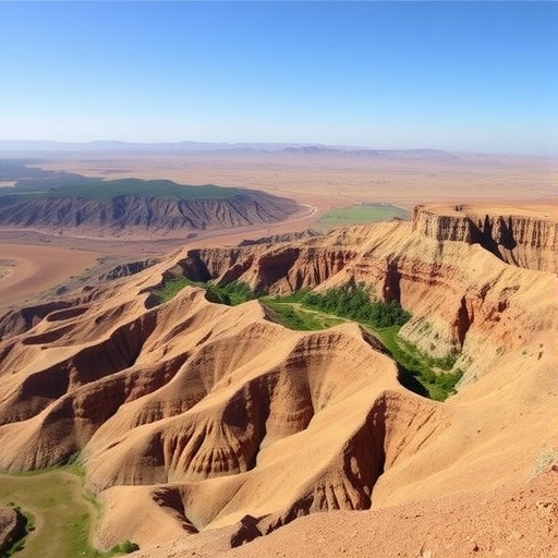
The identification of these erosion hotspots is not simply a cartographic exercise but a decisive step in environmental management. These hotspots, primarily located along steep slopes and riverbanks, are epicenters of sediment runoff that contribute to downstream siltation, reservoir capacity loss, and degraded aquatic habitats. The study highlights how these hotspots act as focal points for intervention, where soil conservation practices, such as reforestation, contour farming, and the construction of check dams, can maximize their impact by stabilizing soils and retaining organic material crucial for agriculture.
Beyond mapping soil loss, the study intricately connects land use dynamics with hydrological processes. Changes in vegetation cover alter not just the quantity of sediments but also influence infiltration rates, surface runoff, and groundwater recharge patterns. Employing integrated spatial analysis, the researchers articulate how disturbed landscapes exacerbate flood risks and disrupt natural water cycles, affecting water availability for rural communities whose livelihoods depend closely on these resources. Such insights are essential for developing adaptive management strategies that encompass both soil and water conservation in tandem.
The socio-economic implications of this research extend beyond environmental science. The northwestern Ethiopian region relies heavily on rain-fed agriculture, making soil fertility a linchpin for food security. Erosion-induced land degradation reduces crop yields, endangers livelihoods, and accelerates rural poverty cycles. By quantifying erosion under different land use conditions, this study offers a predictive framework that local governments and international development agencies can use to prioritize investments in sustainable land management, inform land tenure policies, and foster community-driven soil conservation initiatives.
Moreover, this research showcases the increasing integration of remote sensing technologies with traditional soil erosion models. The synergy facilitates near-real-time monitoring, allowing for dynamic adjustment of conservation strategies as landscapes evolve. Advanced sensors and geographic information system (GIS) tools employed in this study present a compelling blueprint for environmental monitoring programs worldwide, illustrating how cutting-edge science can be harnessed to address some of the most pressing sustainability challenges of our time.
In terms of methodological rigor, the multidisciplinary team’s approach merits particular attention. Combining expertise in hydrology, geomorphology, environmental modeling, and socioeconomics, they synthesized large datasets spanning climatic variables, satellite imagery, and field surveys. This holistic approach ensures the results are not only statistically robust but also grounded in the socio-environmental realities of the Ethiopian highlands. Such integrative research fosters cross-sector collaboration, essential for designing solutions that balance ecological integrity with human development goals.
An unexpected revelation of the study concerns the temporal variability of erosion patterns. Seasonal fluctuations in rainfall intensity coupled with episodic land use disturbances create highly dynamic soil loss regimes. The researchers emphasize that adaptive management must therefore be flexible and responsive to these natural and anthropogenic rhythms. This nuanced understanding challenges static conservation models and calls for policies that incorporate forecast-based approaches, enhancing resilience against climate variability and land degradation.
When viewed through the broader lens of global environmental concerns, the findings in this Ethiopian watershed resonate powerfully. Soil erosion is a worldwide phenomenon, threatening ecosystems from the Andes to Southeast Asia. The demonstrated applicability of RUSLE, calibrated for local contexts, provides a scalable platform for international erosion assessments. This work underscores the interconnected nature of land use, climate, and soil health, advocating for global cooperation to promote sustainable land stewardship and combat desertification.
The authors also emphasize the critical role of community engagement and education. Recognizing that scientific models alone cannot drive change, they advocate for participatory approaches that involve local farmers and stakeholders in interpreting the data and implementing best practices. This strategy not only enhances the legitimacy of conservation interventions but also taps into indigenous knowledge systems and traditional land management practices that have evolved to withstand erosion pressures over centuries.
Looking ahead, the research team proposes expanding their modeling efforts to incorporate future climate change scenarios, which are expected to exacerbate erosion through altered precipitation patterns and increased land use pressures. Integrating climatic projections with socio-economic models could enable scenario planning that guides long-term land use policies. Such foresight is crucial for building resilient agricultural landscapes capable of sustaining Ethiopia’s growing population under uncertain environmental futures.
This groundbreaking work by Gebremariam and colleagues paves the way for a new generation of integrated environmental assessments. By marrying detailed erosion modeling with land use dynamics, remote sensing technology, and socio-economic considerations, it offers a compelling framework not only for Ethiopia but for mountainous agricultural regions worldwide facing similar challenges. It exemplifies how cutting-edge science can yield practical, context-specific solutions that enhance both ecosystem health and human well-being.
In conclusion, the research provides a roadmap for tackling soil erosion as a pressing global and local issue. Its insights into land use change impacts, erosion hotspot identification, and management strategies are invaluable for environmental policymakers, scientists, and conservationists. As soil degradation continues to threaten agricultural sustainability and food security, studies such as this illuminate the path toward more resilient, productive, and environmentally harmonious landscapes.
The implications of this work are further amplified by the growing emphasis on sustainable development goals, particularly those addressing land degradation neutrality and climate action. The ability to precisely model and manage erosion not only conserves soils but also contributes to carbon sequestration and biodiversity conservation. In this way, localized research in Ethiopia contributes meaningfully to tackling global environmental challenges.
Ultimately, this study reminds us that the delicate balance of land, water, and human livelihoods hinges on informed management and innovative science. The powerful application of RUSLE within complex highland settings illustrates the potential for data-driven interventions to safeguard soils against the relentless forces of erosion. As climatic and anthropogenic pressures intensify, such research will undoubtedly play an increasingly critical role in shaping the future of sustainable land use worldwide.
Subject of Research: Modeling the impacts of land use change on soil erosion and identifying erosion hotspots using the Revised Universal Soil Loss Equation (RUSLE) in a northwestern Ethiopian highland watershed.
Article Title: Modeling land use change impacts and identifying erosion hotspots using RUSLE in a northwestern Ethiopian highland watershed.
Article References:
Gebremariam, L.S., Adem, A.A., Fares, A. et al. Modeling land use change impacts and identifying erosion hotspots using RUSLE in a northwestern Ethiopian highland watershed. Environ Earth Sci 84, 700 (2025). https://doi.org/10.1007/s12665-025-12656-9
Image Credits: AI Generated
DOI: https://doi.org/10.1007/s12665-025-12656-9
