In an innovative leap for urban planning and real estate assessment, researchers have harnessed the power of deep learning to analyze housing dynamics through diverse visual data sources. The study conducted by de Figueiredo Oliveira et al. delves into how combined satellite and street view imagery can be utilized to predict critical urban metrics such as housing price, housing density, and green area coverage. As cities worldwide grapple with rapid urbanization and environmental challenges, this research provides a comprehensive methodology that is not only cutting-edge but necessary for sustainable urban development.
The impetus behind this study stems from the increasing complexity of urban landscapes, where traditional data collection methods often fall short in capturing the full picture. By employing deep learning techniques, the researchers have created a system capable of accurately interpreting images from both satellites and street-level perspectives, allowing for a multi-dimensional analysis of urban areas. This approach addresses the limitations of conventional methods that primarily rely on statistical models and limited datasets, which can lead to oversimplifications and missed insights.
Central to the investigation is how deep learning algorithms facilitate the processing of vast amounts of visual data. These algorithms, which include convolutional neural networks (CNNs), are particularly adept at identifying patterns and features within images that may not be readily apparent to human observers. For instance, the researchers trained their models on extensive datasets comprising various urban environments, enabling them to distinguish between different types of housing stock, densities, and the prevalence of green spaces through image analysis.
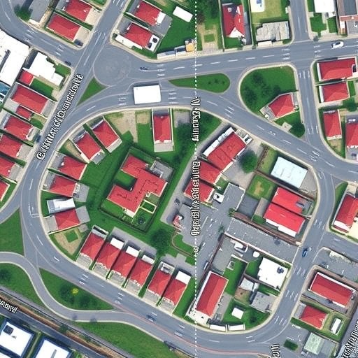
Furthermore, the integration of satellite imagery provides a broad overview of urban sprawl and land use, while street view images offer granular detail about neighborhood characteristics. This dual approach enriches the dataset and enhances the predictive power of the model. The research showcases how synthesizing data from multiple visual sources leads to a more nuanced understanding of urban metrics, ultimately aiding in making informed decisions about urban planning and resource allocation.
The authors meticulously collected and annotated a variety of images representing different regions and urban setups. The data preparation phase was critical to ensure that the models could learn effectively from the diversity of urban landscapes encountered. The resulting dataset not only informs predictions but also serves as a benchmark for future research in this burgeoning field.
As housing prices fluctuate and environmental concerns rise, local governments and real estate developers increasingly need reliable forecasting tools. The study’s predictive capabilities promise to be invaluable in contexts like assessing the viability of new housing projects, evaluating the potential impact of urban greenspaces, and understanding how both influence property values within communities. By tapping into visual data, stakeholders can gain insights that are more reflective of on-the-ground realities, thereby enhancing policy effectiveness and community outcomes.
Moreover, the researchers’ deployment of deep learning models encourages a data-driven approach to urban planning. Unlike traditional methods that may rely on historical data alone, the insights derived from real-time analysis of imagery provide a more dynamic understanding of urban evolution. This agility in assessing housing dynamics is particularly crucial in an era marked by rapid changes in demographics and economic conditions, which can dramatically influence housing markets.
The implications of this research extend beyond mere prediction capabilities. The integration of artificial intelligence in evaluating urban landscapes also opens doors for community engagement. By visualizing predictions and scenarios generated by deep learning models, urban planners can foster discussions with residents about future developments and environmental initiatives. This collaborative approach can ensure that community voices are heard and integrated into planning processes, leading to more livable urban environments.
In addition to improving housing predictions, the study also emphasizes the importance of green area coverage in sustainable urban development. The relationship between accessible green spaces and residential satisfaction is well documented, yet measuring this dynamically has been a challenge. This research provides a framework whereby the impact of green areas on property values can be quantified using visual data analysis, promoting a greater understanding of urban biodiversity and its contribution to quality of life within cities.
Critically, the research team anticipates that their model will evolve over time, incorporating new techniques and expanding datasets to maintain accuracy in predictions as urban conditions change. This iterative improvement process reflects the broader trends in artificial intelligence, wherein models not only learn but improve as they are exposed to more data. The long-term vision for this research is to develop a robust tool that municipal governments and real estate organizations can use to manage urban growth sustainably.
As cities continue to experience the pressures of population growth and environmental degradation, the methodologies established in this study represent a pioneering step towards smarter urban governance. By uniting advanced machine learning techniques with visual data analysis, researchers are laying the groundwork for transformative changes in how we conceptualize and interact with urban environments.
In essence, this study by de Figueiredo Oliveira et al. holds significant promise for the future of urban planning, offering innovative solutions to longstanding challenges. As such, it not only presents a scientific advancement; it serves as a clarion call for more integrated, data-driven urban strategies that uphold sustainability and enhance the quality of life in our cities. The future of urban landscapes may well depend on our ability to leverage these technological advancements for the greater good.
As the findings make their way into the broader discourse on urban development, it is essential to foster engagement across all sectors, from academia to industry to government. Collaborative efforts, bolstered by insights from deep learning, will be pivotal in crafting cities that are equitable, vibrant, and resilient in the face of future challenges.
With the publication of this research, the next chapter in the dialogue surrounding urban planning is set to unfold, paving the way for smarter cities that are designed not just for today’s needs but for the generations to come.
Subject of Research: Urban planning and housing predictions using deep learning techniques.
Article Title: Predicting housing price, housing density, and green area coverage from combined satellite and street view imagery using deep learning.
Article References:
de Figueiredo Oliveira, A.B., Castelli, M. & Suel, E. Predicting housing price, housing density, and green area coverage from combined satellite and street view imagery using deep learning.
Discov Cities 2, 66 (2025). https://doi.org/10.1007/s44327-025-00109-8
Image Credits: AI Generated
DOI: https://doi.org/10.1007/s44327-025-00109-8
Keywords: Deep learning, urban planning, housing price prediction, satellite imagery, street view analysis, green area coverage.
