In the summer of 2022, a rare and destructive coastal flooding event struck the Maldives, an archipelagic nation renowned for its idyllic low-lying atolls scattered across the Indian Ocean. This flooding affected 20 islands when a distant swell generated by a severe storm coincided almost perfectly with an exceptionally high tide level. The resultant inundation is considered the most severe since the catastrophic Boxing Day tsunami of 2004, capturing the urgent attention of coastal scientists and policymakers worldwide. A detailed analysis combining field observations with advanced numerical modelling has since shed light on the mechanisms of this flood event and paints a dire warning for the future of low-lying islands globally under climate change pressures.
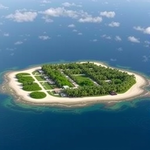
The research effort, led by the University of Plymouth in collaboration with Deltares, a Netherlands-based applied research institute, focused on the southwest tip of the Huvadhoo Atoll, specifically the island of Fiyoaree. Two field expeditions conducted in January and July 2022 recorded hydrodynamic and geomorphological conditions critical to understanding the flooding dynamics. These on-site observations provided valuable ground-truth data, enabling the calibration of sophisticated computer models designed to simulate coastal flooding and erosion processes with high spatial and temporal resolution.
Central to the study was the deployment of XBeach, a state-of-the-art numerical model developed by Deltares and international partners, including Plymouth researchers. This model incorporates nonlinear wave dynamics, sediment transport, and morphological evolution, allowing scientists to simulate how extreme wave events interact with island topography and bathymetry to cause flooding. By replicating the specific conditions of the July 2022 swell-tide event, model outputs successfully predicted wave heights and inundation extents that closely matched the field data, reinforcing confidence in its predictive capability.
Beyond reproducing a singular historic incident, the research extrapolated its findings by running simulations for all relevant storm events recorded between 1990 and mid-2023—158 in total—under both current and projected future sea levels. Intriguingly, while only the 2022 event resulted in modeled flooding at present, the influence of anticipated sea-level rise implies a dramatic shift: by 2050, nine additional storms historically non-inundating under today’s conditions could precipitate significant flooding. This alarming trend signals a drastic increase in flood frequency, from rare 25-year events to possibly once every two or three years within three decades.
The implications of these findings extend beyond academic curiosity, issuing a clear call to action for Maldives authorities and other similarly vulnerable low-lying island nations. The frequency and severity of flooding are poised to intensify under projected sea-level rise scenarios coupled with an increase in extreme weather events. Coastal infrastructure and communities face heightened disruption and risks, demanding urgent investment in adaptive strategies, flood mitigation, and robust coastal management practices that can operate effectively in an increasingly volatile environment.
Yet, the picture is more nuanced. Professor Gerd Masselink, leader of the ARISE project, emphasizes paradoxical natural processes that could offer islands some resilience. He notes that the overwashing waves deposit coral sand and rubble atop island surfaces, paradoxically raising land elevation in certain areas and enhancing their capacity to resist future flooding. This geomorphological feedback may provide a natural buffer against sea-level rise, hinting that complete island submersion may not be an inevitable outcome despite worsening flood risks.
This study contributes to an evolving paradigm in island climate resilience research. Earlier works suggested that many low-lying atoll islands, especially those without aggressive engineered coastal defenses such as concrete seawalls, possess innate geomorphic adaptability. Natural sediment redistribution processes can remodel island profiles in response to erosive forces, potentially preserving land area and habitability over the long term, albeit with complex spatial and temporal variability.
Methodologically, the fusion of empirical fieldwork and cutting-edge numerical modeling exemplifies contemporary scientific rigor in climate impact assessment. Calibration of models like XBeach through empirical measurements of wave dynamics, sediment characteristics, and flood extents enhances predictive reliability. These hybrid approaches enable scenario testing that incorporates both climatological and oceanographic inputs, providing decision-makers with actionable data to forecast risk and prioritize interventions.
Moreover, the ARISE project, funded by UK Research and Innovation via the Engineering and Physical Sciences Research Council with a budget of £2.8 million, represents a significant investment into refining our understanding of how atoll islands interact with rising sea-levels and changing wave climates. Its mission to revolutionize modeling capabilities is crucial for informing sustainable human occupation strategies across vulnerable insular environments subject to climate change.
Coastal flooding specialists like Dr. Robert McCall at Deltares underscore the practical utility of such research. By quantifying the thresholds at which flooding risks escalate for specific storm and sea-level scenarios, the research empowers governments with vital foresight. It informs design parameters for hard and nature-based flood protections, guides urban planning, and underpins the development of early warning and community resilience systems, all indispensable for safeguarding livelihoods.
This unfolding body of work transcends academic circles, resonating deeply with at-risk communities whose cultural heritage, economies, and very existence hinge on the capacity to adapt effectively to rapidly evolving environmental threats. The Maldives’ 2022 flooding event serves both as a harbinger and a case study, crystallizing the urgency for informed, integrative responses that marry scientific innovation with policy and local knowledge.
Ultimately, the findings articulate a sobering yet cautiously optimistic narrative. While low-lying island nations face escalating risks from climate-induced flooding, natural geomorphic processes may offer pathways for persistence, provided these are thoroughly understood and supported through adaptive management. With flooding potentially becoming an almost annual challenge by mid-century, the trajectory for the Maldives and similar island states depends critically on proactive engagement with the science and decisive action to implement resilient futures.
Subject of Research: Not applicable
Article Title: Numerical modelling of the 1 July 2022 flooding event, Southwest Huvadhoo Atoll, Maldives: Implications for the future
News Publication Date: 13-Nov-2025
Web References:
https://www.plymouth.ac.uk/research/coastal-processes/arise
http://dx.doi.org/10.1017/cft.2025.10013
References:
Masselink, G., McCall, R., et al. (2025). Numerical modelling of the 1 July 2022 flooding event, Southwest Huvadhoo Atoll, Maldives: Implications for the future. Coastal Futures. DOI: 10.1017/cft.2025.10013
Image Credits: Gerd Masselink
Keywords: Coastal flooding, sea-level rise, atoll islands, Maldives flooding 2022, numerical modelling, XBeach, ARISE project, climate change adaptation, coastal geomorphology, storm surge, island resilience, coastal hazard mitigation
