In a significant development within the field of environmental earth science, the widely discussed article on the “Application of Remote Sensing Image Processing Based on Artificial Intelligence in Landscape Pattern Analysis” by Q. Zhang has been formally retracted. Originally published in the 2025 volume of Environmental Earth Sciences, this research initially promised to revolutionize landscape ecology and spatial pattern recognition through avant-garde integration of artificial intelligence (AI) algorithms with high-resolution remote sensing imagery.
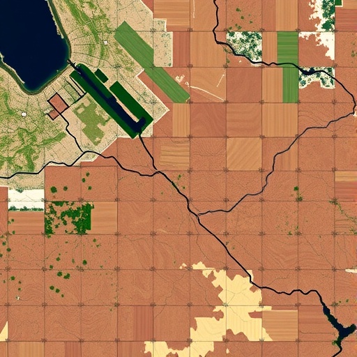
The study originally focused on leveraging AI-driven image processing techniques to decipher complex landscape patterns that influence ecological processes, biodiversity conservation, and land use planning. Remote sensing, the science of obtaining information about an object or area from a distance, commonly through satellites or aerial imagery, has long been a cornerstone technology in environmental monitoring. Combining this with AI—particularly deep learning frameworks—was hailed as an innovative approach to automatically extract meaningful data from raw spatial inputs, thereby enabling faster, more accurate landscape pattern quantification.
The promise of the article rested upon detailed methodological innovations, where convolutional neural networks (CNNs) and other machine learning models were employed to classify land cover types, detect subtle spatial heterogeneities, and identify anthropogenic impacts on natural environments. These automated processes aimed to outperform traditional manual interpretation methods that are time-consuming and often subjective. Early readers and environmental scientists had high expectations, anticipating that these advancements could underpin smarter urban planning, ecosystem management, and climate adaptation strategies on a broader scale.
However, the retraction note issued in the journal reveals that fundamental issues surfaced post-publication. While specific details remain somewhat confidential due to the sensitive nature of retractions, it is customary in academia that such actions are taken when data integrity concerns, methodological flaws, or replication failures are discovered. The withdrawal of Zhang’s article underscores the critical importance of transparency and reproducibility in computational environmental research, especially when AI models are involved.
Remote sensing image processing using AI must navigate numerous technical challenges. Data preprocessing is a pivotal step, involving the correction of atmospheric, geometric, and radiometric distortions inherent in raw satellite data. Any lapses in this phase can cascade down to severe inaccuracies in classification outcomes. Furthermore, AI models demand extensive, accurately labeled training datasets—a perennial challenge in environmental sciences where ground truth can be sparse or costly to obtain. The retracted study had claimed to overcome these hurdles through sophisticated data augmentation and transfer learning techniques, yet independent verification calls these claims into question.
Deep learning architectures like CNNs are lauded for their ability to discern hierarchical features from imagery data, yet their ‘black-box’ nature often complicates interpretability. The unpredictability in such models, coupled with overfitting risks, demands rigorous cross-validation and transparent reporting of performance metrics. These parameters are critical when the outputs inform real-world decisions about land conservation or hazard mitigation. The retraction may indicate that the reported model validation was insufficient or that performance metrics were misrepresented.
Moreover, remote sensing data is intrinsically multi-temporal and multi-spectral, incorporating a complex fusion of information layers. Effectively harnessing this data to analyze dynamic landscape patterns requires not only AI expertise but also deep domain knowledge in ecology and geography. Interdisciplinary collaboration is vital to ensure that computational models align with ecological realities. Any deficiencies in this integration likely contribute to the shortcomings that led to the paper’s dismissal.
The incident also raises broader questions about the rush to adopt AI in environmental studies without adequately addressing its limitations and ensuring robust scientific protocols. While AI undoubtedly offers transformative potential in decoding vast environmental datasets, the field must establish standardized benchmarks and transparent sharing of datasets and code to uphold scientific integrity. This event serves as a cautionary tale stressing vigilance between excitement about technological promise and the rigorous demands of empirical validation.
The withdrawal will inevitably impact ongoing research projects that cited Zhang’s work, potentially forcing reevaluation of methodologies that depended on its findings. For practitioners and policymakers relying on AI-enhanced remote sensing for landscape management, it underscores the necessity of critical appraisal and corroboration from independent sources. In the larger scientific ecosystem, retractions, though disheartening, perform the essential role of self-correction, preserving the trustworthiness of published knowledge.
Looking forward, the integration of AI in remote sensing remains a fertile area of exploration, with ongoing advances in sensor technology, computational power, and algorithmic sophistication. Innovations in explainable AI (XAI) are emerging to demystify model decisions, making results more accessible and actionable for environmental stakeholders. Satellite constellations delivering higher-resolution, hyperspectral imagery are enriching data availability, potentially overcoming some training data scarcity issues.
Collaborative platforms and open science initiatives are also empowering researchers worldwide to pool resources and validate AI applications in landscape pattern analysis more rigorously. These efforts aim to transform isolated case studies into reproducible frameworks that can adapt to diverse ecosystems and scales. Adoption of best practices from computational disciplines—such as version control, containerized computing environments, and pre-registration of analysis plans—can further strengthen research reliability.
In summary, the retraction of Zhang’s article is a pivotal moment, highlighting both the immense promise and the complex pitfalls involved in applying AI to environmental remote sensing. This episode importantly reminds the scientific community that technological innovation must be coupled with heightened scrutiny, reproducibility, and interdisciplinary collaboration to truly unlock new insights into our planet’s landscapes. As the pursuit continues, the quest to harness artificial intelligence for earth science applications will undoubtedly evolve with deeper maturity and ethical consciousness.
Despite this setback, enthusiasm for merging AI with remote sensing remains undiminished among researchers, governmental agencies, and tech innovators alike. As data volumes continue to grow exponentially, automated intelligence offers the only scalable means to decode patterns that can inform ecosystem resilience and sustainable development. The challenge now lies in ensuring that this pursuit is underpinned by ironclad scientific rigor, transparent validation, and candid reporting—a mandate central to rebuilding confidence and charting credible progress in this burgeoning domain.
The saga of this article’s rise and fall should not be viewed merely as a cautionary tale, but as a constructive inflection point. It invites the global scientific enterprise to refine standards, improve methodologies, and collaboratively build an integrated knowledge base capable of tackling the mounting environmental challenges facing humanity. The fusion of remote sensing and AI is a formidable frontier—one that demands our highest standards and collective diligence to navigate successfully into the future.
Subject of Research: Application of artificial intelligence in remote sensing image processing for landscape pattern analysis
Article Title: Retraction Note: Application of remote sensing image processing based on artificial intelligence in landscape pattern analysis
Article References:
Zhang, Q. Retraction Note: Application of remote sensing image processing based on artificial intelligence in landscape pattern analysis.
Environ Earth Sci 84, 659 (2025). https://doi.org/10.1007/s12665-025-12698-z
Image Credits: AI Generated
