In a groundbreaking advancement that promises to reshape the landscape of earth observation and environmental monitoring, researchers have developed an innovative methodology to generate seamless land surface temperature (LST) data at an unprecedented fine resolution of 100 meters. This cutting-edge approach ingeniously leverages the synergy between MODIS (Moderate Resolution Imaging Spectroradiometer) and Landsat satellite data, overcoming longstanding challenges posed by cloud cover and partial cloudiness—issues that traditionally limit the reliability and resolution of thermal remote sensing data.
Land surface temperature is a critical parameter influencing a myriad of environmental and climatic processes, from urban heat island effects to agricultural productivity and ecosystem dynamics. Accurate and high-resolution LST data are indispensable for scientists, policymakers, and environmental managers who strive to understand and mitigate the impacts of climate change and human activities on the Earth’s surface. Despite its importance, achieving fine-scale, continuous LST products has been bedeviled by the trade-off between spatial resolution and temporal frequency inherent in remote sensing instruments.
The new research pivots on creating a seamless fusion of data from MODIS, known for its high temporal resolution but coarse spatial resolution, and Landsat, which offers higher spatial fidelity albeit with a less frequent revisit time and limited thermal imaging capabilities under cloudy conditions. By deploying a sophisticated stacked ensemble regression model, assisted by Landsat’s detailed imagery, the team has overcome barriers that once restricted thermal data quality, enabling reconstruction of LST with exceptional spatial detail even on days marred by partial cloud cover.
The heart of this innovative methodology is its capacity to intelligently integrate data from multiple satellite sources with differing temporal and spatial scales. Stacked ensemble regression—a machine learning technique that combines multiple predictive models to leverage their unique strengths—forms the analytical backbone that bridges the gap between nominally incompatible datasets. This method enhances predictive accuracy and robustness, ensuring that the generated LST maps maintain consistency across clear sky and partially obscured conditions.
Developing reliable LST products using traditional methods is often constrained by the pervasive presence of clouds, which obscure satellite sensors’ view and introduce gaps into time series datasets. These gaps compromise the continuity of temperature monitoring and reduce the spatial detail necessary for local-scale analyses. The novel use of partial cloud data, rather than discarding it, marks a significant departure from conventional techniques that rely exclusively on clear sky observations.
The approach begins by isolating usable thermal information from MODIS, despite the presence of clouds in certain pixels, and then enriches the data with high-resolution surface characteristics derived from Landsat imagery. The fusion is carefully calibrated to preserve thermal fidelity while excising or compensating for cloud-induced distortions. As a result, the output is a high-resolution, seamless LST product that can be applied daily at a scale relevant for agricultural management, urban planning, and ecological studies.
This research does not merely enhance the technical toolbox for earth observation; it also democratizes access to vital environmental data by generating products of improved quality and resolution at a reduced cost and computational burden. The reliance on machine learning obviates the need for extensive physical modeling, allowing for scalable solutions adaptable to different geographic regions and sensor configurations.
Moreover, the seamless 100-meter LST products enable unprecedented insights into microscale thermal dynamics, such as heat variations within urban neighborhoods or temperature heterogeneity across heterogeneous landscapes like forest edges and riparian zones. This paves the way for more effective interventions in areas such as urban heat mitigation, precision agriculture, and habitat conservation, where temperature-driven processes are nuanced and spatially complex.
Importantly, this methodological breakthrough contributes to the global effort of climate resilience by providing timely, continually updated surface temperature maps that inform early warning systems and climate adaptation strategies. The integration of clear and partially cloudy data significantly increases observation density, enabling near real-time monitoring essential for disaster response and resource management.
The validation of this approach, as detailed in the research, demonstrates superior performance relative to existing models, with improvements manifesting in both spatial resolution and temporal continuity. This enhancement is especially critical in regions prone to frequent cloud cover, such as tropical and mountainous zones, where standard LST products often suffer from extensive data gaps.
By integrating machine learning into the remote sensing domain, this study exemplifies the powerful convergence of AI and environmental science. It underscores how data-driven algorithms can tackle complex geospatial challenges that traditional analytical methods struggle to solve, setting a paradigm for future multi-sensor data fusion research.
The implications of this research extend beyond land surface temperature mapping. The successful application of stacked ensemble regression in fusing satellite data portends similar advancements in other remote sensing fields such as vegetation health monitoring, soil moisture estimation, and urban land use classification—domains where integrating datasets with varying resolutions and acquisition conditions is vital.
Potential further developments include expanding the dataset inputs to incorporate newer satellite platforms, such as Sentinel thermal bands, or integrating meteorological variables to refine model accuracy. Coupled with advances in cloud computing and big data analytics, such continuous improvement could revolutionize environmental monitoring workflows.
This innovative fusion framework heralds a new era where high-fidelity, seamless environmental datasets become the norm rather than the exception. By bridging the gap between spatial granularity and temporal resolution, it empowers stakeholders with actionable information, fostering informed decision-making to address sustainability challenges at local, regional, and global scales.
In conclusion, the seamless generation of 100-meter resolution land surface temperature from otherwise incomplete satellite data represents a milestone achievement. The transformative approach employing Landsat-assisted stacked ensemble regression paves the way for more comprehensive and accessible thermal earth observation products. As climate change accelerates and environmental stressors intensify, such cutting-edge remote sensing methodologies will be indispensable tools for science, policy, and society alike.
Subject of Research: Generation of high-resolution, seamless land surface temperature data using satellite remote sensing and machine learning techniques.
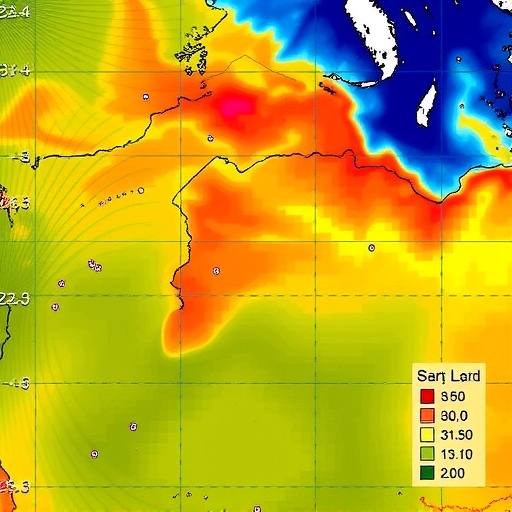
Article Title: Generation of 100 m seamless land surface temperature from clear sky or partially cloudy MODIS data using Landsat-assisted stacked ensemble regression.
Article References:
Jahangir, Z., Shao, Z., Yu, Y. et al. Generation of 100 m seamless land surface temperature from clear sky or partially cloudy MODIS data using Landsat-assisted stacked ensemble regression. Environmental Earth Sciences 84, 653 (2025). https://doi.org/10.1007/s12665-025-12624-3
Image Credits: AI Generated
