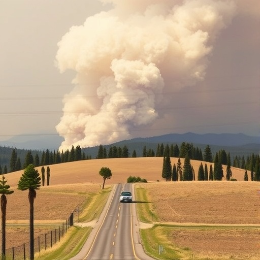
When wildfires erupted in Los Angeles in early January 2025, it set off an urgent public health crisis as residents sought reliable information about air quality amidst the chaos. The Palisades Fire and others rattled nerves and raised significant concerns about the potential health risks associated with smoke exposure. As the fires raged on, people turned to friends and local scientists for guidance, desperately wanting to know how to protect themselves and their families from hazardous air pollution.
Miriam Marlier, a scientist at UCLA and member of the Western Fire and Forest Resilience Collaborative (WFFRC), was approached by her neighbors with pressing questions. Many residents were unsure of where to find accurate air quality data and whether existing information could be trusted to help inform protective measures. The WFFRC, under the guidance of forest ecologist Winslow Hansen from the Cary Institute of Ecosystem Studies, focuses on actionable research that addresses the needs of decision-makers amid the Western United States’ ongoing fire crisis.
Recognizing the urgency of the situation, Marlier and her colleagues, including Claire Schollaert, a postdoctoral associate at WFFRC, mobilized quickly to study the effects of smoke on air quality. Their aim was to assess the reliability and comprehensiveness of publicly available data during the wildfire events and to understand how air quality fluctuated in real-time. This crucial research was later published in the journal Environmental Science and Technology Letters, offering insights that could significantly enhance public health responses during similar events in the future.
Hansen noted that this study marked a significant achievement by being the first of its kind to quantify air quality’s degradation from the Los Angeles fires at finely detailed spatial and temporal resolutions. The team’s analysis leveraged an impressive dataset, examining nearly 750 air pollution sensors, both regulatory and low-cost, throughout the city.
As widespread agreement exists about the dangers of smoke exposure, government agencies typically advise residents to consult the Environmental Protection Agency’s (EPA) air quality index during wildfire events. However, there are multiple resources available, including the AirNow Fire and Smoke Map. The reliance on these diverse datasets can often lead to confusion, as they are derived from different monitoring methods and time frames, leaving the public grappling with varying air quality advisories.
Schollaert underscored the significance of effectively communicating air quality information during critical fire events, emphasizing that smoke exposure remains the primary concern for the public’s health. Thus, providing residents with understandable and accurate data is vital in mitigating risks related to health and safety.
The researchers compared air quality data from the EPA regulatory monitors, low-cost PurpleAir sensors, and satellite observations. Their analysis sought to create a more integrated understanding of the smoke plume behaviors and air quality impacts in the area, shedding light on how multiple datasets can complement each other in providing a fuller picture of air quality.
The results confirmed that air quality in Los Angeles significantly deteriorated during the fires, particularly noted on January 8 and 9. Crucially, the study highlighted that air quality was not static but instead fluctuated dramatically from hour to hour and day to day. Factors such as the Santa Ana winds, known for their role in spreading wildfires, also helped thin the concentration of smoke from the Palisades Fire quickly into offshore waters. However, the same winds unfortunately carried smoke from other fires deep into the most populated regions of Los Angeles County.
A key takeaway from the study was the realization of how regulatory monitors often underrepresent local variations in air quality due to their limited spatial distribution. Incorporating low-cost air quality sensors and satellite data into public health communication tools could bridge dangerous knowledge gaps. Ultimately, ongoing collaborations and technology that integrates diverse datasets will empower health officials to better serve communities seeking information during wildfire smoke events.
Satellite data may capture broader smoke dynamics, helping to illustrate patterns of movement in the atmosphere, but their accessibility to the public remains limited. The study found that while there was a consensus across different data sources regarding the detrimental effects of smoke, discrepancies in regional distributions and averaging times could lead to confusion regarding air quality readings.
Given these findings, the authors advocate for a substantial increase in ground-based air quality sensors, which would significantly bolster pollution monitoring efforts. Moreover, they stress the importance of harmonizing satellite data into user-friendly platforms, thereby increasing transparency and reliability in how air quality is communicated to the public.
The researchers understand the need for simplicity in air quality reporting. Many individuals hope for straightforward metrics—such as a single number indicating whether it’s safe to engage in outdoor activities. Schollaert emphasized the responsibility of the scientific community to streamline information, ensuring that it is both truthful and comprehensive.
Hansen reflected on the overwhelming amount of data available in today’s environment, highlighting the necessity of synthesizing various datasets to provide consistent and actionable insights for the public, policymakers, and emergency managers. With the right frameworks in place, science can serve as a powerful tool for improved public understanding and actionable health outcomes in times of crisis.
The proactive approach demonstrated by WFFRC serves as a model for effectively addressing the urgent needs arising from environmental challenges like wildfires. By emphasizing service to communities while producing crucial scientific insights, this collaborative research initiative marks a pivotal step towards enhancing air quality monitoring systems, thereby helping mitigate health risks associated with such catastrophic events.
As the ongoing climate crisis continues to influence the frequency and intensity of wildfires throughout the western United States, ensuring communities have the correct tools, data, and support to respond robustly to these challenges remains a primary objective for scientists, policymakers, and public health officials alike. To responsibly navigate this new terrain is to embrace greater collaboration across various disciplines and empower those vulnerable communities with reliable information. Only then can we hope to safeguard public health amid uncontrollable natural disasters.
Subject of Research: Air quality assessment during California wildfires
Article Title: Smoke from the Palisades Fire and its Impact on Los Angeles Air Quality
News Publication Date: July 14, 2025
Web References: Environmental Science & Technology Letters
References: DOI: 10.1021/acs.estlett.5c00486
Image Credits: Jeff Suer
Keywords
Air quality, Wildfires, Public health, Risk communication, Particulate matter, Sensors
