In recent years, the intersection of technology and urban studies has garnered significant attention, particularly when it comes to crime prediction and prevention. A groundbreaking study authored by Ioannidis, Nascetti, and Ceccato explores the potential of remote sensing technology paired with machine learning techniques to identify what are being referred to as “crime hot spots” in urban settings. By employing a random forest modelling approach, the researchers aim to furnish urban planners and law enforcement agencies with tools that can preemptively address crime, thereby enhancing safety and quality of life in cities.
The study harnesses remotely sensed land cover data, which includes information derived from satellite imagery and aerial surveys. This data provides critical insights into urban landscapes, enabling researchers to understand various elements like vegetation, water bodies, and built environments. By integrating such data with socio-economic information, the authors effectively model the relationships between land use and crime occurrence. The innovative approach not only augments traditional criminological theories but also offers a data-driven perspective on urban crime dynamics.
At the heart of the study lies the Random Forest algorithm, a powerful machine learning technique that is particularly well-suited for managing large datasets with complex relationships. This method operates by constructing multiple decision trees based on subsets of the input data and then aggregating the results to improve predictive accuracy. The authors selected this approach primarily due to its robustness in handling non-linear data and its ability to minimize overfitting, which is a significant risk in predictive modelling scenarios.
The research design involved a comprehensive collection of crime event data, which included different types of offenses and their geographical locations. When this data is analyzed alongside land cover types, researchers can pinpoint specific areas where certain crimes are more likely to occur. For instance, areas with high commercial activity might experience more property crimes, while regions with significant socio-economic disadvantage could be more prone to violent crimes. In this context, the research serves as a crucial tool for community policing strategies that require informed decision-making.
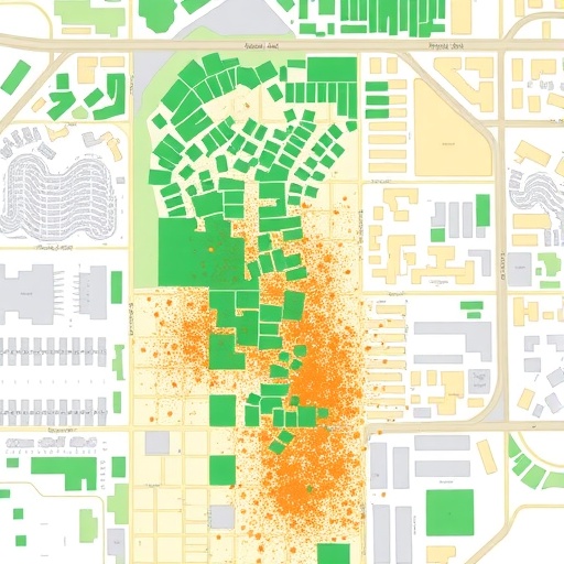
One of the most compelling aspects of the study is its application of spatial analysis techniques, which enrich the interpretations of the data. By visualizing the results through heat maps and spatial clusters, the authors provide law enforcement with intuitive resources to focus their patrols and interventions. Visualization aids not only in comprehensibility but also in effectively communicating findings to stakeholders in urban governance and public safety.
Moreover, the study recognizes the implications of socio-environmental factors in crime dynamics. It acknowledges that beyond mere numbers of incidents, underlying societal issues shape criminal behavior. Variables such as unemployment rates, education levels, and community cohesion can influence crime rates, emphasizing the need for an interdisciplinary approach in crime prevention strategies. The blending of criminology with environmental science and data analytics thus stands as a unique model for urban crime research.
The researchers also conducted validation tests to assess the accuracy of their predictive models. By partitioning their dataset into training and testing segments, they ensured that their algorithm maintained consistent performance when applied to unseen data. This rigour is essential for establishing credibility in the predictive capabilities of the Random Forest approach, instilling confidence among policymakers and law enforcement institutions in its applicability.
As cities worldwide grapple with increasing urbanization and associated crime challenges, this study introduces a paradigm shift in the way crime data can be leveraged for proactive interventions. The combination of modern technology in the form of remote sensing and machine learning holds the potential to revolutionize traditional policing methods. A shift from reactive to proactive strategies not only promises to reduce crime but also fosters community trust in law enforcement.
Furthermore, the implications of this research extend to urban planning and policy formulation. Urban planners can utilize insights garnered from the Random Forest models to design neighborhoods that mitigate potential crime, by considering the placement of public spaces, residential areas, and commercial establishments. This aligns with a broader vision of designing safer cities equipped to meet the demands of rapidly changing urban demographics.
While the benefits of the study are clear, it is essential to approach the findings with a degree of caution. The ethical implications of using predictive policing methods must be considered, as algorithms can inadvertently perpetuate biases present in historical crime data. Transparency in the datasets used and the algorithms applied can help mitigate these concerns, ensuring that the tools developed are equitable and just.
Public engagement also plays a critical role in the successful implementation of these findings. Communities must be informed and involved in discussions surrounding crime prevention strategies. An inclusive approach not only empowers residents but can also lead to the development of local solutions tailored to the unique challenges faced by specific neighborhoods.
The potential for applying similar methodologies extends beyond urban crime to various areas of public safety, including disaster response, health risk management, and resource allocation. Studying patterns and predicting future occurrences through comprehensive data analysis can empower cities to effectively allocate resources and enhance overall governance.
In conclusion, Ioannidis, Nascetti, and Ceccato’s study stands as a testament to the power of interdisciplinary research in addressing contemporary urban challenges. By employing random forest modelling of remotely sensed land cover data, the researchers provide an innovative solution for identifying crime hot spots. This pioneering work not only enhances understanding of urban crime dynamics but also serves as a catalyst for proactive measures in safety and urban planning.
Subject of Research: Crime Hot Spots in Urban Areas
Article Title: Random forest modelling of remotely sensed land cover data to identify crime hot spots in urban areas
Article References:
Ioannidis, I., Nascetti, A., Ceccato, V. et al. Random forest modelling of remotely sensed land cover data to identify crime hot spots in urban areas.
Discov Cities 2, 122 (2025). https://doi.org/10.1007/s44327-025-00171-2
Image Credits: AI Generated
DOI: https://doi.org/10.1007/s44327-025-00171-2
Keywords: Crime prevention, Urban studies, Machine learning, Remote sensing, Random forest algorithm
