In the dynamically evolving landscape of the Himalayan region, river terraces stand as silent witnesses to geological processes that have shaped the physiography for millennia. The recent study focusing on the intricate morphology and stability of upstream river terraces along the Teesta River, which flows through the ecologically sensitive and geologically complex zones of Sikkim and the Darjeeling district in West Bengal, India, offers vital insights into regional fluvial geomorphology and hazard assessment. These terraces serve as key indicators of past river behavior, sediment dynamics, and tectonic activity, playing a crucial role in understanding not only the natural history of the region but also the threats posed by environmental and anthropogenic changes.
The Teesta River, a significant tributary of the Brahmaputra, originates in the eastern Himalayas and traverses through steep terrains characterized by rapid topographical transitions. Its upstream reaches are marked by distinctive terrace formations that have been shaped by a combination of tectonic uplift, climatic fluctuations, and sediment transport processes. The detailed morphological analysis conducted in this latest research deciphers terrace configurations, spatial distribution, and sediment characteristics, elucidating their evolution and current stability status.
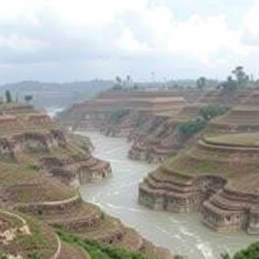
Understanding terrace morphology is central to grasping landscape evolution in mountainous river basins. In the Teesta catchment, terraces vary in height, width, and sediment composition, reflecting episodes of river incision and aggradation. These terraces are crucial not only in reconstructing paleohydrological regimes but also in predicting the behavior of the river under present and future stressors. The study uses remote sensing technologies coupled with field investigations, providing a comprehensive morphological map that details terrace stratigraphy and geomorphic expressions.
Beyond mere morphological description, the stability assessment of these terraces provides critical knowledge directly linked to landslide susceptibility and flood risk. The region’s steep gradients and young geology make it particularly prone to slope failures, which are exacerbated by excessive rainfall, deforestation, and seismic events. The terrace stability indices developed in this study integrate geomorphological parameters, such as slope angle, terrace height, soil type, and vegetation cover, enabling the identification of vulnerable zones that might trigger land degradation or infrastructural damage.
One of the remarkable aspects of the research lies in its attention to upstream geomorphic factors that influence terrace formation and stability. Alpine and sub-alpine climatic conditions, monsoon intensity, and river discharge patterns all interact to sculpt the terrace landscape. The interplay between tectonics—especially ongoing uplift—and erosion rates governs terrace preservation and modification. By analyzing these interactions, the researchers paint a dynamic picture of landscape change over decadal to millennial timescales, relevant for regional hazard mitigation efforts.
Importantly, the study situates the terrace analysis within the context of human habitation and land-use practices in Sikkim and Darjeeling. These areas, though ecologically rich, face pressures from agricultural expansion, infrastructure projects, and tourism development. Terrace stability is thus not only a geomorphological concern but a socio-economic one, influencing community livelihoods and regional planning. The findings advocate for integrated land management strategies that respect the natural terrace configurations while accommodating sustainable development.
Advanced geospatial techniques underpin the study’s methodology, including high-resolution satellite imagery analysis, digital elevation model (DEM) interpretations, and geographic information systems (GIS). These tools have allowed the researchers to delineate terrace boundaries with precision and quantify morphometric attributes. Fieldwork complemented these remote assessments by verifying sediment deposits, terrace soil profiles, and vegetative cover, enabling a robust cross-validation of the morphological data.
The research also embraces temporal aspects of terrace dynamics by correlating sediment layers with known climatic events and tectonic episodes. Such correlation allows for a deeper understanding of terrace genesis and modification episodes, linking landscape evolution to broader earth system processes. This temporal insight is invaluable, particularly in the Himalayan context where monsoonal variability and seismic activity are recurrent and impactful.
Sedimentological analysis within terrace deposits reveals variations in grain size distribution, composition, and sorting that hint at changing fluvial energies over time. In upstream sections, more coarse-grained sediments suggest high-energy river flows, often tied to monsoon floods or glacier meltwater bursts. Downstream variations infer sediment sorting influenced by river braiding and channel migration. These sedimentary characteristics also affect terrace porosity and permeability, variables critical for slope stability evaluations.
In addition to natural processes, the study highlights anthropogenic influences modifying terrace stability. Activities such as unplanned road excavation, terracing for agriculture without adequate slope stabilization, and deforestation contribute to increased erosional threats. These human-induced factors amplify natural instability, necessitating urgent geotechnical interventions and policy measures to safeguard these geomorphological features and adjacent habitats.
The implications of this research extend beyond pure science, touching on disaster risk resilience in a region vulnerable to extreme weather events, earthquakes, and landslides. By pinpointing unstable terrace zones, authorities can better allocate resources for early warning systems, emergency preparedness, and infrastructural reinforcements. It also opens pathways toward educating local communities about sustainable practices that harmonize with the geomorphological realities of their environment.
Moreover, the findings enrich the global understanding of mountain river systems, offering comparative analogs for similar Himalayan catchments and other tectonically active mountainous rivers worldwide. The methodological framework combining morphological analysis with stability indices could set a precedent for future geomorphological and hazard assessments in comparable settings.
This comprehensive study showcases how modern geoscientific approaches can unravel intricate natural processes while addressing pressing socio-environmental challenges. As mountain regions face escalating impacts from climate change and human pressure, such multidisciplinary analyses become indispensable for crafting adaptive strategies that protect both nature and people.
In summary, the detailed examination of the upstream terraces along the Teesta River not only enhances scientific knowledge on Himalayan geomorphology but also presents a practical blueprint for risk assessment and sustainable land management. This synergy of science and societal needs exemplifies the vital role of earth science research in fostering resilient mountain communities amid a changing planet.
Subject of Research: Morphological characteristics and stability of upstream river terraces in the Teesta River basin, with implications for geomorphological evolution and hazard risk in the Himalayan region.
Article Title: Morphological analysis and stability assessment of upstream terraces: a case study from Teesta river, covering parts of Sikkim and Darjeeling district of West Bengal, India.
Article References:
Roy, R., Mukhopadhyay, B.P. & Chaudhuri, S. Morphological analysis and stability assessment of upstream terraces: a case study from Teesta river, covering parts of Sikkim and Darjeeling district of West Bengal, India. Environ Earth Sci 84, 450 (2025). https://doi.org/10.1007/s12665-025-12464-1
Image Credits: AI Generated
