In the realm of natural hazards, landslides remain one of the most destructive and unpredictable phenomena. Recently, a groundbreaking study focusing on the Kulon Progo Mountains in Indonesia has shed new light on landslide susceptibility zonation by employing advanced statistical methods. This research not only refines our understanding of terrain vulnerability in this seismically and climatically dynamic region but also sets a precedent for hazard assessment worldwide.
Indonesia’s topography, characterized by rugged mountains and complex geological formations, makes it highly susceptible to landslides, especially in the rainy season. The Kulon Progo Mountains, a significant part of the island’s landscape, have long been a concern for geologists and environmental scientists due to frequent slope failures triggered by heavy rainfall and anthropogenic activities. Accurate mapping of landslide-prone areas within this range is critical to minimize human and economic losses.
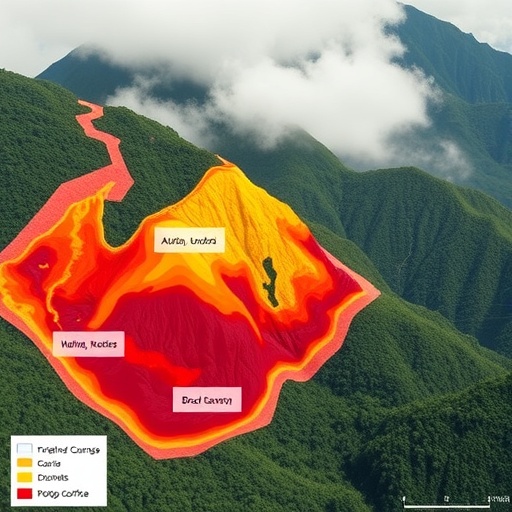
The study embraced a statistical approach to landslide susceptibility zonation, integrating multiple geospatial datasets and environmental variables. Unlike traditional qualitative methods, the quantitative nature of statistical models allows for objective evaluation of the relative importance of various factors contributing to slope instability. The researchers meticulously gathered data on slope angle, soil type, land use, rainfall, seismic activity, and more, laying the groundwork for a comprehensive landslide susceptibility map.
One of the notable technical advancements in this work was the use of logistic regression analysis combined with Geographic Information Systems (GIS). This integration enabled the researchers to spatially analyze and visualize the probability of landslide occurrences across the diverse terrain of Kulon Progo. By correlating historical landslide event data with environmental attributes, the model produced a probability map highlighting high-risk zones that demand urgent attention.
The scientific community has often debated the effectiveness of statistical modeling against physically based simulations in landslide prediction. This study contributes significantly to that discourse by demonstrating the robustness of statistical methods when applied with high-resolution geospatial data and proper validation techniques. The model was rigorously validated using an independent landslide inventory, showing impressive accuracy and reliability in susceptibility assessments.
Crucially, the susceptibility map derived from the study does more than pinpoint vulnerable areas; it offers insights into the interplay of natural and human factors that destabilize slopes. For instance, deforestation and unregulated land-use changes were found to exacerbate landslide risks in certain pockets of Kulon Progo. This intersection between environmental degradation and geological vulnerabilities underscores the necessity for integrated land management strategies.
The researchers also explored temporal aspects of landslide susceptibility by incorporating rainfall intensity and frequency patterns over time. This dynamic approach distinguishes areas that are persistently at risk from those that are intermittently hazardous, providing an invaluable tool for disaster preparedness and mitigation agencies. Such temporal sensitivity enhances the practical utility of susceptibility zonation in early warning systems.
Another compelling dimension of the research is the socio-economic implications. The susceptibility zonation map can inform local government policies on infrastructure development, guiding the placement of critical facilities away from high-risk zones. Moreover, it has the potential to influence community-level disaster risk reduction initiatives by raising awareness and encouraging preparedness in vulnerable populations.
The methodology employed in the Kulon Progo case exhibits adaptability and scalability. With minor calibrations, similar statistical modeling frameworks can be applied to diverse geological settings, extending the impact of this study far beyond Indonesia. This universality reinforces the value of harnessing data science and spatial analysis in tackling global challenges posed by landslides.
From a technological viewpoint, the use of remote sensing data combined with GIS is pivotal. Satellite imagery provides up-to-date and detailed land surface information critical for continuous monitoring. When integrated into the statistical model, such data significantly elevate the precision and operational feasibility of landslide susceptibility assessments.
This research also paves the way for the integration of machine learning algorithms into susceptibility analysis. While logistic regression offers clarity and ease of interpretation, advancing to more complex models such as random forests or support vector machines could enhance prediction performance. The foundation established by the current study creates fertile ground for future improvements in landslide hazard modeling.
Furthermore, the spatial distribution patterns revealed by the study correlate strongly with geological transitions and tectonic activities in the region. Recognizing these links affirms the essential role of multidisciplinary approaches that combine geology, hydrology, climatology, and social sciences in addressing landslide risks holistically.
Importantly, the study’s results highlight the necessity for continuous data updating and model refinement to accommodate environmental changes, whether due to climate variability or human interventions. Sustained monitoring and adaptive management strategies are vital to maintaining the efficacy of landslide susceptibility zonation as a living tool for risk reduction.
In conclusion, the statistical landslide susceptibility zonation conducted in Kulon Progo Mountains represents a significant milestone in hazard mapping. By blending meticulous data collection, rigorous statistical analysis, and spatial technology, this study delivers actionable insights with wide-reaching implications for disaster risk management. As climate change and human pressures escalate geological hazards, such innovative, data-driven approaches are paramount to safeguarding lives and livelihoods across vulnerable landscapes.
Subject of Research: Landslide susceptibility zonation using statistical methods in the Kulon Progo Mountains, Indonesia.
Article Title: Statistical landslide susceptibility zonation: Kulon Progo Mountains, Indonesia.
Article References:
Erzagian, E., Fathani, T.F. & Wilopo, W. Statistical landslide susceptibility zonation: Kulon Progo Mountains, Indonesia. Environ Earth Sci 84, 601 (2025). https://doi.org/10.1007/s12665-025-12519-3
Image Credits: AI Generated
