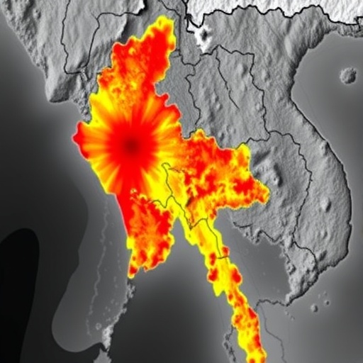
In a groundbreaking study led by researchers Z. Xie, S. Wang, and Y. Yuan, a comprehensive simulation of seismic waves generated by a potentially devastating Mw 7.7 earthquake forecasted for Myanmar in 2025 has been conducted. This research, which takes a detailed look at the seismic intensity field near the fault line, marks a significant advance in our understanding of how seismic waves behave in complex geological settings. The study utilizes a wealth of data sourced from the mid- to far-field seismic networks operated by the China Earthquake Networks Center (CENC), shedding light on the patterns and intensity of expected seismic activity.
Seismic waves, the energy released during an earthquake, travel through the Earth’s crust and can cause destruction depending on their intensity and distance from the epicenter. For urban planners, disaster preparedness teams, and even policymakers, understanding these waves’ behavior is crucial for mitigating damage during seismic events. The simulations carried out in this research provide detailed maps of expected seismic intensities across the region, which could massively impact how emergency response services prepare for the impending natural disaster.
The 2025 Myanmar earthquake is anticipated to be particularly severe due to the geopolitical and geological complexities of the region. Its potential impact is magnified by Myanmar’s dense population and infrastructure, which includes urban areas that are not well-prepared for such a significant seismic event. Herein lies the importance of this research; it not only forecasts the earthquake’s potential effects but also provides a scientific basis for developing better risk mitigation strategies.
Utilizing advanced computational techniques, the team was able to model the interaction of seismic waves with various subsurface structures. The results indicate that certain topographical features can amplify seismic waves, leading to localized areas of extreme intensity, while other geological formations may shield some regions from the worst of the effects. The nuanced understanding of these local geological variations allows for tailored preparedness programs that can focus on the most vulnerable areas.
In addition to the findings on local geological effects, the simulations reveal important insights about the earthquake’s potential to generate secondary hazards like landslides and tsunamis. By establishing clear relationships between seismic intensity and ground shaking, the study lays the groundwork for future research on how to quantify these secondary risks effectively. This aspect is crucial, as secondary hazards often catch regions off-guard, leading to further destruction beyond what the earthquake itself causes.
The implications of the study extend far beyond immediate predictions. As climate change continues to influence geological activity worldwide, understanding the mechanics of seismic waves is more vital than ever. Increased pressure on fault lines and geological formations due to both natural processes and human activities means that the predictive power of this research could be essential for future urban development and land management strategies.
One of the significant breakthroughs presented in this study is the integration of data from different seismic network sources. This collaborative approach allows for a more comprehensive dataset, enabling the researchers to create enhanced models that capture regional seismic activity more accurately. By harnessing real-time data, emergency services can respond more efficiently and effectively in the event of an earthquake, potentially saving lives and reducing damage.
The research methodologies employed by Xie and colleagues are state-of-the-art, involving complex algorithms developed to simulate wave patterns accurately. The use of high-performance computing enables the simulation of intricate fault systems and their interactions with ground structures. This part of the research showcases the synergy between traditional seismology and cutting-edge technology, emphasizing how advancements in computational power are transforming our ability to predict natural disasters.
Moreover, the researchers emphasize the need for ongoing funding and support for seismic monitoring systems. Investment in such infrastructure not only aids in the immediate understanding of potential seismic events but has long-term benefits for public safety. Continuous monitoring can lead to real-time data updates, which are invaluable for timely public warnings and response measures during an earthquake.
Insights gained from the study also foster international collaboration in seismology. By sharing methodologies and findings, countries can better prepare for seismic activity, not only in Myanmar but across all seismically active regions globally. The interconnectedness of global seismic networks is vital for enhancing our collective response to natural disasters, creating a robust framework for information exchange.
In conclusion, this research provides an essential service to the population of Myanmar and beyond, offering forecasts and models that can influence design and safety protocols in urban settings. With a clearer understanding of seismic wave dynamics, communities can work towards resilience in the face of inevitable natural disasters, transforming knowledge into actionable strategies.
The significance of this study becomes even more pronounced if one considers the historical context. Past earthquakes have shown that preparedness is often the differentiator between calamity and managed crisis. This research highlights the proactive steps that can be taken to safeguard populations from devastating seismic events and marks a pivotal moment in the field of earthquake engineering.
Finally, the results of this study, published in the esteemed Earthquake Engineering and Engineering Vibration, offer a blend of academic rigor and practical application, ensuring that the knowledge produced can be utilized by a broad audience, from researchers to urban planners. By addressing both theoretical and practical aspects of seismic waves, the research stands to make a lasting impact on how societies navigate and prepare for earthquake risks now and in the future.
Subject of Research: Seismic wave simulation and near-fault seismic intensity for the 2025 Myanmar Mw 7.7 earthquake.
Article Title: Seismic wave simulation of near-fault seismic intensity field for the 2025 Myanmar Mw 7.7 earthquake constrained by mid- to far-field CENC seismic network data.
Article References:
Xie, Z., Wang, S., Yuan, Y. et al. Seismic wave simulation of near-fault seismic intensity field for the 2025 Myanmar Mw 7.7 earthquake constrained by mid- to far-field CENC seismic network data.
Earthq. Eng. Eng. Vib. 24, 629–639 (2025). https://doi.org/10.1007/s11803-025-2326-4
Image Credits: AI Generated
DOI:
Keywords: Seismic waves, earthquake simulation, seismic intensity, Myanmar earthquake, disaster preparedness, geotechnical engineering.
