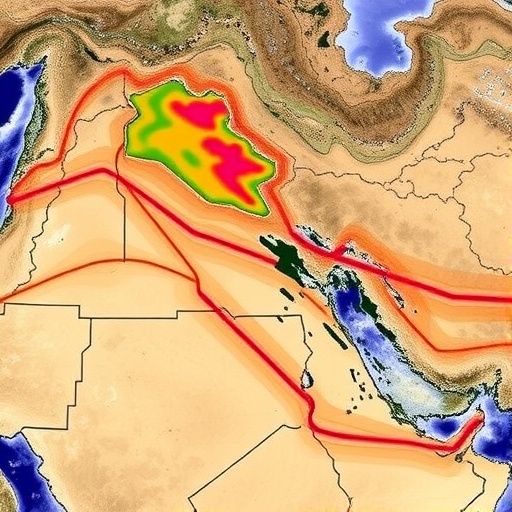
In a groundbreaking advancement for environmental monitoring and land use planning, researchers have unveiled a novel approach that leverages Sentinel-2 satellite data alongside a sophisticated integration of cellular automata and deep learning techniques. This innovative framework has been employed to generate unprecedentedly accurate land cover forecasts for Northern Iraq, a region of critical ecological and geopolitical importance. By harnessing time series analysis from Sentinel-2’s high-resolution multispectral imagery, the research team has transcended traditional land classification methods, introducing a dynamic and predictive model that captures landscape transformations with remarkable precision.
The core of this pioneering study rests on the fusion of two powerful computational paradigms. Cellular automata—mathematical models that simulate complex spatial phenomena through discrete grid-based systems—provide the mechanism to replicate spatial interactions and diffusion processes in land cover evolution. Meanwhile, deep learning, a subset of artificial intelligence modeled after neural networks, offers highly adaptable pattern recognition capabilities, enabling the model to intelligently interpret temporal sequences and variable environmental conditions present in the satellite data. This bi-modal approach therefore effectively encapsulates both spatial dependencies and temporal dynamics, which are often overlooked in classic land cover change detection.
Sentinel-2, a European Space Agency (ESA) satellite constellation, is known for its continuity of Earth observation with revisits every five days, providing crucial multi-temporal data streams. These data streams, consisting of 13 spectral bands with resolutions as fine as 10 meters, empower analysts with the ability to discern subtle land cover differences over time. The research team exploited this frequent revisit and fine spectral granularity to build rich temporal profiles of land patterns, facilitating sensitive detection of changes that might signal ecological disturbances, agricultural expansions, or urban sprawl.
Northern Iraq’s diverse ecosystem comprises mountainous terrains, agricultural expanses, and urban settlements, all subject to rapid environmental and human-induced changes. Accurate land cover mapping here is essential for resource management, urban planning, and conflict resolution efforts amidst the area’s socio-political complexities. Traditional remote sensing approaches typically suffer from limitations in either spatial resolution or temporal coherence, reducing their ability to predict future land cover with confidence. The new methodology overcomes these hurdles by blending cellular automata’s local interaction simulations with deep neural networks’ global pattern extraction, producing forecasts that not only map current landscapes but also project future transformations under varying scenarios.
The cellular automata component explicitly models neighborhood effects and spatial autocorrelation of land use changes, accounting for the influence one pixel’s class may exert on its neighbors. This feature is crucial in land processes, where phenomena such as deforestation, urbanization, or desertification tend to propagate through contiguous regions rather than isolated patches. By integrating time-dependent data sequences from Sentinel-2, the deep learning framework identifies latent features and subtle land cover signals otherwise obscured by noise or seasonal fluctuations, enhancing model robustness.
Training of the integrated model involved assembling extensive labeled datasets derived from Sentinel-2 imagery spanning multiple years. The deep learning network was meticulously optimized to discern class-specific temporal signatures, such as the phenological cycles of vegetation or the expansion pattern of built-up areas. The resultant hybrid system effectively generates predictive land cover maps that dynamically adjust to observed trends, thus enabling stakeholders to anticipate environmental shifts before they become pronounced.
One of the compelling advantages of this approach is its scalability and adaptability. While the study focused on Northern Iraq, the underlying principles can be extended to other regions with appropriate satellite data availability. The model architecture supports transfer learning and fine-tuning, allowing researchers and policymakers to customize it for local conditions, land cover classes, and climate variables, thus addressing global challenges in land management and environmental monitoring.
Environmental scientists and land use planners stand to benefit immensely from these advances. The predictive capacity uncovers proactive opportunities for mitigating adverse ecological impacts, planning sustainable agriculture, and managing urban growth more intelligently. Moreover, improved accuracy and temporal resolution help in validating climate models, monitoring endangered habitats, and assessing post-disaster recovery, reinforcing the critical role of satellite remote sensing in planetary stewardship.
The research also showcases the synergetic potential when combining domain-specific models like cellular automata with modern AI frameworks. By bridging theoretical modeling with data-driven learning, the methodology transcends prior limitations, achieving performance that neither approach could provide independently. This innovation is emblematic of the broader trend in Earth sciences, where hybrid computational techniques push the envelope of remote sensing applications, opening pathways to discover new patterns and insights in complex environmental systems.
Moreover, the research underlines the importance of continuously updated high-quality satellite data for monitoring our rapidly changing planet. Sentinel-2’s mission illustrates how coordinated international efforts in satellite deployment and open data policy enable scientific breakthroughs and practical applications worldwide. As environmental challenges intensify—from climate change to land degradation—such sophisticated predictive tools become indispensable for timely decision-making.
This study’s findings also hold potential implications for geopolitical stability, as Northern Iraq is a region vulnerable to land disputes, population displacements, and resource conflicts. Accurate predictive land cover maps can facilitate evidence-based negotiations, equitable resource distribution, and enhanced planning for resilient communities. The timely identification of land cover trends tied to human activities or natural factors is critical for forming adaptive governance strategies.
In conclusion, the use of Sentinel-2 time series data integrated with cellular automata and deep learning models represents a significant leap forward in land cover forecasting capabilities. The methodological fusion offers a powerful, scalable, and precise tool for environmental monitoring, land management, and policy guidance, specifically demonstrated within the complex terrain of Northern Iraq. As satellite technology evolves and computational power grows, such hybrid models promise to revolutionize our understanding and management of terrestrial ecosystems globally.
This landmark research exemplifies the convergence of satellite remote sensing, spatial modeling, and artificial intelligence, marking a new era of predictive environmental science. The implications extend beyond academic interest, promising transformative impacts on sustainable development, climate resilience, and biodiversity conservation. By anticipating land cover changes with high accuracy and temporal granularity, societies can better prepare for the future and safeguard the delicate balance of our natural landscapes.
As Earth observation continues its rapid development, interdisciplinary collaborations like this study will be vital. The seamless synergy between data collection, computational modeling, and domain expertise fosters innovations that address complex environmental challenges holistically. This approach sets a precedent for future research endeavors aiming to harness the full potential of remote sensing and AI for planetary health and sustainability.
Researchers around the world are encouraged to explore and build upon this integrative modeling framework, adapting it to their local conditions and priorities. By doing so, the global scientific community can accelerate progress toward comprehensive land cover monitoring systems that inform policy and inspire conservation initiatives. Ultimately, advancements like these democratize access to critical environmental knowledge, contributing significantly to global efforts in mitigating environmental degradation and promoting sustainable development goals.
The fusion of Sentinel-2 data with advanced computational techniques, as demonstrated in this research, highlights how technology can empower humanity to understand and manage Earth’s complex systems more effectively. It offers a compelling vision of the future—one where data-driven foresight enables proactive stewardship of the planet’s precious resources, ensuring resilience for generations to come.
Subject of Research:
The integration of Sentinel-2 satellite time series data with cellular automata and deep learning for precise land cover forecasting in Northern Iraq.
Article Title:
Leveraging Sentinel-2 A time series and integrated cellular automata-deep learning for accurate land cover forecasts in Northern Iraq.
Article References:
Hussein, F., Latifi, H. & Mojaradi, B. Leveraging Sentinel-2 A time series and integrated cellular automata-deep learning for accurate land cover forecasts in Northern Iraq. Environ Earth Sci 84, 586 (2025). https://doi.org/10.1007/s12665-025-12561-1
Image Credits:
AI Generated
