In recent years, the escalating impact of climate change on coastal regions has emerged as a critical area of scientific inquiry, with ramifications that affect ecosystems, economies, and human settlements globally. A groundbreaking study led by Hussain, S.A., Tripathi, A., and Tiwari, S.P., published in Environmental Earth Sciences in 2025, delves deeply into the vulnerability of the Saudi Arabian coastline using an innovative multi-parametric remote sensing approach. This research not only advances our understanding of climate-induced vulnerabilities but also pioneers the integration of diverse satellite datasets for coastal risk assessments, setting a new benchmark for environmental monitoring.
The Saudi coast, stretching along the Red Sea and the Arabian Gulf, represents a unique interface between arid landscapes and marine ecosystems. This biome is extraordinarily sensitive to climatic perturbations such as sea-level rise, increasing sea surface temperatures, and changing precipitation patterns. Understanding these dynamics requires an intricate balance of field observations and remote sensing technologies capable of capturing spatiotemporal variability on fine scales. The study in question employs satellite imagery combined with environmental modeling to decode the multifaceted vulnerabilities of this crucial region.
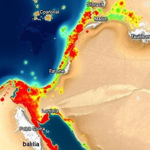
Leveraging a suite of satellite-derived data, including land surface temperature, vegetation indices, and shoreline displacement metrics, the researchers constructed a comprehensive vulnerability index. This index quantitatively evaluates susceptibility to erosion, flooding, and habitat loss along different segments of the Saudi coastline. The multi-parametric nature of this approach is critical because it encapsulates physical, biological, and anthropogenic factors, thereby providing a holistic picture of environmental stressors magnified by climate change.
What sets this study apart is its methodical use of remote sensing data from multiple platforms, including MODIS, Sentinel-2, and Landsat missions. By integrating these data sources, the research team captured changes over various temporal scales, ranging from seasonal variability to decadal trends. This approach permits the detection of otherwise imperceptible environmental shifts that traditional ground-based observations might miss, particularly in challenging desert-coastal interfaces where accessibility is limited.
One key finding from the analysis is the pronounced increase in shoreline recession rates along certain stretches of the Gulf coast. This erosion is exacerbated by altered hydrodynamics stemming from rising sea levels and intensified storm surge events. Such physical transformations threaten critical habitats like mangroves and salt marshes, which serve as natural buffers against extreme weather, and are pivotal in carbon sequestration efforts. The loss of these habitats would not only disrupt ecological balance but also jeopardize local livelihoods dependent on fisheries and tourism.
Further scrutiny revealed significant alterations in surface water temperature patterns, with anomalous warming trends recorded in nearshore waters. These temperature variations have profound implications for marine biodiversity, affecting reproductive cycles, migration patterns, and the overall health of coral reefs lining the Red Sea coastline. The researchers highlight that such thermal stressors compound existing anthropogenic pressures, propelling ecosystems toward irreversible tipping points unless urgent mitigation strategies are enacted.
In addition to physical and ecological parameters, the study incorporates socioeconomic variables such as population density and infrastructure proximity. Coastal urban centers in Saudi Arabia are rapidly expanding, amplifying exposure to climate-related hazards. The overlay of human settlement data onto environmental vulnerability maps reveals hotspots where the confluence of natural and human factors elevates risk profiles dramatically. This integration underscores the need for adaptive urban planning and disaster risk reduction frameworks tailored to climate realities.
Technically, the deployment of advanced image processing algorithms, including machine learning classification techniques, enabled precise delineation of land cover changes and identification of vulnerable zones. The fusion of spectral indices such as Normalized Difference Vegetation Index (NDVI) and Normalized Difference Water Index (NDWI) facilitated nuanced differentiation between vegetation degradation and waterbody fluctuations over time. These methods exemplify the profound capabilities of modern remote sensing analytics to transform raw data into actionable insights.
Moreover, the temporal resolution of satellite imagery allowed the detection of episodic events such as flash floods and sand dune migration, phenomena often underrepresented in conventional coastal assessments. By tracing these dynamic processes, the researchers elucidate the interplay between geomorphological changes and extreme weather incidences, contributing to a more integrated understanding of climate resilience in arid coastal settings.
The comprehensive vulnerability maps produced by the team serve as invaluable tools for policymakers and conservationists. They delineate priority areas requiring intervention, guide resource allocation for climate adaptation projects, and help forecast future scenarios under varying greenhouse gas emission trajectories. By presenting clear and quantifiable evidence, the study supports sustainable development pathways aligned with Saudi Arabia’s Vision 2030 goals, which emphasize environmental stewardship alongside economic diversification.
Global implications of this research are significant, as the methods and findings resonate beyond the Saudi context. Arid and semi-arid coastal regions worldwide face similar challenges, and the demonstrated multi-parametric remote sensing framework offers a replicable model for vulnerability assessments in other vulnerable zones. The integration of interdisciplinary data sources exemplifies how modern earth observation capabilities can directly inform climate resilience policies on a global stage.
Importantly, this research also spotlights gaps in existing climate models, particularly their coarse spatial resolution and limited incorporation of local geomorphic processes. By validating remote sensing observations with in situ measurements, Hussain and colleagues advocate for more granular and dynamic modeling efforts that better capture regional complexities. Their work thus encourages the fusion of empirical data and predictive simulations to refine future vulnerability projections.
The study further emphasizes the critical role of continuous monitoring programs to track ongoing environmental changes and assess the efficacy of implemented adaptation measures. The dynamic nature of coastal systems necessitates an iterative approach where remote sensing platforms are routinely leveraged to update risk assessments, ensuring timely responses to emerging threats triggered by climate variability.
In conclusion, the innovative use of multi-parametric remote sensing technology in this Saudi Arabian coastal vulnerability study sets a new precedent for climate change impact analysis. By combining satellite imagery, environmental metrics, and socioeconomic data, the research offers a comprehensive, high-resolution snapshot of how climate change is reshaping fragile coastal landscapes. This work delivers vital insights that will shape regional climate adaptation strategies, enhance ecological conservation efforts, and contribute to the broader scientific discourse on coastal resilience in the face of a warming planet.
Subject of Research: Climate change-induced vulnerability analysis of the Saudi Arabian coastline using a multi-parametric remote sensing approach.
Article Title: Climate change induced vulnerability analysis of the Saudi coast: A multi-parametric remote sensing approach.
Article References:
Hussain, S.A., Tripathi, A., Tiwari, S.P. et al. Climate change induced vulnerability analysis of the Saudi coast: A multi-parametric remote sensing approach. Environ Earth Sci 84, 337 (2025). https://doi.org/10.1007/s12665-025-12297-y
Image Credits: AI Generated
