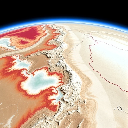
In a groundbreaking study, researchers have unveiled significant insights into the water surface characteristics of the Salar de Uyuni, Bolivia, utilizing satellite radar altimetry. This revolutionary technology has enabled scientists to reveal intricate spatial and temporal changes in the smoothness of the water surface over time. The Salar de Uyuni, which is the world’s largest salt flat, provides a unique environment for studying water dynamics, especially given its extreme climatic conditions and large area facilitating in-depth analysis.
The research, led by a team of scientists including Vignudelli, Abileah, and Mollinedo, showcases the importance of employing advanced satellite technologies to gain deeper understanding of environmental conditions. Traditionally, studying large-scale water body dynamics required intensive ground-based observations, often limited by accessibility and geographical constraints. However, the advent of satellite radar altimetry has transformed this field of study, offering a bird’s eye view and continuous monitoring of these vast areas.
One of the primary findings of the study is the variation in water surface smoothness, which is an indicator of ecological and hydrological changes in the region. Through radar altimetry, the researchers were able to capture minute changes in water surface characteristics, which can have significant implications not just for the immediate environment but also for global climate patterns. These findings underscore how even remote regions like the Salar de Uyuni are influenced by wider environmental changes, making this research relevant to a global audience.
Important measurements taken through the satellite radar altimetry include fluctuations in surface roughness, which can be attributed to several factors including evaporation rates, rainfall patterns, and temperature variations. The researchers have illustrated that as climate patterns shift, so too does the nature of water bodies in the region, potentially leading to alterations in local ecosystems and affecting the livelihoods of communities dependent upon them.
Furthermore, the use of radar altimetry in this study allows for unprecedented accuracy in monitoring water levels over time. Unlike traditional methods that may suffer from inaccuracies due to physical obstructions or weather conditions, radar satellites offer a reliable alternative. This precision is critical for environmental scientists looking to understand and combat the ongoing impacts of climate change.
The implications of the changes observed in the Salar de Uyuni extend beyond the local ecosystem. As one of the world’s primary sources of lithium extraction—an essential element for modern batteries—the health of this region impacts global markets and technological advancement. Therefore, understanding these hydrological changes could inform strategies to sustainably manage resources that are vital for the energy transition.
Additionally, the research highlights the potential for satellite radar technology to be implemented in other remote regions around the world. By establishing a precedent with the Salar de Uyuni, this method could be utilized to monitor other crucial water bodies that are similarly affected by climate change. The scalability of satellite monitoring opens new avenues in environmental science, enhancing our ability to respond to global challenges.
As the researchers compiled their findings, they also emphasized the importance of interdisciplinary collaboration. The integration of satellite data with ground-based research and modeling can create a fuller picture of environmental dynamics. Such collaborations are essential in effectively addressing the multifaceted challenges posed by climate change, including habitat destruction and resource management.
In a world increasingly challenged by environmental degradation, studies like this serve as critical reminders of our need to adapt to the changing planet. By leveraging technology for more comprehensive monitoring, scientists can pave the way for innovative solutions to mitigate adverse effects. The results from the Salar de Uyuni project exemplify how data-driven approaches can inform policy decisions and foster community awareness regarding environmental issues.
Moreover, this research serves as a catalyst for raising awareness among the public about the significance of satellite technology in environmental monitoring. Educating communities about these developments engenders a collective responsibility toward safeguarding our planet, particularly in regions that may often go unnoticed in global discussions.
The advancements made through this study not only contribute to ongoing scientific discourse but also inspire future research. Additional inquiries could explore the relationships between water surface smoothness and biodiversity, the impact of anthropogenic influences on local hydrology, and even socioeconomic factors relating to resource extraction. As such, the findings transcend beyond immediate observations, sparking a vital dialogue on sustainable practices in resource management.
In conclusion, the revelations from the Salar de Uyuni underscore the transformative nature of satellite radar altimetry as a tool for environmental research. This remarkable technological breakthrough offers key insights into the complex interplay of climate and ecological changes, shaping our understanding of vital natural resources. Continued exploration of these findings can ultimately lead to improved sustainability efforts and a renewed commitment to protect vulnerable ecosystems worldwide.
As researchers move forward, it is imperative that the knowledge gained from the Salar de Uyuni study informs broader strategies aimed at addressing global climate challenges. By advancing our understanding of how such water bodies change, we facilitate not just conservation efforts, but also lay the groundwork for future generations to engage with our planet responsibly.
Subject of Research: Satellite radar altimetry and its application in understanding water surface characteristics in Salar de Uyuni.
Article Title: Satellite radar altimetry reveals spatial and temporal changes in water surface smoothness in the Salar de Uyuni, Bolivia.
Article References: Vignudelli, S., Abileah, R., Mollinedo, P.P. et al. Satellite radar altimetry reveals spatial and temporal changes in water surface smoothness in the Salar de Uyuni, Bolivia. Commun Earth Environ 6, 753 (2025). https://doi.org/10.1038/s43247-025-02715-1
Image Credits: AI Generated
DOI:
Keywords: Satellite Radar Altimetry, Salar de Uyuni, Water Surface Smoothness, Climate Change, Environmental Monitoring, Lithium Extraction, Ecosystem Health.


