A groundbreaking study published in Environmental Earth Sciences has unveiled a sophisticated risk-based model designed to enhance the assessment of gully erosion susceptibility in the Jhang-Ping and Ping-Lin watersheds. This innovative research, spearheaded by Zhang, Chuang, Chen, and colleagues, addresses the urgent environmental challenge posed by gully erosion—a severe form of land degradation that threatens ecosystems, agricultural productivity, and infrastructure. By integrating multifaceted conditioning indicators into their model, the researchers have paved the way for more precise, actionable predictions that can bolster preventative strategies and watershed management practices.
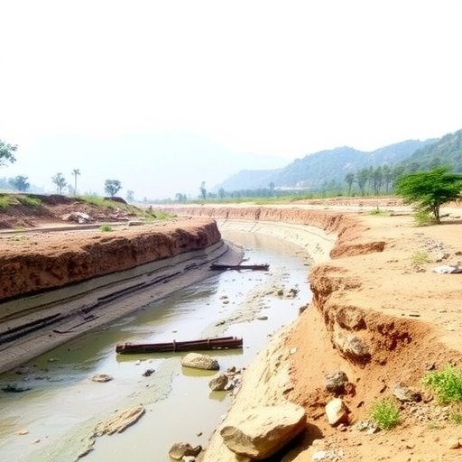
Gully erosion represents a significant geomorphological process whereby intense surface runoff carves deep channels into the earth, leading to the rapid removal of soil and sediment. This phenomenon not only reshapes landscapes but also exacerbates sediment transport, negatively impacting aquatic habitats and human communities downstream. Despite its critical environmental implications, accurately predicting areas susceptible to gully formation has proven a complex endeavor due to the interplay of diverse natural and anthropogenic factors. The research team’s approach addresses this complexity through a systematic evaluation of spatial conditioning indicators that modulate erosion dynamics.
Leveraging both topographical and hydrological data, the model incorporates physical factors such as slope gradient, soil texture, land use patterns, rainfall intensity, and vegetation cover. Each of these indicators contributes uniquely to the erosion susceptibility landscape. For instance, steep slopes can accelerate surface runoff velocity, while land use changes like deforestation can diminish the soil’s cohesive properties, thereby amplifying vulnerability to gully initiation. By parametrizing these variables within a risk-based analytical framework, the researchers have achieved a more nuanced understanding of gully erosion predisposition.
A critical innovation in this study lies in how the model weights these conditioning indicators through a risk-based algorithm. Unlike traditional mapping techniques that rely heavily on singular factors or qualitative assessments, this model quantitatively integrates data layers, enabling probabilistic predictions of erosion hotspots. Such an approach not only enhances the precision of susceptibility assessments but also offers scalability, allowing the methodology to be adapted readily to other regions facing similar geomorphological threats.
The field data collection undertaken in the Jhang-Ping and Ping-Lin watersheds was extensive, involving direct erosion measurements and sediment sampling to calibrate the model. Remote sensing technologies and GIS mapping played instrumental roles in gathering spatial datasets, facilitating high-resolution terrain analysis. The amalgamation of ground truthing and geospatial analytics underscores the robustness of the modeling framework. This integrative methodology serves as a model for future interdisciplinary collaborations aiming to mitigate land degradation challenges.
By applying their risk-based susceptibility model, the researchers were able to delineate specific zones within the watersheds that exhibit elevated gully erosion risk. These zones correlated strongly with areas characterized by steep topography, sparse vegetation, and abrupt changes in land use, such as agricultural encroachment into previously forested habitats. The identification of these critical zones holds profound implications for land management policies, particularly in prioritizing conservation and restoration efforts to curtail erosion impacts before irreversible landscape damage ensues.
The implications of this study extend beyond academic novelty; they resonate with the pressing need for sustainable watershed management, especially in regions vulnerable to climate variability. The model’s capability to forecast erosion-prone areas equips policymakers and stakeholders with a predictive tool essential for planning mitigation strategies such as reforestation, controlled grazing, terracing, and the construction of check dams. These interventions, guided by precise susceptibility maps, can significantly reduce sediment loads in waterways, preserve soil fertility, and protect biodiversity.
Moreover, the demonstrated applicability of the model in two distinct watersheds underscores its potential versatility. The Jhang-Ping and Ping-Lin watersheds, although subjected to particular climatic and anthropogenic influences, serve as representative case studies. The approach can be customized to other geographical contexts by adjusting indicator weightings to reflect local environmental conditions. This adaptability renders the risk-based model a powerful asset in the global fight against land degradation and desertification.
The study also contributes to advancing computational techniques in environmental science by illustrating the integration of multivariate datasets in susceptibility forecasting. It offers a blueprint for harnessing emerging technologies such as machine learning and big data analytics to refine predictive accuracy further. Future iterations of this model could incorporate real-time monitoring data, enabling dynamic updates to susceptibility assessments and fostering rapid-response mechanisms to emerging erosion threats.
Perhaps most significantly, the research highlights the interconnectedness of human activity and geomorphological processes. Land use intensification, urban expansion, and deforestation emerge as potent accelerants of gully erosion within the modeled watersheds. This insight reinforces the imperative for holistic land use planning that balances development with ecological integrity, ensuring that human footprints do not exacerbate natural susceptibility to erosion.
In synthesizing geomorphic characteristics with anthropogenic factors, the study advocates for a paradigm shift in erosion management—from reactive measures aimed at remediating damage to proactive strategies informed by predictive modeling. Such a shift aligns with global environmental sustainability goals and supports resilience-building in communities that depend on stable landscapes for their livelihoods.
The authors also emphasize the importance of community engagement in implementing erosion control measures identified by the risk-based model. Local stakeholders, including farmers, landowners, and municipal authorities, are integral to the success of erosion mitigation initiatives. Education and participatory planning can foster ownership of land stewardship practices, translating scientific insights into tangible on-the-ground action.
The comprehensive nature of the research, combining fieldwork, remote sensing, GIS, and quantitative modeling under a risk-based framework, exemplifies the multidisciplinary collaboration required to address complex environmental problems. It sets a new standard for erosion susceptibility assessments and encourages researchers worldwide to adopt similarly integrative approaches to environmental challenges.
Zhang and colleagues’ work stands as a testament to the power of scientific innovation in confronting pressing natural resource issues. By delivering a predictive, adaptable model that accurately maps terrain vulnerability, they provide a vital tool for safeguarding watersheds and ensuring the longevity of ecosystems that support both nature and human well-being.
As climate change intensifies the frequency of extreme weather events, including heavy rainfall that exacerbates erosion, the need for effective predictive tools becomes all the more urgent. This study anticipates these challenges head-on, offering a scientifically rigorous and practical solution to better manage and mitigate gully erosion risks well into the future.
In conclusion, this pioneering research not only enhances our understanding of the factors driving gully erosion but also equips decision-makers with a state-of-the-art model to shield vulnerable landscapes. Its implications for environmental science, land management, and policy formulation are profound, heralding a new era in proactive erosion control and watershed conservation.
Subject of Research: Gully erosion susceptibility assessment using a risk-based model with environmental conditioning indicators.
Article Title: Gully erosion susceptibility assessment in Jhang-Ping and Ping-Lin watersheds: a risk-based model using conditioning indicators.
Article References:
Zhang, WY., Chuang, CW., Chen, CL. et al. Gully erosion susceptibility assessment in Jhang-Ping and Ping-Lin watersheds: a risk-based model using conditioning indicators. Environ Earth Sci 84, 677 (2025). https://doi.org/10.1007/s12665-025-12540-6
Image Credits: AI Generated
