In the vast and ecologically critical region known as High Mountain Asia, which encompasses the mighty Himalayas, Hindu Kush, Karakoram, Pamir, and Tian Shan mountain ranges, researchers have observed a striking acceleration in river discharge over the past two decades. A groundbreaking study published in the journal AGU Advances has revealed that at least 10% of the rivers flowing through this extensive mountainous region have experienced a significant surge in water volume, driven primarily by the rapid melting of glaciers and changes in precipitation patterns. This discovery sheds new light on the hydrological impacts of climate change in one of the most water-stressed and geopolitically vital regions on Earth.
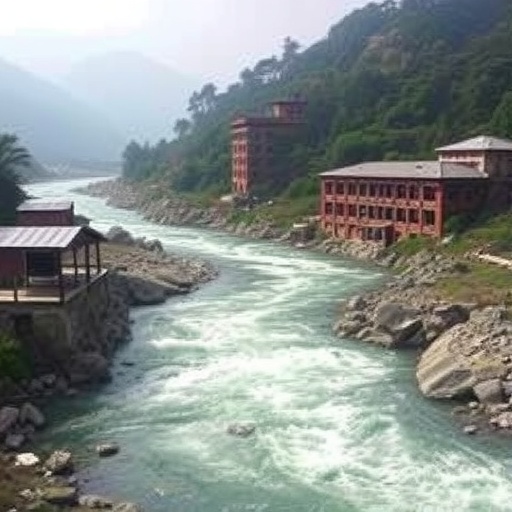
High Mountain Asia is home to tens of thousands of glaciers, supplying freshwater to some of the largest rivers in Asia, such as the Yangtze, Indus, Amu Darya, and Syr Darya. These rivers collectively sustain nearly two billion people downstream, providing essential resources for drinking water, agriculture, industry, and hydropower. The study’s lead author, Jonathan Flores from the University of Massachusetts Amherst, and an international team of researchers leveraged over one million satellite images from Landsat and PlanetScope, supplemented by extensive ground-based water gauge measurements, to meticulously analyze river discharge changes from 2004 to 2019 at an unprecedented spatial resolution. They divided river networks into segments as small as 8 kilometers (roughly 5 miles), enabling precise detection of localized hydrological trends.
The researchers found that in many upstream sections of these rivers, water flow had nearly doubled within a decade—a startling rate of increase rarely documented in comparable mountainous regions. On average, rivers showing an upward trend in discharge increased by about 8% per year. Even some of the largest rivers with volumes exceeding 1,000 cubic meters per second exhibited statistically significant annual increases of 2% or more, equivalent to thousands of extra gallons flowing every second. Such substantial augmentations in river discharge indicate profound alterations in regional hydrology, largely attributed to accelerated glacier melt and evolving precipitation regimes driven by global warming.
This increase in river discharge, while seemingly beneficial in providing more abundant water resources for hydropower and agriculture, carries complex and potentially adverse consequences. The surge in flowing water corresponds directly with higher stream power, a measure of the river’s capacity to carry sediment such as gravel, sand, and silt. Enhanced sediment transport poses a considerable threat to hydraulic infrastructure, including dams and hydropower turbines, by accelerating wear, clogging water intakes, and reducing reservoir storage capacity. In particular, dams designed based on historical flow patterns may not withstand the increased sediment loads, necessitating adaptive engineering to address these new stressors.
Spatially, the increase in river discharge is unevenly distributed across High Mountain Asia. Rivers originating in the western part of the region, which rely heavily on glacial meltwaters, show the most pronounced increases in water volume. This contrasts with rivers in the eastern zones predominantly fed by monsoonal rain, where discharge rates have exhibited more variability with some stable or even declining trends. The amplification of glacier melt in the west correlates strongly with rising regional temperatures, with glaciers projected to lose between 29% and 67% of their mass by the end of the century if current warming trajectories persist.
One of the most notable implications of these findings is the temporal dynamic of water availability downstream. Although upstream river sections currently exhibit increased flow, this phenomenon may be short-lived. As glaciers continue to shrink and lose mass, the contribution of meltwater to river discharge is expected to diminish eventually, leading to reduced water availability in the long term. Downstream communities heavily reliant on stable water supplies for irrigation, drinking, and energy production could face heightened vulnerability once the buffering effect of glacier meltwater wanes.
The study also highlights the urgent need to integrate these new hydrological insights into infrastructure planning and water resource management across High Mountain Asia. Many existing dams and hydropower plants were designed using historical data that do not account for rapidly shifting flow regimes and sediment loads. Incorporating detailed, segment-level river discharge data can inform the optimization of dam capacities, turbine design, and sediment management strategies, ultimately enhancing the resilience of water infrastructure in a changing climate.
From a broader ecological perspective, increasing river discharge and sediment flux can transform aquatic habitats, impacting biodiversity and ecosystem functions. Sediment accumulation and changes in flow regimes disrupt habitats for fish and other wildlife, potentially destabilizing riverine ecosystems that have evolved under relatively stable conditions. Such ecological shifts further challenge conservation efforts in these biodiverse regions, necessitating multidisciplinary approaches that encompass both hydrology and ecology.
The research team’s innovative methodology—melding satellite remote sensing with ground data and segment-level analysis—sets a new standard for monitoring and understanding river systems across complex mountainous terrains. This approach not only captures spatial heterogeneity within river networks but also enables timely assessments of hydrological responses to climate change. Importantly, the open-source nature of the collected data promotes accessibility for policymakers, engineers, and local communities, fostering informed decision-making grounded in cutting-edge science.
Despite the inherent challenges, the transient rise in river discharge could offer short-term advantages for hydropower generation and irrigation, particularly amid growing energy demands in the region. However, these benefits must be weighed against the long-term environmental and infrastructural risks posed by accelerated glacier loss and sedimentation. Strategic adaptation and enhanced transboundary cooperation will be critical to balancing resource utilization with sustainable management across the diverse nations relying on the rivers of High Mountain Asia.
In conclusion, the accelerating river discharge identified by this study reveals a double-edged hydrological transformation in High Mountain Asia. Driven by climate-induced glacier melt and shifting precipitation patterns, increased river flows highlight both emerging opportunities and looming threats to water security, energy infrastructure, and ecosystem health. With nearly two billion individuals dependent on these watershed systems, understanding and anticipating these changes is paramount. The findings underscore the imperative to integrate dynamic hydrological data into regional water management frameworks, infrastructure design, and climate resilience planning to safeguard the future of this vital region.
Subject of Research: Not applicable
Article Title: Accelerating River Discharge in High Mountain Asia
News Publication Date: 13-Aug-2025
Web References: https://agupubs.onlinelibrary.wiley.com/doi/10.1029/2024AV001586
References: Flores et al., AGU Advances, DOI: 10.1029/2024AV001586
Image Credits: Flores et al., AGU Advances
Keywords: High Mountain Asia, river discharge, glacier melt, hydrology, climate change, sediment transport, hydropower, water resources, Himalayas, Karakoram, river flow increase, remote sensing, infrastructure resilience
