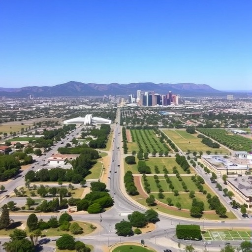
In the sprawling urban landscape of Los Angeles, where the ebb and flow of human activity intertwines with natural elements, a new technological lens reveals a startling truth: not all public parks and open spaces offer equal relief from the rising thermometer. Thanks to advances in remote sensing technologies and a rigorous analytical framework, researchers have recently uncovered profound thermal inequities woven into the city’s green refuges. This groundbreaking study, undertaken by Agatep, Fisher, Tacazon, and their colleagues, dives deep into the microclimate disparities of Los Angeles’s public parks, exposing how environmental injustice manifests even in spaces traditionally perceived as communal sanctuaries.
Los Angeles experiences a well-documented urban heat island effect, where densely built environments absorb and retain heat, pushing temperatures higher than surrounding rural areas. However, this new research shifts the narrative from citywide averages to the nuanced, parcel-by-parcel examination of urban green spaces. By leveraging high-resolution remote sensing data—capturing land surface temperatures across temporal scales—the study meticulously dissects how thermal burdens vary from one park to another, often along lines of socioeconomic stratification. This approach transcends conventional temperature monitoring by incorporating satellite-derived infrared imagery, enabling an unprecedented spatial and temporal resolution in urban thermal profiling.
Remote sensing provides a bird’s eye, data-rich vantage point allowing scientists to peer beyond the visible spectrum into thermal bands that reveal surface heat emissions. This technique, anchored by platforms such as Landsat and more advanced hyperspectral imaging satellites, measures the land surface temperature (LST) with precision. Historically, LST has been linked to urban form, vegetation density, and material properties, but what this study uniquely elucidates is the intersection of these physical attributes with demographic patterns and urban planning legacies. Parks within wealthier neighborhoods typically exhibited cooler surface temperatures, while those in marginalized, lower-income areas were significantly hotter during peak heat periods.
The researchers attributed these inequities to multiple intertwined factors. At the core, vegetation health and canopy cover varied dramatically between parks, with affluent communities tending to have more mature, dense tree canopies that provide effective shading and contribute to evapotranspiration—the natural cooling process whereby plants release water vapor—thereby reducing local temperatures. In contrast, parks in underserved neighborhoods often had sparse greenery, degraded soil quality, and impermeable artificial surfaces that contribute to greater heat absorption and retention. Such contrasts underscore the crucial role urban forestry and landscape management play not only in aesthetics but in thermal regulation and public health.
Furthermore, the study highlights how the spatial configuration of parks relative to surrounding urban matrices compounds thermal disparities. Parks embedded within dense concrete jungles, flanked by highways or industrial zones, face amplified radiant heat, whereas those bordered by tree-lined residential areas benefit from microclimates that shield them from extreme temperature spikes. This complex interplay between urban morphology and vegetation underscores the necessity to consider the broader urban context when assessing the effectiveness of green spaces as climate buffers.
Another striking revelation concerns the temporal dynamics of surface temperature fluctuations. While daytime heat differentials were expected and aligned with existing models, nighttime temperatures exhibited persistent warmth in less vegetated parks—a phenomenon that exacerbates health risks during heatwaves by limiting nocturnal cooling. This sustained heat retention disproportionately affects vulnerable populations, who depend heavily on public open spaces for respite but find these areas exacerbate rather than alleviate thermal stress in key moments.
From a public health perspective, these thermal inequities translate into tangible disparities in heat-related illnesses and mortality risk. Urban heat islands and associated microclimate variations disproportionately burden low-income communities disproportionately. With climate change propelling average temperatures upward and increasing the frequency of severe heat events, ensuring equitable access to thermally safe public spaces becomes an urgent social and environmental justice imperative. The study’s remote sensing approach offers a replicable methodology for municipal planners and policymakers seeking to identify and redress these disparities through targeted interventions.
Technically, the study deployed advanced image processing algorithms paired with geographic information system (GIS) tools to analyze multi-temporal satellite data. By layering positional demographics, vegetation indices such as the Normalized Difference Vegetation Index (NDVI), and surface temperature maps, the team constructed an integrative model capturing nuanced temperature gradients across the city’s diverse urban fabric. This integrative model not only quantifies thermal inequities but also enables predictive analytics for scenario planning under future climate conditions, offering a data-driven blueprint for sustainable urban resilience.
Crucially, beyond quantifying disparities, the research advocates actionable strategies to mitigate urban thermal inequities. Recommendations include expanding tree canopy cover in vulnerable parks, introducing reflective and permeable surface materials, and redesigning park layouts to maximize shading and airflow. Such interventions, validated by remote sensing monitoring, could recalibrate the urban thermal environment and democratize access to cool public spaces as climate stressors intensify.
This research arrives at a pivotal moment as cities globally grapple with the twin challenges of urbanization and climate change. Remote sensing, once the preserve of earth science disciplines, is now instrumental in social equity investigations, enabling cities to visually map—and ultimately confront—the invisible contours of environmental injustice. Los Angeles’s case exemplifies how technology can transcend generalized environmental assessments, revealing layered realities that demand integrated urban design, public policy, and community engagement approaches.
The study also raises broader questions about how urban ecosystems function as thermal regulators in an increasingly warming world. It challenges the assumption that green spaces universally mitigate heat risks and calls for a more granular understanding of green space quality, composition, and spatial context. This nuanced perspective promises to affect how future urban sustainability initiatives prioritize resource allocation, community participation, and technological integration for climate adaptation.
Collaboration among remote sensing scientists, urban ecologists, public health specialists, and policymakers was central to the study’s depth. Interdisciplinary approaches allowed the researchers to translate complex thermal data into actionable insights that resonate with stakeholders and affected communities. This holistic approach embodies a new frontier in urban sustainability scholarship, where technology and social equity meet at the crossroads of climate urgency.
In conclusion, the findings by Agatep, Fisher, Tacazon, and their colleagues represent a significant leap forward in detecting and addressing thermal inequities in urban green spaces. Their application of remote sensing technologies reveals systemic disparities invisibly baked into the city’s environmental fabric, underscoring the vital role of technological innovation in fostering climate justice. By decoding the thermal signatures of Los Angeles’s parks, this study charts a path toward more equitable, resilient cities that cool rather than exacerbate the impacts of climate change for all residents.
As urban planners and policymakers digest these insights, the imperative is clear: green space is not just a matter of quantity but of quality and distribution. Ensuring equitable thermal relief demands sophisticated data-driven planning, community investment, and sustained commitment to environmental justice principles. In the era of worsening heat extremes, science is providing the tools to see the problem with unprecedented clarity—and hopefully, the means to solve it.
Subject of Research: Thermal inequities in public parks and open spaces in Los Angeles measured using remote sensing technologies.
Article Title: Thermal inequities in public parks and open spaces in Los Angeles determined by remote sensing.
Article References:
Agatep, A., Fisher, J.B., Tacazon, K. et al. Thermal inequities in public parks and open spaces in Los Angeles determined by remote sensing. npj Urban Sustain (2026). https://doi.org/10.1038/s42949-026-00366-5
Image Credits: AI Generated
