The Transformative Role of Remote Sensing in Understanding Land Use and Land Cover Change in Arid and Semi-Arid Ecosystems
In the rapidly changing landscape of our planet, the interplay between human activity and environmental processes is more critical than ever. The systematic review by Agassounon et al. sheds light on the essential role of remote sensing in monitoring land use and land cover change (LUCC), particularly in arid and semi-arid regions. These ecosystems, characterized by limited moisture and unique biodiversity, are undergoing significant transformations due to anthropogenic factors. This review synthesizes current knowledge and identifies key challenges and future opportunities in the application of remote sensing technologies for environmental monitoring.
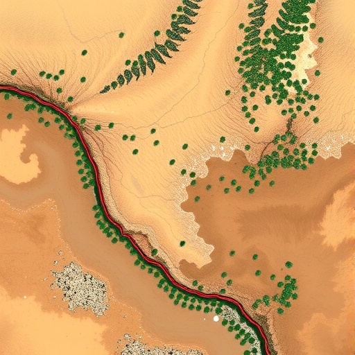
Remote sensing, encompassing a range of satellite and aerial imaging technologies, allows scientists to observe and analyze vast areas of land with unprecedented efficiency. By capturing high-resolution imagery, remote sensing provides critical data that informs our understanding of how land use patterns have evolved over time. This methodology is invaluable for assessing environmental changes, including desertification, urban sprawl, and agricultural expansion. As such, remote sensing is at the forefront of research aimed at reversing degradation and promoting sustainable land management practices in vulnerable regions.
One significant advantage of remote sensing is its ability to collect consistent data over time, facilitating long-term ecological studies. This temporal aspect is crucial in understanding both immediate and gradual changes in land cover. For example, researchers can track the expansion of agricultural land into previously untouched areas and its subsequent impact on biodiversity and soil health. The review emphasizes that continuous monitoring through remote sensing helps in identifying trends, validating models, and ultimately guiding policy decisions and conservation efforts.
However, the application of remote sensing is not without challenges. One primary concern highlighted in the review is the resolution of satellite imagery. While advancements have led to improved resolution, many remote sensing systems still struggle to capture fine-scale changes that occur, particularly in heterogeneous landscapes typical of arid and semi-arid ecosystems. The review calls for innovative methodologies to enhance the resolution and granularity of data, ensuring that subtle ecological changes are detected efficiently.
In addition to resolution challenges, data interpretation poses another hurdle for scientists working with remote sensing technology. The complexity of land cover classification, especially in transitional zones like arid regions, can lead to misinterpretations. The review discusses the importance of integrating remote sensing data with ground-truthing techniques. By validating satellite data through fieldwork, researchers can enhance their analyses’ accuracy and reliability, thereby strengthening the overall conclusions drawn from remote sensing studies.
Moreover, the socio-economic factors influencing land use and land cover change are intricate and multifaceted. Remote sensing can provide insights into how local communities utilize land resources, yet these observations must be contextualized within socio-economic frameworks. The review highlights the necessity of interdisciplinary collaboration, blending remote sensing data with social sciences to better understand the motivations driving land use changes. This holistic approach is essential for crafting effective land management strategies that consider both ecological sustainability and community needs.
Climate change is another critical driver of change in arid and semi-arid ecosystems. Remote sensing plays a pivotal role in documenting the impacts of climatic shifts on land cover. For instance, altered precipitation patterns and increasing temperatures can trigger shifts in vegetation types and soil degradation. The systematic review demonstrates how remote sensing data could help predict these changes, enabling proactive responses to mitigate potential negative impacts on biodiversity and human livelihoods.
Emerging technologies are constantly revolutionizing the field of remote sensing, with improvements in sensor technology and data processing capabilities enhancing our ability to monitor land use changes. Drones and unmanned aerial vehicles (UAVs) are becoming increasingly popular for collecting high-resolution imagery over localized areas, overcoming some of the limitations faced with traditional satellite imagery. The review suggests that integrating UAV data into mainstream remote sensing practices could significantly advance our understanding of ecological dynamics within arid ecosystems.
Despite the potential of remote sensing, challenges related to data accessibility and standardization remain prevalent. Access to high-quality satellite imagery can be limited by costs, and differing standards among agencies complicate data comparisons. The review advocates for initiatives aimed at democratizing access to remote sensing data. By establishing open-source data platforms, researchers and policymakers worldwide can collaborate more efficiently, fostering a global response to LUCC challenges.
Stakeholder engagement is equally important to the success of remote sensing applications in land management. Local communities, governments, and non-governmental organizations play a critical role in utilizing remote sensing data for informed decision-making. The review emphasizes that effective communication of findings to stakeholders can lead to better land use planning and conservation strategies, illustrating the potential for science to enact change in real-world contexts.
Future research directions highlighted in the systematic review open a window into exciting possibilities for the use of remote sensing in LUCC studies. Advanced machine learning algorithms are becoming instrumental in processing and interpreting remote sensing data, allowing for more sophisticated analyses of land use patterns. The review calls for further exploration into these technologies, envisioning a future where artificial intelligence augments traditional methods, leading to breakthroughs in ecological understanding and management.
Finally, the review underlines the urgency of addressing LUCC in arid and semi-arid ecosystems given their vulnerability to both human actions and environmental changes. The role of remote sensing in these efforts cannot be overstated. As the world grapples with the consequences of climate change and unsustainable land use practices, remote sensing provides a lens through which we can better understand and respond to these challenges. By harnessing the power of technology and fostering collaborative research, humanity can take critical steps towards preserving the fragile ecosystems that sustain both wildlife and human populations.
The implications of this systematic review extend beyond the realm of academic inquiry, suggesting actionable pathways toward sustainable land use practices. By continuing to innovate in the field of remote sensing and addressing the identified challenges, researchers and practitioners alike can equip themselves with the tools necessary to combat land degradation and promote environmental stewardship in arid and semi-arid regions.
Subject of Research: Remote sensing applications in land use and land cover change (LUCC) in arid and semi-arid ecosystems.
Article Title: Remote sensing applied in land use and land cover change (LUCC) in arid and semi-arid ecosystems: Current status, challenges and prospects – A systematic review.
Article References:
AGASSOUNON, B.M., ASSEDE, E.S.P., BASTIN, JF. et al. Remote sensing applied in land use and land cover change (LUCC) in arid and semi-arid ecosystems: Current status, challenges and prospects – A systematic review.
Environ Monit Assess 197, 1266 (2025). https://doi.org/10.1007/s10661-025-14755-3
Image Credits: AI Generated
DOI: 10.1007/s10661-025-14755-3
Keywords: Remote sensing, land use, land cover change, arid ecosystems, semi-arid ecosystems, environmental monitoring, sustainability, climate change, data accessibility, machine learning.
