In a groundbreaking advancement for agricultural science, Brazilian researchers have pioneered a novel methodology leveraging remote sensing technologies to precisely map the impact of frost damage on corn crops. This innovative approach employs satellite imagery combined with sophisticated machine learning algorithms to mitigate uncertainties veterinarians and farmers face regarding crop losses resulting from adverse weather conditions. By harnessing these cutting-edge tools, this model offers nuanced insights into environmental stressors, ultimately aiming to bolster food security and stabilize market fluctuations influenced by climate variability.
The framework devised by these researchers facilitates user customization across a spectrum of variables, rendering the system highly adaptable to diverse crops and geographical contexts. This versatility is especially pertinent given the heightened unpredictability of weather patterns exacerbated by climate change. The ability to generate more accurate, real-time assessments of crop health during harvest periods not only supports individual producers in optimizing yield decisions but also empowers policymakers to design more effective mitigation strategies. Such data-driven insights are critical for shaping agricultural insurance frameworks and public policies that safeguard entire production chains.
Globally, grain production is heavily concentrated in five key nations: China, the United States, India, Brazil, and Argentina. These countries are pivotal suppliers of staple grains such as rice, corn, wheat, and soybeans, whose harvest fluctuations directly influence international prices and supply stability. In recent years, these vital crops have demonstrated increased vulnerability to extreme climatological events including prolonged droughts, intense rainfall, and notably, more frequent and severe frost episodes. The repercussions of these environmental stresses extend beyond agricultural sectors, impacting geopolitical food security concerns, as discussed during prominent climate summits like COP30 in Belém.
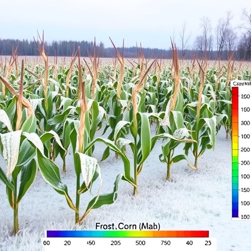
The focus of this study was the western mesoregion of Paraná state in Brazil, specifically the extensive corn plantations across Toledo and Cascavel. Over 700,000 hectares of second-harvest corn were subjected to detailed scrutiny to detect and quantify frost-induced damage experienced between May and June of 2021. This particular period was marked by severe frost occurrences, which posed significant threats to crop viability amid a backdrop of previously experienced drought conditions that had already delayed optimal planting timelines.
Utilizing optical remote sensing data from the MultiSpectral Instrument (MSI) aboard the Sentinel-2 satellite constellation, researchers integrated medium-resolution spatial imagery with advanced machine learning techniques, notably the Random Forest classifier algorithm. This combination achieved an impressive classification accuracy rate of 96% in isolating corn crop areas and discerning frost-affected zones. Their methodology, termed GEEadas—standing for Google Earth Engine-based Automatic Detection of Adverse-Frost Stress—has demonstrated unprecedented effectiveness for large-scale agricultural monitoring and real-time damage assessment.
The researchers highlight the critical importance of such precise spatial analysis capabilities, particularly in regions like Paraná where climate unpredictability challenges traditional farming practices. Marcos Adami, a key contributor and researcher at the National Institute for Space Research (INPE), emphasizes the socio-economic repercussions of crop failures within agriculturally dependent communities. The integration of remote sensing methods offers a powerful complement to conventional field surveys, enhancing the speed and scope of damage detection and informing strategies that aim to ensure continued productivity under adverse climatic conditions.
Adami’s longstanding collaboration with Professor Michel Eustáquio Dantas Chaves, from São Paulo State University (UNESP), has been instrumental in advancing remote sensing applications tailored specifically for agronomic needs. Neither researcher underestimates the stakes involved for producers who face persistent climate uncertainties, especially with extreme events like frost, which can devastate yields and precipitate economic hardship. Their method’s ability to delineate affected areas with high fidelity provides essential information for stakeholders ranging from farmers and insurers to government agencies responsible for resource allocation and disaster response.
The Brazilian Institute of Geography and Statistics (IBGE) underscores the agricultural sector’s vital role in the national economy. As of the October 2025 harvest estimate, Brazil’s production of cereals, legumes, and oilseeds hit a historic peak, with an output of 345.6 million tons—marking an 18% increase from the previous year. Rice, corn, and soybeans dominated this output, collectively accounting for over 90% of production volume and harvested land area. Paraná state holds the distinction as Brazil’s second-largest grain producer, trailing only Mato Grosso, and anticipates record corn production exceeding 140 million tons.
Second-harvest corn, cultivated predominantly after soybean crops and harvested mid-year, plays an increasingly critical role in Brazil’s agronomic landscape. Over the past decade, production has doubled, driven by improved practices such as the adoption of advanced fertilizers and the introduction of short-cycle corn varieties. However, this crop phase faces intrinsic risk due to lower water availability and heightened susceptibility to extreme weather, including frost. Despite existing frost warning systems, there remains a deficiency in precise damage assessment methodologies, which GEEadas aims to address effectively.
To ensure the veracity of their findings, researchers cross-validated frost damage maps derived from GEEadas against official records from the Paraná State Department of Agriculture and Supply, supplemented by independent data from insurance claims. Typically, when adverse events cause crop loss, specialized evaluators conduct on-site damage appraisals for insurance purposes. However, field assessments often encounter spatial and temporal constraints, underscoring the value of satellite-based observations, which provide comprehensive and timely coverage unattainable by ground inspections alone.
Adami and his team are actively collaborating with the National Supply Company (CONAB) across various states including Rio Grande do Sul, Paraná, and São Paulo. Their joint objective is to refine methodologies and aggregate data to enhance the accuracy of crop yield estimations. Accurate quantified assessments are essential for aligning market forecasts, insurance payouts, and policy interventions, ultimately fostering resilience within Brazil’s vital agrarian sectors amidst evolving climatic challenges.
The implications of this research extend far beyond Brazil’s borders, presenting a scalable and highly precise tool that could revolutionize agricultural monitoring worldwide. By integrating satellite remote sensing with machine learning, the GEEadas system exemplifies how technological innovation can empower farmers, insurers, and governments to mitigate risks associated with climate variability. As global food demands continue to rise alongside increasing climate unpredictability, solutions like this represent critical advancements in safeguarding crop productivity and ensuring sustainable agricultural practices.
As the agricultural community grapples with the challenges imposed by climate change, research initiatives such as this underscore the importance of interdisciplinary cooperation, combining Earth observation science with agronomic expertise. The high accuracy and adaptability of the GEEadas model set a promising precedent for future developments in precision agriculture, enabling stakeholders to make data-driven decisions that protect both livelihoods and food systems at local, national, and international scales.
Subject of Research:
Remote sensing and machine learning-based assessment of frost damage in maize crops.
Article Title:
GEEadas: GEE-based automatic detection of adverse-frost stress
News Publication Date:
18-Nov-2025
Web References:
DOI: 10.1016/j.rsase.2025.101799
References:
Published in the journal Remote Sensing Applications: Society and Environment.
Keywords:
Maize, Climate variability, Modeling, Public policy
