In recent years, groundwater resources have emerged as critical components in water management, especially in agricultural and urban planning contexts. Groundwater, the water stored in underground aquifers, plays a vital role in sustaining ecosystems and meeting the water needs of various sectors. Amid the pressing challenges posed by climate change, rapid urbanization, and population growth, understanding the spatial distribution of groundwater potential is of paramount importance. A noteworthy investigation into this topic has been conducted in the Upper Ken Basin located in Madhya Pradesh, India. The study uses Geographic Information Systems (GIS) combined with the Analytic Hierarchy Process (AHP) to identify areas with significant groundwater potential.
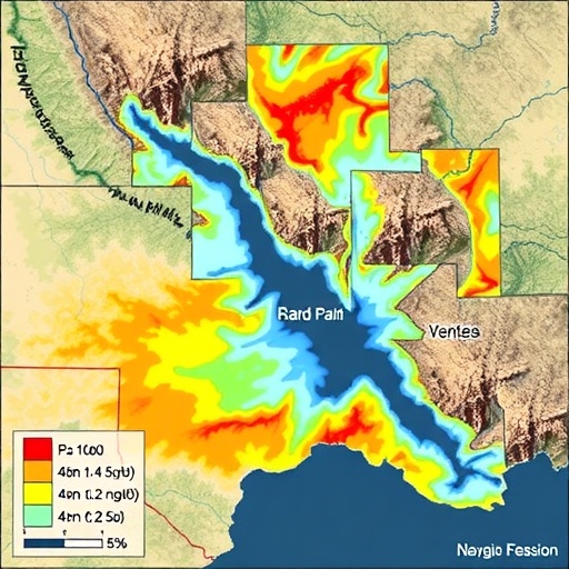
The significance of this study lies in its innovative approach to groundwater mapping, which is not solely dependent on traditional hydrogeological methods but integrates advanced geospatial technology. The researchers, led by Parmar K. and Chothodi S., employ GIS for spatial analysis, enabling them to visualize potential groundwater zones with unrivaled accuracy. This method allows for the combination of multiple data layers, including geology, land use, slope, and rainfall, into a unified model that reveals the intricate relationships and influences these factors have on groundwater availability.
The Upper Ken Basin, a relatively under-researched area, presents unique hydrogeological characteristics, making it a suitable case study for this research. The basin’s geographical features, specifically its terrain and sedimentary structures, are crucial for understanding groundwater flow and storage capacities. By analyzing these characteristics through remote sensing techniques, researchers can discern patterns that the naked eye might overlook. As understanding groundwater systems becomes increasingly linked to sustainable development goals, the choice of study area emphasizes the need for innovative solutions tailored to local contexts.
Utilizing the Analytic Hierarchy Process, the authors demonstrate a systematic method of prioritizing various factors contributing to groundwater recharge. This multi-criteria decision-making approach considers subjective judgments while providing a structured framework for evaluating the influence of different variables on groundwater potential. By assigning weights to each criterion based on expert input, AHP facilitates a comprehensive analysis that results in a prioritized list of areas most favorable for groundwater exploitation. This not only aids in identification but also ensures that decision-makers can approach groundwater management with greater precision.
Climate variability, particularly changes in precipitation patterns, adds another layer of complexity to groundwater management. The Upper Ken Basin has experienced fluctuations in its hydrological regime, leading to periods of both drought and flooding. Through GIS mapping linked to precipitation data, the research provides insights into how these climatic events further impact groundwater recharge rates. It underscores the critical need for integrated water resource management strategies that take into account the effects of climate change on groundwater systems.
The findings have significant implications for policymakers and local governance structures in Madhya Pradesh. As agriculture remains a primary occupation in the region, the knowledge gained from this study can be instrumental in guiding farmers towards sustainable irrigation practices. By pinpointing areas with high groundwater potential, stakeholders can make informed decisions about where to allocate resources, which in turn can enhance crop yields while promoting water conservation.
In addition to agricultural benefits, this research also holds relevance for urban planning in nearby settlements. As cities expand, the demand for reliable water supplies grows. The ability to accurately map groundwater sources enables urban planners to design infrastructure that effectively incorporates groundwater use, ensuring that growing populations have access to this essential resource. Furthermore, the study emphasizes the importance of collaboration between various sectors, including agriculture, urban planning, and environmental conservation, to achieve holistic water management solutions.
Groundwater not only supports agriculture and drinking water supplies but also has ecological implications. The interconnectedness of surface water and groundwater systems means that any changes to groundwater quality can have cascading effects on local ecosystems. Protecting these vital resources through responsible management practices is essential to maintaining biodiversity and environmental health. The spatial analysis performed in this study serves as a foundational tool for safeguarding these ecological networks from over-extraction and contamination.
As with all research initiatives, the practical implementation of the findings is crucial. The study calls attention to the necessity for ongoing monitoring and data collection in groundwater management processes. Implementing a framework that allows continuous evaluation of groundwater resources can facilitate adaptive management strategies that are responsive to changing environmental conditions. This proactive approach is vital for maintaining sustainable groundwater levels in the face of ongoing climatic challenges.
Moreover, the rise of community engagement in water management discussions is becoming increasingly important. The researchers advocate for involving local populations in decision-making processes, particularly when it comes to identifying critical zones for groundwater use. Empowering communities through education and active participation can enhance the effectiveness of groundwater management strategies. By fostering a collective sense of stewardship, local stakeholders can facilitate sustainable practices that support both present and future generations.
In conclusion, Parmar and Chothodi’s exploration of groundwater potential in the Upper Ken Basin offers an enlightening perspective on the intersection of technology and resource management. Their use of GIS and AHP represents a significant advancement in understanding groundwater resources in complex and dynamic environments. The study not only addresses immediate local needs but also contributes broader insights applicable to global water resource management challenges. As our understanding of groundwater systems evolves, it becomes increasingly clear that innovative solutions, collaboration across sectors, and community involvement will be key to nurturing this precious resource for years to come.
In essence, this research reinforces the critical role of informed decision-making driven by scientific data in the sustainable management of groundwater resources. As the world grapples with the implications of water shortages and environmental change, studies like this serve as vital beacons guiding us towards effective, sustainable practices that ensure the longevity of our aquifers. By embracing technological advancements and fostering collaborative management approaches, societies can harness the full potential of groundwater as a cornerstone resource in our quest for sustainable development and ecological balance.
Subject of Research: Groundwater potential analysis using GIS and AHP in the Upper Ken Basin, Madhya Pradesh, India.
Article Title: Spatial analysis of groundwater potential zone using GIS and AHP: a case study of the Upper Ken Basin, Madhya Pradesh, India.
Article References:
Parmar, K., Chothodi, S. Spatial analysis of groundwater potential zone using GIS and AHP: a case study of the Upper Ken Basin, Madhya Pradesh, India.
Environ Sci Pollut Res (2025). https://doi.org/10.1007/s11356-025-36957-5
Image Credits: AI Generated
DOI:
Keywords: Groundwater management, GIS, Analytic Hierarchy Process, Upper Ken Basin, sustainable agriculture, climate change, spatial analysis, water resource management.
