In the dynamic field of environmental science, the sustainable management of natural resources is critical for ensuring ecological balance and human well-being. Recent advancements in Geographic Information Systems (GIS) and remote sensing technologies have enabled researchers to model and analyze groundwater potential with unprecedented precision. A notable study published in 2025 by Ashagrie et al. focuses on groundwater potential in Bahir Dar City, Ethiopia, employing these modern tools to address the growing concerns surrounding water scarcity and land management practices.
Groundwater is an essential resource for many communities, especially in regions experiencing variable rainfall and climate change impacts. In Bahir Dar City, where rapid urbanization exacerbates the demand for water, understanding groundwater potential is vital. The researchers utilized GIS and remote sensing to collect and analyze data on various factors affecting groundwater availability, including topography, land use, soil types, and climatic conditions.
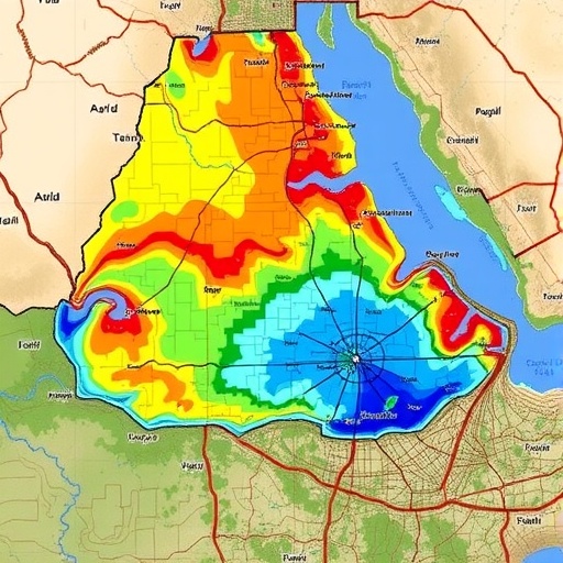
The study’s methodology hinges on the integration of multiple datasets, allowing for a comprehensive modeling of groundwater resources. By leveraging satellite imagery and data from existing well networks, the researchers could create spatially explicit maps detailing groundwater potential across different land management scenarios. This approach not only highlights areas with the highest potential for groundwater extraction but also informs decisions about sustainable land use.
One of the most striking findings from the research was the significant variability in groundwater potential across different land management scenarios. The researchers evaluated three primary scenarios: traditional farming practices, commercial agriculture, and urban development. Each scenario’s impact on groundwater recharge and extraction was meticulously analyzed, revealing that traditional farming practices, with their emphasis on soil conservation and organic inputs, yielded the highest groundwater potential.
In contrast, areas subjected to intensive urban development showed a marked decline in groundwater recharge capacity. The impervious surfaces associated with urbanization limit the natural infiltration of rainwater into the ground, leading to a concerning depletion of aquifers. The study underscores the urgent need for adopting water-sensitive urban design principles, which could mitigate some of the adverse effects of urbanization on groundwater resources.
Moreover, the researchers discussed the implications of their findings for water management policies in Ethiopia. Given the socio-economic context of Bahir Dar City, where agriculture remains a primary source of livelihood for many, it is paramount that policymakers consider the sustainability of groundwater resources. The integration of GIS and remote sensing into policy-making processes can facilitate more informed decisions, ultimately leading to enhanced groundwater management strategies.
Despite the advancements in technology, the study also revealed challenges associated with data availability and quality. In many regions of Ethiopia, including Bahir Dar, limited access to reliable and up-to-date data can hinder effective groundwater management. The authors emphasize the importance of establishing robust data collection frameworks that capitalize on the capabilities of remote sensing technologies to continuously monitor groundwater conditions and inform management practices.
The research also highlights the role of community participation in water management. Engaging local communities in monitoring and decision-making processes can lead to more sustainable outcomes. The researchers advocate for initiatives that empower communities to adopt water conservation practices and manage groundwater resources collectively, ensuring that local knowledge contributes to scientific understandings of water systems.
As water scarcity becomes an increasingly pressing global issue, the relevance of this study extends beyond the borders of Ethiopia. The methodologies and insights derived from Bahir Dar City can offer valuable lessons for other regions facing similar challenges. Researchers worldwide can draw from these findings to develop context-specific models and strategies that address local water management issues while considering the unique socio-economic and environmental dynamics at play.
The intersection of technology, ecology, and community engagement represents a promising frontier for sustainable resource management. As this study illustrates, the integration of GIS and remote sensing into groundwater potential modeling offers a pathway toward informed decision-making that balances human needs with ecological sustainability. The collaboration of scientists, policymakers, and local communities will be crucial in shaping a future where water resources are managed wisely, ensuring their availability for generations to come.
In conclusion, the groundbreaking work of Ashagrie et al. serves as a compelling catalyst for discussions surrounding sustainable groundwater management. Through innovative technological applications and community-centered approaches, we have the potential to create resilient water systems that support both people and the environment. The urgency of the findings is a clarion call for action, inviting all stakeholders to collaborate on solutions that prioritize the preservation and sustainable use of groundwater resources.
As we advance in our understanding of groundwater dynamics, we must remain vigilant in addressing the complex challenges posed by climate change, urbanization, and resource depletion. The future of our natural resources hinges on our ability to integrate scientific knowledge with sustainable practices, ensuring a harmonious coexistence between human activity and the natural world.
Groundwater is life, and as demonstrated in Bahir Dar City, our actions today will directly influence the availability of this precious resource tomorrow.
Subject of Research: Groundwater potential modeling using GIS and remote sensing in Bahir Dar City, Ethiopia.
Article Title: Modeling groundwater potential using GIS and remote sensing under different land management scenarios in Bahir Dar City Ethiopia for sustainable management.
Article References:
Ashagrie, W.A., Tarkegn, T.G., Tariku, G.D. et al. Modeling groundwater potential using GIS and remote sensing under different land management scenarios in Bahir Dar City Ethiopia for sustainable management. Discov Sustain (2025). https://doi.org/10.1007/s43621-025-02462-5
Image Credits: AI Generated
DOI:
Keywords: Groundwater management, GIS, Remote sensing, Sustainable development, Bahir Dar City, Ethiopia.
