In a groundbreaking study poised to reshape our understanding of high-altitude cryospheric dynamics, researchers have harnessed the combined strengths of remote sensing and cutting-edge machine learning algorithms to map and model permafrost distribution in the Garhwal Himalaya, India. This innovative approach not only provides unprecedented spatial resolution of permafrost extent but also offers a predictive framework crucial for anticipating the impacts of climate change in this sensitive and vulnerable mountainous region. The implications of this research resonate far beyond regional boundaries, signaling a transformative advance in environmental earth sciences.
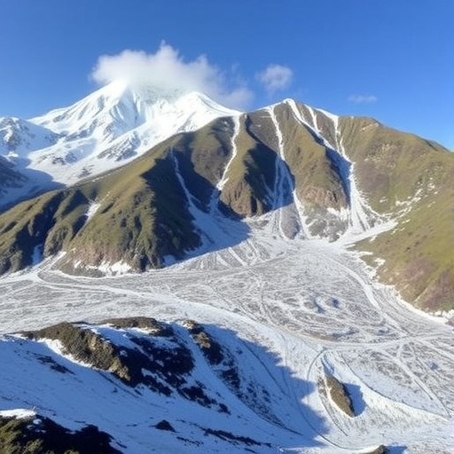
Permafrost, defined as ground that remains continuously frozen for at least two consecutive years, represents a critical component of the Earth’s cryosphere. Its presence influences hydrology, ecosystem stability, and geomorphological processes. In the Garhwal Himalaya, where the complex interplay of topography, climate, and geology governs environmental conditions, accurate permafrost monitoring has long challenged scientists due to logistical inaccessibility and harsh terrain. Traditional field surveys, while vital, are constrained by limited coverage and temporal resolution, underscoring the necessity for remote sensing’s satellite-based observations combined with intelligent data analytics.
The research team, led by A.C. Pandey and colleagues, posited that leveraging satellite imagery with machine learning techniques could surmount these challenges. They employed multispectral data capable of capturing surface thermal signatures, snow cover dynamics, and vegetation indices—all parameters that correlate with ground thermal regimes. By training machine learning models on existing ground-truth permafrost observations and integrating ancillary geographical data such as elevation, slope, and aspect, the study achieved highly accurate predictions of permafrost zones across the rugged Himalayan landscape.
Central to the methodology was the utilization of advanced supervised learning algorithms adept at handling nonlinear relationships inherent in environmental data. These algorithms discerned subtle patterns and interactions among input variables that traditional statistical methods might overlook. By iteratively refining model parameters and validating against independent datasets, the researchers achieved a high degree of robustness, addressing both spatial heterogeneity and temporal variability in permafrost distribution.
The mapping revealed that permafrost in the Garhwal region is distinctly patchy, exhibiting strong dependencies on microclimatic conditions and terrain morphology. North-facing slopes and high-altitude ridges showed consistent permafrost presence, aligning with theoretical expectations based on solar insolation and thermal conductivity. However, the model also uncovered previously undocumented permafrost remnants at lower elevations, suggesting localized thermal anomalies driven by unique topographical shading or subsurface hydrology—findings with significant implications for regional water resource management.
One of the study’s most profound contributions lies in its prospect for climate change impact assessments. As global temperatures rise, permafrost thawing can trigger cascades of environmental hazards including landslides, altered stream flows, and the release of greenhouse gases such as methane. The predictive capacity of the machine learning framework allows for scenario modeling under different warming trajectories, offering policymakers actionable intelligence to devise mitigation and adaptation strategies for communities that rely on these fragile mountain ecosystems.
Moreover, the incorporation of remote sensing data facilitates continuous monitoring, enabling near-real-time updates on permafrost status. This dynamic approach elevates the capacity for early warning systems designed to anticipate geomorphological hazards tied to permafrost degradation. Such foresight is essential for safeguarding mountain infrastructure, sustaining biodiversity, and protecting human lives in these rapidly changing environments.
Importantly, the model’s adaptability suggests it could be extended to other Himalayan sectors and, with calibration, to global mountain permafrost areas. As energy and computational resources become more accessible, the fusion of remote sensing and artificial intelligence promises a scalable, cost-effective method for global cryosphere monitoring. This democratization of high-quality environmental data aligns with international scientific goals to enhance climate resilience through improved earth system observations.
The study underscores a broader paradigm shift in earth sciences research, where interdisciplinary techniques converge to tackle complex ecological phenomena. The integration of geospatial technology, computer science, and environmental science exemplifies the innovative pathways necessary for grappling with the multifaceted challenges of climate change. Such work illustrates how novel analytical frameworks can transform raw data into meaningful environmental insight, driving both science and policy forward.
Further investigation is warranted to refine model sensitivities to seasonal snow cover fluctuations, soil moisture dynamics, and subsurface ice content, all of which influence permafrost thermal regimes. Additionally, expanding ground validation efforts, involving local stakeholders and scientific expeditions, will enhance model fidelity and foster collaborative stewardship of these critical landscapes. By continuously advancing these methodologies, the scientific community can sharpen predictive models that serve as linchpins for sustainable mountain development.
As the Himalayas stand as both a climatic sentinel and a reservoir of freshwater resources, understanding and anticipating permafrost changes is paramount. The innovative study by Pandey et al. not only illuminates the spatial intricacies of permafrost distribution but also provides a visionary template for future cryospheric research in mountainous environments worldwide. Their pioneering work signifies a leap forward in deploying technological innovation to address one of the planet’s most pressing environmental challenges.
Ultimately, the convergence of remote sensing and machine learning heralds a powerful toolkit for earth scientists contending with cryospheric and climatological complexities. This synergy expands analytical horizons, generating timely, spatially resolved datasets that can inform broad-scale ecological forecasting and disaster risk reduction. As this field progresses, similar approaches will likely become standard practice, enhancing our collective capacity to monitor, model, and manage permafrost and other critical environmental resources amid a warming world.
This research paves the way for enhanced environmental governance in the Himalayas, empowering decision-makers with nuanced understandings of terrain-specific climate vulnerabilities. In a region where millions depend on glacial and permafrost-fed water supplies, such knowledge is invaluable. By illuminating the previously opaque patterns of frozen ground distribution, the study contributes essential insights into the region’s hydrogeological stability and potential future scenarios under continuous climatic stress.
In addition to hydrological relevance, understanding permafrost distribution has profound implications for biodiversity conservation efforts. Many specialized alpine species rely on the microhabitats sustained by frozen soils; degradation of permafrost can trigger habitat loss and ecosystem disruption. The ability to accurately detect permafrost zones thus informs conservation planning, enabling targeted measures to preserve biodiversity hotspots vulnerable to thawing.
The successful application of machine learning in such a challenging environmental context reinforces the role of artificial intelligence as a transformative catalyst in earth system science. By extracting actionable knowledge from complex, noisy datasets, AI-enhanced models promise to accelerate scientific discovery and improve environmental stewardship. As climate change accelerates, marrying technological innovation with environmental science becomes ever more urgent and indispensable.
In synthesis, the study by Pandey and colleagues marks a milestone in cryosphere research. By innovatively merging satellite remote sensing with machine learning, it substantially advances both the science of permafrost dynamics and practical methodologies for environmental monitoring. This work not only enriches the scientific community’s toolkit but also offers a beacon for climate adaptation strategies in the Himalayas and analogous high-mountain systems worldwide.
Subject of Research: Permafrost distribution modeling using remote sensing and machine learning techniques in mountainous regions.
Article Title: Permafrost distribution modeling using remote sensing and machine learning technique in the Garhwal Himalaya, India.
Article References:
Pandey, A.C., Islam, A., Dwivedi, C.S. et al. Permafrost distribution modeling using remote sensing and machine learning technique in the Garhwal Himalaya, India. Environ Earth Sci 85, 35 (2026). https://doi.org/10.1007/s12665-025-12739-7
Image Credits: AI Generated
