In the ongoing battle against soil degradation, the integration of cutting-edge technologies has emerged as a beacon of hope for conserving one of Earth’s most vital natural resources. Recent advancements in machine learning and geospatial analysis have catalyzed a transformative approach to mapping and predicting soil erodibility—a critical factor in understanding how landscapes evolve under the pressures of natural processes and human activity. A groundbreaking study by Abiye, Alebachew, and Dengiz, reported in the 2025 edition of Environmental Earth Sciences, demonstrates the unparalleled precision achievable by harnessing these state-of-the-art tools. Their work transcends conventional methods, carving new pathways toward sustainable land management and environmental protection.
Soil erosion represents a profound environmental challenge, responsible for diminishing agricultural productivity, altering hydrological cycles, and exacerbating sedimentation in water bodies. Traditional methods for assessing soil erodibility—a measure of soil’s susceptibility to erosion—have often relied on laborious field sampling coupled with rudimentary predictive models. These approaches, while foundational, frequently lack the spatial and temporal resolution necessary to support effective and targeted intervention strategies. The study by Abiye and colleagues introduces an innovative fusion of machine learning algorithms combined with high-resolution geospatial data, heralding a new epoch in soil sciences.
At the core of their methodology lies the strategic application of supervised machine learning models, trained on an extensive repository of soil properties and environmental variables. Features such as soil texture, organic matter content, rainfall intensity, slope gradient, and land cover patterns were meticulously integrated into their analytical framework. By leveraging algorithms capable of capturing complex, nonlinear interactions among variables, their model transcended the predictive limitations of traditional statistical methods. This computational sophistication enables a nuanced understanding of erosive processes at scales previously unattainable.
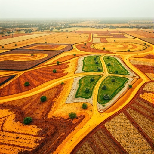
Complementing the algorithmic prowess is the utilization of remote sensing technologies and geographic information system (GIS) platforms. High-resolution satellite imagery, digital elevation models (DEMs), and spectral data contribute to a robust spatial dataset underpinning the predictive models. The seamless fusion of these geospatial inputs ensures that variations in landscape features—such as vegetation cover and topographic complexity—are accurately represented. Consequently, the resulting erodibility maps offer granular insights into the intricate mosaic of erosion risk across heterogeneous terrains.
A remarkable aspect of this study is its emphasis on predictive accuracy and model validation. The authors employed rigorous cross-validation techniques and independent test datasets to benchmark their machine learning framework’s performance. The results exhibit substantial improvements in predictive power compared to conventional soil erodibility assessments. This enhanced accuracy is not merely academic; it equips land managers and policymakers with actionable intelligence crucial for prioritizing conservation efforts, optimizing land use planning, and mitigating detrimental environmental impacts.
The implications of adopting such technology-driven soil erodibility mapping extend beyond immediate ecological concerns. Accurate, spatially explicit predictions enable more effective targeting of soil conservation measures—such as contour farming, terracing, and afforestation—to vulnerable hotspots. This strategic deployment of interventions contributes to broader goals of sustainable agriculture, fostering resilient food systems in the face of climatic uncertainties. Furthermore, informed erosion risk assessments are indispensable for infrastructure development, disaster risk reduction, and maintaining ecosystem services.
Beyond applications, the study signifies a methodological paradigm shift by embracing interdisciplinary convergence. By synthesizing advancements in environmental science, computer science, and remote sensing, Abiye and colleagues exemplify how integrative approaches can unravel complex environmental challenges. This holistic lens acknowledges soil erosion as a multifactorial phenomenon, influenced by biophysical, climatic, and anthropogenic drivers. The resulting models not only capture these multifaceted interactions but also accommodate spatial heterogeneity, which is crucial for translating scientific knowledge into practical solutions.
The scalability and adaptability of the proposed machine learning framework are particularly noteworthy. While the study focused on a specific geographic region, the underlying techniques and data integration strategies are transferable to diverse ecosystems worldwide. This scalability opens avenues for global soil erosion monitoring initiatives, which could benefit from standardized, data-driven approaches. In turn, such global efforts would contribute substantially to international environmental targets, including land degradation neutrality and sustainable development goals.
Another compelling contribution of the research is its potential to integrate real-time monitoring capabilities. Advances in satellite technologies and data acquisition frequencies position this machine learning approach for continuous updating and refinement. Dynamic soil erodibility assessments responsive to seasonal, climatic, and land-use changes enhance decision-making agility. This temporal dimension is critical for adapting conservation strategies to evolving environmental conditions and for early warning systems in erosion-prone areas.
Importantly, the study also addresses the challenges and limitations inherent in leveraging machine learning and geospatial data for environmental predictions. Issues such as data quality, heterogeneity in sampling density, and algorithm interpretability are acknowledged and scrutinized. By transparently discussing these constraints, the authors pave the way for future enhancements—such as integrating more comprehensive datasets, employing explainable AI techniques, and fostering community science initiatives to enrich spatial information layers.
Moreover, the collaboration between soil scientists, remote sensing experts, and data scientists underscores the importance of interdisciplinary communication and capacity building. Developing user-friendly tools based on these sophisticated models can democratize access to critical erosion risk information among stakeholders ranging from local farmers to national agencies. Empowering diverse actors through technology-centric knowledge transfer mechanisms has the potential to revolutionize soil conservation practices on the ground.
This research arrives at a pivotal moment when environmental degradation intersects with socio-economic vulnerabilities on a global scale. Soil erosion not only threatens ecosystem integrity but also jeopardizes livelihoods, particularly in agrarian communities susceptible to climate variability. By providing precise, data-driven maps of soil erodibility, the study offers a crucial instrument for bridging the gap between scientific insight and practical resilience-building efforts. The approach champions a proactive rather than reactive stance in environmental management, aligning with contemporary sustainability paradigms.
Embedded within the technical rigor of this work is a compelling narrative about the transformative potential of emerging technologies in environmental stewardship. It exemplifies how leveraging the confluence of big data analytics, remote sensing, and machine learning transcends traditional scientific frontiers. As pressure mounts on natural resources amid accelerating human encroachment and climate change, such innovations embody a hopeful frontier for safeguarding the planet’s foundational soil resources.
Looking forward, the integration of this refined soil erodibility mapping with other environmental models—such as hydrological or biodiversity simulations—could yield comprehensive landscape management tools. These synergistic modeling platforms would enable more holistic environmental impact assessments and facilitate multi-objective land-use planning. Furthermore, coupling predictive erosion risk with socio-economic data layers could enhance the targeting of policy interventions to support vulnerable populations.
Ultimately, the pioneering work by Abiye, Alebachew, and Dengiz manifests the immense possibilities when technology and environmental science converge with precision and purpose. Their approach not only deepens our understanding of soil erosion dynamics but also equips practitioners with the evidence base needed to protect soil health sustainably. As global environmental challenges intensify, such interdisciplinary innovations will be indispensable for nurturing resilient ecosystems and human communities alike.
Subject of Research: Precise soil erodibility mapping and prediction using machine learning and geospatial technologies.
Article Title: Harnessing machine learning and geospatial technologies for precise soil erodibility mapping and prediction.
Article References:
Abiye, W., Alebachew, E.D. & Dengiz, O. Harnessing machine learning and geospatial technologies for precise soil erodibility mapping and prediction. Environ Earth Sci 84, 291 (2025). https://doi.org/10.1007/s12665-025-12270-9
Image Credits: AI Generated
